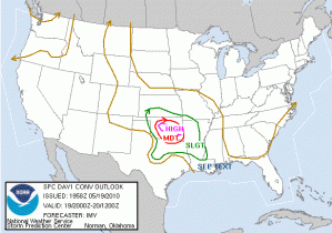
A significant severe weather day is underway for central Oklahoma (SPC high risk [see image] and PDS tornado watch valid from 2pm -10pm CDT). After a post-event wrap of yesterday’s operations, forecasters quickly reviewed current conditions and model forecasts from the HRRR, NSSL-WRF and OUN-WRF. By 2pm CDT activities had begun in the HWT with two teams examining the GOES-R convection initiation products for storms along the dryline in western OK.
Travis Smith (EWP Weekly Coordinator, 17-21 May 2010)

