The forecasters began the afternoon by evaluating the 5/7/08 tornado archived CASA event. Comments included: the rapid update andd closely spaced radars caused the forecasters to stay more focused on the evolution; it was sometime difficult to choose the best of the single radars to concentrate on; the wind analysis should be available in the WDSSII GUI, it was quite challenging to manage the wealth of information.
After this, the forecasters evaluated the 10 July 2006 wet microburst archived PAR event. The forecasters commented that their situation awareness helped thme to be better prepared for the nature of the event. They loooked a lot at the LLSD Divergence prodcut to analyze the Mid-Altitude Radial Convergence (MARC) signatures.
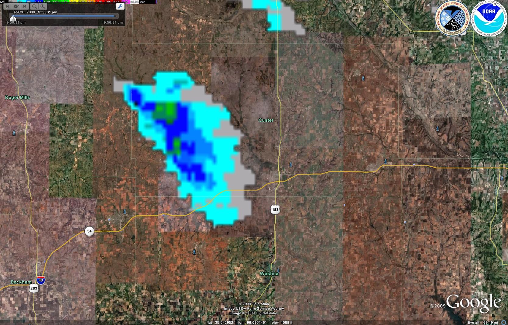
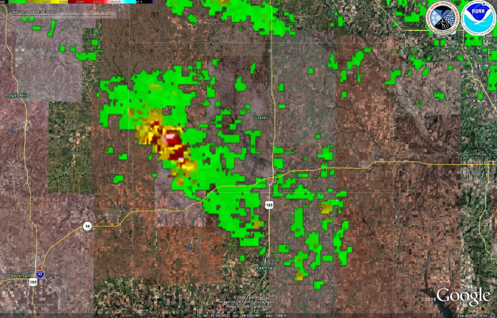
The IOP was centered on Oklahoma and was planned to involve mainly the PAR data, and perhaps the CASA data if storms formed in that smaller domain (the LMA network was unavailable today). We began the IOP at 530pm, but the cap held and held and held, until storms broke through around 7:30pm in western Oklahoma. The forecasters evaluated real-time PAR data, in conjunction with the WDSSI MRMS data, on an isolated supercell storm, mainly a large hail producer, as it moved southward through Dewey and Custer Counties. Using AWIPS, the forecasters issued severe thunderstorm and several tornado warnings on the storm. They noted that the MRMS rotation tracks indicated weaker shear than indicated on the PAR. This was primarily because the PAR was looking above the 0-2 km AGL layer used to compute the MRMS azimuthal shear products. The MESH swaths helped with the polygon cone orientation once again.
Figure 1. MESH Tracks.
Figure 2. Rotation Tracks.
Greg Stumpf (EWP Weekly Coordinator, 27 Apr – 1 May 2009)


