
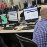
FLASH — short for the Flooded Locations and Simulated Hydrographs Project — is now in the hands of NWS forecasters!
Official websites use .gov
A
.gov website belongs to an official government
organization in the United States.
Secure .gov websites use HTTPS
A
lock (
) or https:// means you’ve safely connected to
the .gov website. Share sensitive information only on official,
secure websites.
FLASH — short for the Flooded Locations and Simulated Hydrographs Project — is now in the hands of NWS forecasters!

Given the success of the RON in Oklahoma City, a second meetup has been scheduled for the upcoming 2016 NWA Annual Meeting in Norfolk.

Experiments designed to improve National Weather Service severe weather forecasts will be conducted in the 2015 Spring Forecasting Experiment from May 4 through June 5, part of the NOAA Hazardous Weather Testbed (HWT) Experimental Forecast…
Several experiments to improve National Weather Service severe weather warnings will be conducted this spring in the NOAA Hazardous Weather Testbed (HWT) as part of the annual Experimental Warning Program.
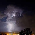
An NSSL/CIMMS and TTU team pushed hard to get lightning products functional for potential severe weather on April 16 and were successful.
Kristin Calhoun (NSSL/CIMMS) will give an invited webinar to National Weather Service meteorologists and hydrologists on April 1, 2015, about current lightning prediction products in research and development at NSSL.
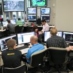
Weather forecasters rely on an incredibly large amount of information when they make forecasts and issue warnings. A new system, activated by NOAA’s National Weather Service last week, quickly harnesses the tremendous amount of weather…
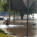
In this record-breaking spring tornado season, emergency responders are saving precious hours when they count the most – in the immediate aftermath of a devastating storm.
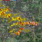
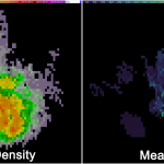
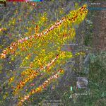
Rotation tracks of the storms in southeast Kansas and southwest Missouri on May 22, 2011 produced by NSSL’s WDSS-II: On Demand system. Brighter reds and yellows show stronger rotation.
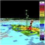
A team from NSSL completed the installation of NSSL’s real-time Multiple-Radar/Multiple-Sensor (MRMS) system at the FAA William J Hughes Technical Center in Atlantic City, N.J. last week.