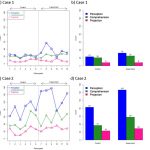
Qualitative findings from the 2013 Phased Array Radar Innovative Sensing Experiment and uses for social science in the forecaster warning decision process.

Qualitative findings from the 2013 Phased Array Radar Innovative Sensing Experiment and uses for social science in the forecaster warning decision process.
Early online release 1/13/15 Journal: Weather and Forecasting Impacts of Phased Array Radar Data on Forecaster Performance during Severe Hail and Wind Events Katie A. Bowden, Pamela L. Heinselman, Darrel M. Kingfield, and Rick P.…

Researchers from NSSL/CIMMS will share the latest radar research at the 8th European Conference on Radar in Meteorology and Hydrology September 1-5 in Garmisch-Partenkirchen, Germany.
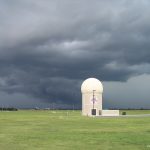
During the 2013 central Oklahoma severe weather season, researchers will demonstrate and evaluate new capabilities developed for the NOAA National Weather Radar Testbed Phased Array Radar (NWRT/PAR).

The Secretary of Commerce has awarded a Gold Medal to the NSSL/CIMMS Radar Research and Development Division for “scientific and engineering excellence in adapting military phased array radar technology to improve U.S. weather radar capabilities.”
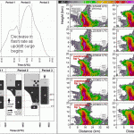
Researchers from NSSL and CIMMS have published the first study to combine rapidly-updating phased array radar data with high-resolution lightning data to study lightning behavior in a hail storm.
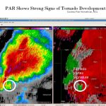
Severe weather in Oklahoma this spring has offered opportunities for collecting data.
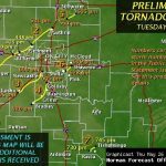
Seven destructive tornadoes struck Oklahoma on May 24, 2011. The tornadoes were well forecast by the National Weather Service (NWS), and NSSL was in position to capture the storms in several ways.
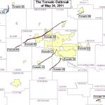
The tornado outbreak forecasted by the NOAA Storm Prediction Center and the National Weather Service Forecast Office in Norman, Oklahoma became a reality as five damage-producing tornadoes struck central Oklahoma between 3 pm and 7…
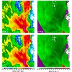
As severe weather approaches central Oklahoma this spring, NSSL/Cooperative Institute for Mesoscale Meteorological Studies researchers will be able to study fast-changing storms using a new radar processing technique.