
NSSL has released this image documenting the rotation tracks of the devastating tornadoes on April 27-28.
Official websites use .gov
A
.gov website belongs to an official government
organization in the United States.
Secure .gov websites use HTTPS
A
lock (
) or https:// means you’ve safely connected to
the .gov website. Share sensitive information only on official,
secure websites.
Guest blogger
NSSL has released this image documenting the rotation tracks of the devastating tornadoes on April 27-28.
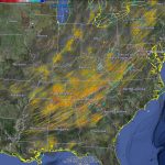
NSSL has released an image documenting the rotation tracks of the devastating tornadoes on April 27-28. Bright reds and yellows show more intense circulations.
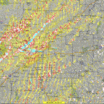
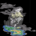
NSSL’s Warning Decision Support System-Integrated Information (WDSS-II) On Demand can be used to help confirm when and where severe weather occurs. The American Red Cross and local NWS forecast offices have used the product for disaster response and recovery, and damage surveys. This image shows rotation tracks across Arkansas from the Monday, April 25 tornado outbreak.
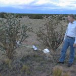
Dave Rust tries to figure out how to extract an Electric Field Meter from a cactus!
A simulation of a Florida thunderstorm showing two lightning flashes (upper-level intracloud and a negative cloud-to-ground). Light gray is the cloud boundary, darker gray is 35 dBZ reflectivity. 2D color slice is simulated NEXRAD reflectivity.
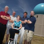
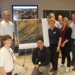
Vaisala Outstanding Research Paper winners (L-R): Richard Adams, Dave Priegnitz, Pam Heinselman, Travis Smith, Kevin Manross. See full story below!
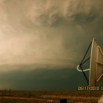
A Shared Mobile Atmospheric Research and Teaching Radar scans a supercell thunderstorm near Artesia, NM during VORTEX2 2010 operations.
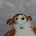
Chase StormDawg, VORTEX2 special correspondent to kids, is showing mammatus clouds he saw in front of his house. He joined VORTEX2 in the field on May 1 to report on what he sees.
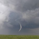
NSSL Media Vehicle driver John Oakland snapped this picture of the tornado captured by VORTEX2 in LaGrange, Wyoming.
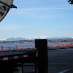
The NO-XP team enjoys the view of the Canadian Rockies from Birch Bay, Washington. They are using the radar to support weather nowcasting for the Cypress Mountain venue at the 2010 Winter Olympic Games.