As Tropical Storm Hilary made landfall in California and affected the southwestern United States, researchers at the NOAA National Severe Storms Laboratory (NSSL) stepped into action, using a cutting-edge tool to lend support to forecasters.
“We provided runs of the Warn-on-Forecast System (WoFS) for real-time experimental use in operations during this event,” said Patrick Burke, WoFS program lead. “It was a great opportunity to lend support to forecasters and emergency managers during a very hazardous storm. We know that WoFS does an especially good job with high winds and heavy rain. And the real-time experiment also allowed us to gather feedback to further improve the system.”
Warn-on-Forecast is a NOAA research project that aims to increase lead time for tornado, severe thunderstorm, and flash flood forecasts and warnings. The system uses high-resolution numerical weather prediction models and high performance computing to make probabilistic predictions of individual thunderstorms out to six hours in advance, and updates those forecasts every half hour using the latest radar and satellite data.
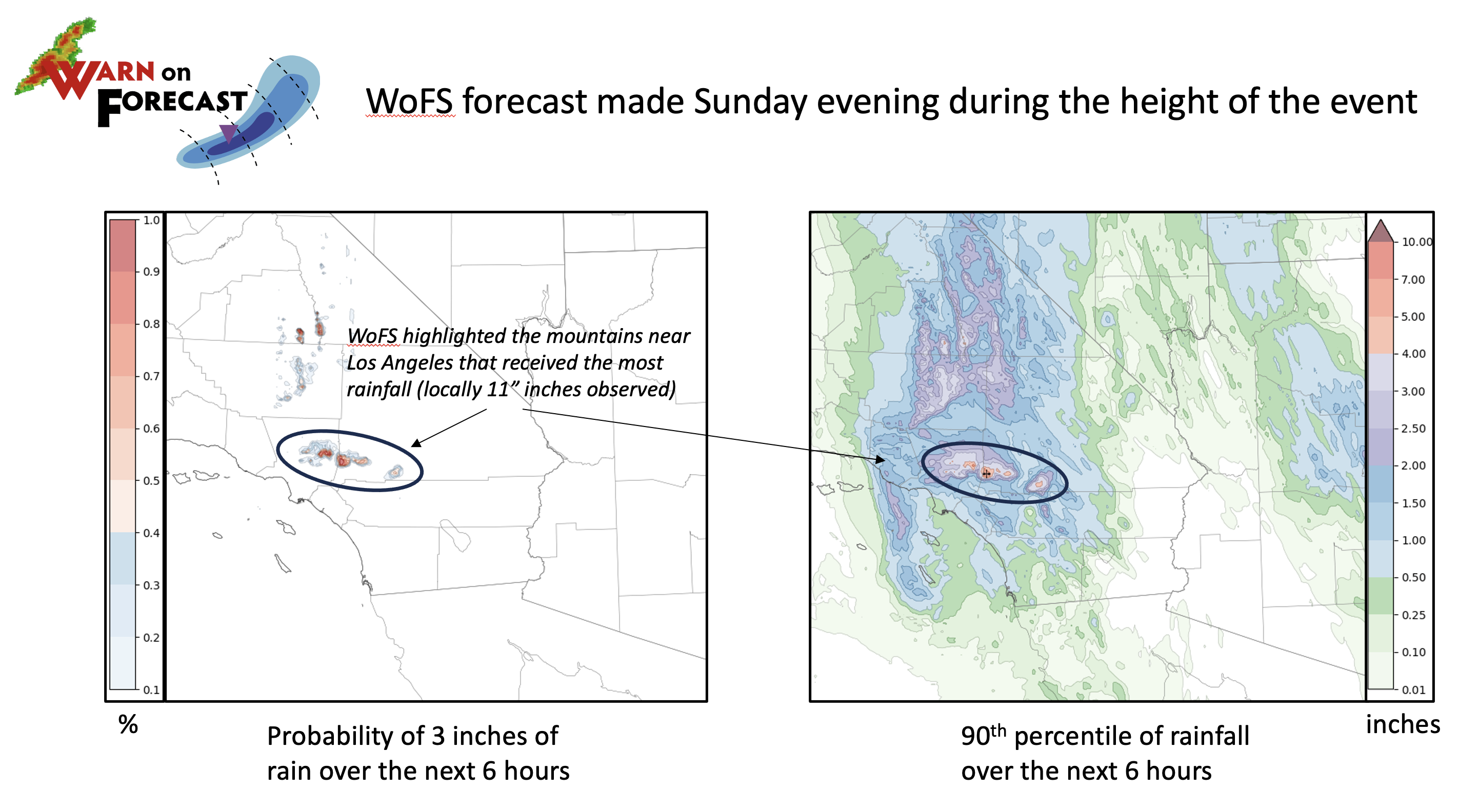
As Hilary made landfall, the WoFS team was able to provide several insights in a collaborative internal chat room used by National Weather Service forecasters. Interpretation of WoFS forecasts for rainfall, winds and rotating storms, gave them greater confidence in their decisions. Sean Benedict, lead meteorologist for the National Weather Service’s Phoenix forecast office, said WoFS data gave him and his team added confidence in issuing warnings in desert areas where tornadoes are rare.
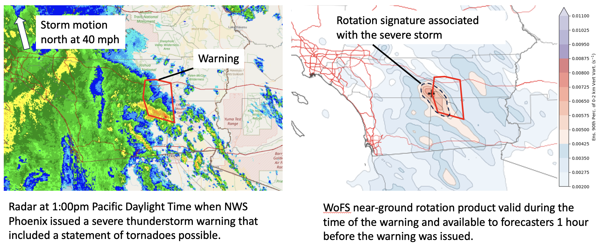
“Warn-on-Forecast runs during the event provided additional confidence that low-level mesocyclones were capable of developing and more specifically what storms were more favorable,” Benedict said. “This additional confidence and heightened awareness, along with some radar characteristics, led to the issuance of a couple Severe Thunderstorm Warnings with Tornado Possible wording in Imperial County.”
“WoFS is an entirely new kind of weather model,” Burke said. “It is designed to describe the probability of hazardous storms at the city and county level. Having this probabilistic data which is updated frequently throughout the event can give the forecaster greater confidence early on. In some cases this results in more accurate warnings and longer lead time.”
Brandt Maxwell, NWS meteorologist at the San Diego Weather Forecast Office offered similar sentiment, particularly around the issue of heavy rainfall and flash flooding.
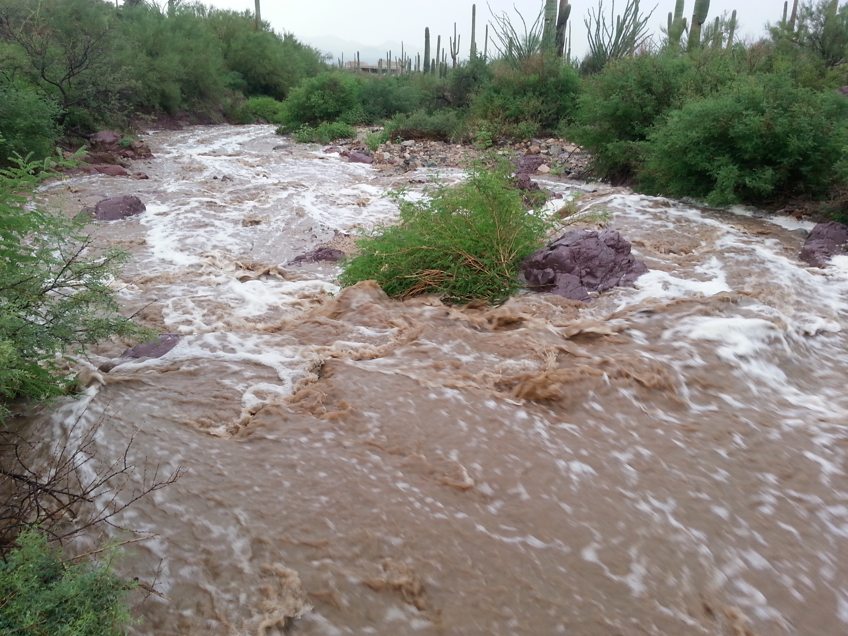
“The thing that helped the most was seeing how heavy the rainfall rates were when the heaviest rains were moving into San Bernardino County during the early evening of the 20th,” Maxwell said. “This gave me greater confidence in issuing flash flood warnings.”
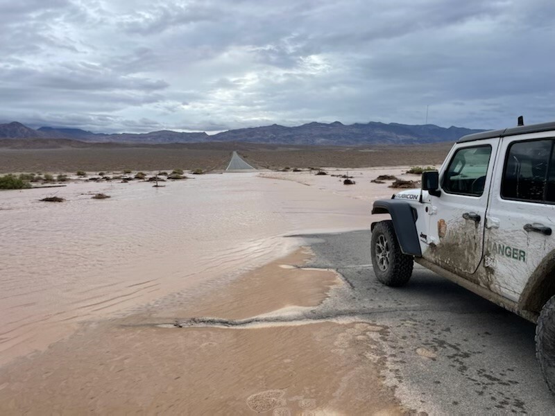
WoFS can be a useful tool to emergency managers and other agencies during events like Tropical Storm Hilary as they plan their response to potential hazards. Nina Oakley, a geohazards climatologist with the California Geological Survey said WoFS can be helpful for situational awareness as they monitor burn areas for debris flows and other post-fire hydrologic events during high-intensity rainfall.
“Short-range probabilistic forecast tools like WoFS can help us narrow in on where we should be closely examining rain gauge data and where we should be monitoring media outlets for potential impacts,” Oakley said. “This can help us plan our post-event response efforts and communicate with our partners more effectively during and post-event.”
WoFS support on Tropical Storm Hilary is just one example of how NOAA’s National Severe Storms Laboratory serves the nation by working to improve the lead time and accuracy of severe weather warnings and forecasts in order to save lives and reduce property damage. NSSL scientists are committed to their mission to understand the causes of severe weather and explore new ways to assist National Weather Service forecasters, as well as federal, university and private sector partners, in serving the public.
“The Warn-on-Forecast Group has a great working relationship with the National Weather Service,” Burke said. “The Hilary event occurred on a weekend, but you had research scientists working over the weekend maintaining the experimental forecast system so we could help the NOAA team in its mission to save lives and property. And ultimately, our goal is to transition our research and products to operations. So gathering feedback during these real-world opportunities is just invaluable.”
NSSL Director, Dr. DaNa Carlis is particularly interested in these types of collaborations and the value they provide in evaluating and perfecting developing tools and technologies.
“As Director of NSSL, these types of collaborations on high impact weather events like TS Hilary are critical and I’d love to see these alliances grow,” Carlis said. “There is so much value in the exchange of information across research and operations due to the real-time feedback. Our researchers learn how the information is being used and what informs decisions across different sectors. These exchanges will yield improvements to research systems like WoFS as NSSL is determined to provide the most impactful tools that are critical to life-saving decisions.”


