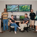
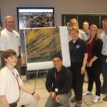
An NSSL/CIMMS team has been honored with the 2013 NOAA Technology Award for the development of the Warning Decision Support System – Integrated Information On Demand (WDSS-II: On Demand).

An NSSL/CIMMS team has been honored with the 2013 NOAA Technology Award for the development of the Warning Decision Support System – Integrated Information On Demand (WDSS-II: On Demand).
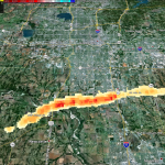
The experimental Tornado Debris Signature algorithm uses dual-pol radar data to map areas of debris.
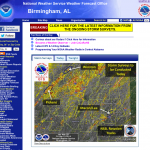
The NWSFO in Birmingham, Ala. used an NSSL product to plan surveys of damage caused by the tornadoes yesterday. NSSL’s On Demand is a web-based tool that can be used to help confirm when and…
In this record-breaking spring tornado season, emergency responders are saving precious hours when they count the most – in the immediate aftermath of a devastating storm.
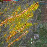
NSSL has released this image documenting the rotation tracks of the devastating tornadoes on April 27-28.
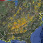
NSSL has released an image documenting the rotation tracks of the devastating tornadoes on April 27-28. Bright reds and yellows show more intense circulations.
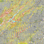
NSSL’s Warning Decision Support System-Integrated Information (WDSS-II) On Demand can be used to help confirm when and where severe weather occurs. The American Red Cross and local NWS forecast offices have used the product for disaster response and recovery, and damage surveys. This image shows rotation tracks across Arkansas from the Monday, April 25 tornado outbreak.