

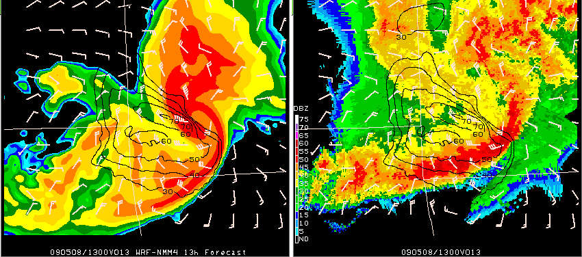
Above is an example of one of the forecasts from the Spring Experiment models from Friday. This bow echo moved across southwest Missouri early Friday morning and these images are centered on Joplin, MO (JLN). On the left is the 13h forecast from the WRF-NMM 4km model initialized at 00Z 08-May-2009 and valid at 13Z. On the right is the verifying 1km base reflectivity image with the model fields for winds overlaid on the radar. The barbs in each of the images are the model’s instantaneous 10m winds in knots (with the grid skipped to lessen the clutter). The isotachs are plotted from the WRF “history variables” for maximum U,V 10m winds (no grid skip). These are the maximum 10m wind speeds in the model over the past hour ending at 13Z.
Instantaneous 10m winds in the model at 13z, near the rotating bow head, are at least 50 knots. The maximum model 10m winds over the past hour range from 60-70 knots near and north of the weak echo channel and around the comma-head of the bow.
This was only one of several exceptional forecasts of this feature from the models being evaluated in this year’s Spring Experiment. To see more output on this case and more, check out the Spring Program website here:
http://hwt.nssl.noaa.gov/Spring_2009/index.php
-GregC