New data product offers a more complete picture of storms

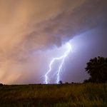
Researchers are excited to announce the release of a new, extensive data product that combines a multitude of data sources to help researchers, forecasters, and weather enthusiasts.

The Multi-Year Reanalysis of Remotely Sensed Storms Project, or MYRORSS, combines individual radar data with other sources, like weather models and lightning data, for a more complete picture of storms. MYRORSS data is high-resolution, three-dimensional, and updates more rapidly, unlike some two-dimensional data sets. Created by researchers and students at the Cooperative Institute for Mesoscale Meteorological Studies and NOAA National Severe Storms Laboratory, MYRORSS provides scientists the capability to create new computer programs for storm analysis and climatologies, or storm climatology studies.

“Most storm climatologies are based on reports,” said Kiel Ortega, a researcher at CIMMS supporting NSSL. “Such reports can be biased based on where people live. With MYRORSS data, we can get a better idea, for example, where hail occurs and with what frequency.”

In addition, scientists may use the data in machine learning and artificial intelligence experiments to learn more about specific components and characteristics of severe weather. One example would be how tornado-producing storms may look different from storms that do not produce tornadoes.

A screenshot of a map showing the path of several tornadoes across the southeastern United States.
This an accumulation of azimuthal shear, called rotation tracks, from a tornado outbreak on April 27, 2011. Researchers are using rotation track data in MYRORSS to identify rotating storms and to help with climatologies, like hail, as rotating storms can produce larger hail than non-rotating storms. (Screenshot provided by Kiel Ortega and Skylar Williams, OU CIMMS/NOAA NSSL)

CIMMS Researcher Vanna Chmielewski who is utilizing the product for her lightning research said the data combination in MYRORSS will make a big difference.

“A large time commitment to many studies is quality controlling the data and aligning different data sources,” Chmielewski said. “For a large statistical or machine learning project, it is also important to have uniformity in how that process is done, otherwise there could be some bias which shows up in the statistical model purely due to changes in how the process was done.

“What has been done by the MYRORSS team is huge in building that base dataset over a large area and time period. This database really has infinite potential for future studies,” she said.

Several meteorological studies have sample sizes that are small, such as data from one field experiment or one severe weather season. Larger studies have often been limited in which data could be included due to time restrictions associated with quality control and other initial steps, Chmielewski explained.

“Having a dataset like this can really help improve science by allowing those larger studies to be more easily done,” she said. 

Chmielewski plans to use MYRORSS data to study “bolts from the blue,” cloud-to-ground lightning flashes typically originating from the backside of a thunderstorm cloud. Such flashes can travel a large distance in clear air away from the storm cloud, angling down and striking the ground.  She also intends to research answers to questions like, “how far can a flash of lightning strike from a storm?” with a larger data sample than previously available. 

The MYRORSS database will allow researchers to tackle many atmospheric questions from over many years and across the country. 

For Chmielewski, this presents new opportunities. 

“Are bolt from the blue flashes more common in some parts of the country than others? Has that changed with time? Can we find reasons why some storms do and others don’t? These sorts of questions are really hard to answer without a base dataset like MYRORSS, and the MYRORSS group has done a great job bringing these storm and environmental variables together into a single, quality-controlled dataset,” she said.

MYRORSS began in 2012 and utilizes the Multi-Radar Multi-Sensor framework, along with many other data sources. Students made this project possible as they combed through terabytes of data. Guided by researchers from CIMMS at the University of Oklahoma and NSSL, students processed the data required for MYRORSS while conducting extensive quality control. The NOAA National Centers for Environmental Information also assisted with some of the data processing.

“MYRORSS was my first experience with research as a student and helped me determine my path in the field,” said Skylar Williams, CIMMS researcher supporting NSSL. 

Williams finished her master’s degree and was hired full-time at CIMMS, continuing her work on MYRORSS. She is excited to share the product with others after years of work.

“The processing was time-consuming— even with more than 15 machines —  and because of the extensive quality control, anytime we found bad data we would actually have to go back and reprocess that entire day,” Williams said. “When dealing with 14 years of data, reprocessing that added up. However, reprocessing allowed us to create a great product with good data for anyone to use.”

Learn more about MYRORSS and view the data here.

Share this:

Researchers study lower atmosphere to answer remaining questions

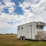
While scientists have learned a lot about our planet, questions remain about the lowest part of the atmosphere where we live. Researchers at the NOAA National Severe Storms Laboratory are looking for answers. Utilizing a series of instruments located in a mobile research unit, researchers are analyzing data gathered by those tools to improve severe weather forecasts.

The lowest mile or so of the atmosphere, known as the planetary boundary layer, is where several elements mix — from pollution to moisture — and how those elements mix and change during the day impact events in the atmosphere.

“Understanding the boundary layer can improve forecasts of severe weather, pollution, and several other things impacting the surface,” said Elizabeth Smith, NOAA National Severe Storms Laboratory researcher.

In an effort to improve understanding, weather researchers with the Cooperative Institute for Mesoscale Meteorological Studies at the University of Oklahoma and NOAA NSSL deployed two trailers decked out with a collection of weather instruments known as the Collaborative Lower Atmospheric Mobile Profiling System in fall 2020.

A research trailer known as CLAMPS parked in a grassy field near a power connector. In the background is an operational radar. The sky is overcast, cloudy and gray.
The Collaborative Lower Atmospheric Mobile Profiling System, or CLAMPS, in Norman, Oklahoma. CLAMPS was deployed near a weather radar and weather station as part of an experiment to better understanding the depth of the boundary layer. (Photo by James Murnan/NOAA)

The CLAMPS platforms were deployed near a weather radar and a weather station in Oklahoma as well as the National Weather Service Forecast Office in Shreveport, Louisiana. The fast-updating, high-resolution data collected provides a more detailed view of the atmosphere and its processes for researchers to analyze.

In addition, the Shreveport NWS Office utilized CLAMPS to monitor both fog and fire weather forecasts during CLAMPS deployment in the area. That office also noted interesting and surprising boundary layer behavior when smoke from fires raging in the western part of the United States infiltrated into the area.

NWS Shreveport Science and Operations Officer Brad Bryant said output from CLAMPS was particularly useful for refining fog and fire weather forecasts because both sets of parameters are closely tied to specifics of the boundary layer CLAMPS is tuned to monitor.

Research equipment parked on the green grass. Behind it is a building and tall operational weather radar.
The CLAMPS trailer in Shreveport, Louisiana at the NWS Forecast Office as part of an OU CIMMS and NOAA NSSL experiment. (Photo by Matthew Carney/OU)

CIMMS Researcher and Project Lead Jacob Carlin said the CLAMPS platform collects information more frequently than weather balloons launched daily by NWS forecasters across the nation. Although both methods gather similar information about the atmosphere, weather balloons are typically launched twice a day while CLAMPS gather data every couple of minutes.

More data can result in a more accurate representation of atmospheric processes at any moment. Data from the CLAMPS systems is combined with data from the NEXRAD radar, further enhancing researchers’ view of the atmosphere and what is happening.

This project is an extension of a recently published study that compared the twice-a-day balloon launch data with data from a nearby NEXRAD radar. Carlin’s team is going further, comparing CLAMPS minute data with a nearby NEXRAD radar and weather station.

“We want to understand how well this method performs with CLAMPS, because if it is able to reliably observe boundary layer height and development, then this method can improve forecasts and forecasting tools,” Carlin said.

With this new dataset, the researchers hope to learn more about how well NEXRAD radar can detect the boundary layer, expanding the capability of existing infrastructure at no additional cost.

Funding for this study was provided by the Cooperative Institute for Mesoscale Meteorological Studies’ Director’s Discretionary Research Fund, which supports the piloting of small-scale innovative and experimental projects.

Share this: