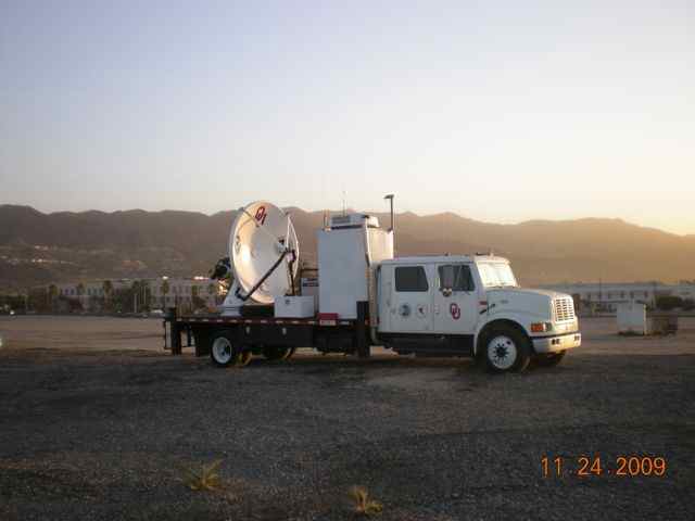
 December 1, NSSL’s mobile radar team will begin to collect data with the Shared Mobile Atmospheric Research and Teaching Radar (SMART-R) in southern California to help monitor rainstorms that may trigger dangerous debris flows.
Debris flows are rivers of rock and earth triggered by rainfall, that can destroy culverts, bridges, roadways, and structures and can cause injury or death.
Areas damaged by wildfires are particularly susceptible to flash floods and debris flows during rainstorms. Rainfall that is normally absorbed by vegetation can run off almost instantly, causing creeks and drainage areas to flood much sooner during a storm, and with more water, than normal.
The National Oceanic and Atmospheric Administration (NOAA), NOAA National Weather Service (NWS), and the United States Geological Survey (USGS) have established a demonstration flash flood and debris-flow early warning system for recently burned areas in southern California. The experiment focuses on helping forecasters improve flash flood and debris flow warnings by providing more detailed measurements of rainfall.
NSSL will supply real-time close-up radar data during rain events with the Shared Mobile Atmospheric Research and Teaching Radar (SMART-R) to supplement local NWS radar in areas where the radar beam is blocked by the terrain. The SMART-R will be based at Burbank-Bob Hope Airport starting 1 December 2009-28 February 2010.
The USGS has identified the Station Fire burn area as the location for the 2009-2010 experiment. The Station Fire burned over 160,000 acres of the Angeles National Forest, making it the largest fire in L.A. County history. “Some of the areas burned by the Station Fire show the highest likelihood for big debris flows that I’ve ever seen,” said Susan Cannon, USGS Research Geologist.
Landslides in the U.S. result in an estimated 25-50 deaths and damages between $1B and $3B annually. This is the fifth year the SMART-R has been operated in the Debris Flow Warning System experiment. Evaluations of the experiment indicate that small, portable radars can augment observations from the fixed—site operational radar network with highly accurate, finer-scale estimates of precipitation.

