
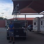
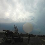
NOAA National Severe Storms Laboratory Researcher Sean Waugh will collect weather data in the path of Hurricane Harvey Friday to record how the landfalling hurricane changes as it develops. The first major hurricane forecast to…
Official websites use .gov
A
.gov website belongs to an official government
organization in the United States.
Secure .gov websites use HTTPS
A
lock (
) or https:// means you’ve safely connected to
the .gov website. Share sensitive information only on official,
secure websites.
NOAA National Severe Storms Laboratory Researcher Sean Waugh will collect weather data in the path of Hurricane Harvey Friday to record how the landfalling hurricane changes as it develops. The first major hurricane forecast to…
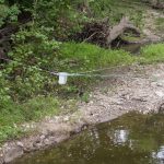
A new research project is already helping save lives and property with early flood notification after a stream in southern Oklahoma rose 10 feet in one hour. Jonathan J Gourley, research hydrologist with the NOAA…
For the first time ever, lightning data from a weather satellite is available and being evaluated in the NOAA Hazardous Weather Testbed. Forecasters, researchers, product developers and broadcast journalists are analyzing recently available experimental data…
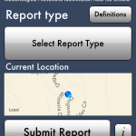
NSSL, CIMMS and University of Oklahoma researchers have launched a new project to collect public observations of flooding that will help improve flash-flood prediction and warning tools in the US.
NSSL scientists will launch instrumented balloons into north Florida thunderstorms as part of an ongoing University of Florida triggered lightning experiment for two weeks beginning July 28.
Researchers with the Coastal and Inland Flooding Observation and Warning (CI-FLOW) project are preparing for Tropical Storm Andrea to test their total water level system on Friday in North Carolina.
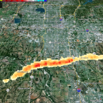
The experimental Tornado Debris Signature algorithm uses dual-pol radar data to map areas of debris.
NSSL tornado climatology expert, Harold Brooks has written a blog post about the remarkable absence of tornado activity during the 12-month period from May 2012 to April 2013.
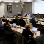
February 5-7 at the National Weather Center.
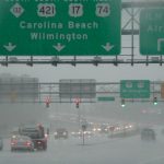
Researchers with the Coastal and Inland Flooding Observation and Warning (CI-FLOW; http://nssl.noaa.gov/ciflow) project are preparing for Hurricane Sandy to test their total water level system in North Carolina this weekend.