
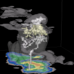
A simulation of a Florida thunderstorm showing two lightning flashes (upper-level intracloud and a negative cloud-to-ground). Light gray is the cloud boundary, darker gray is 35 dBZ reflectivity. 2D color slice is simulated NEXRAD reflectivity.
Official websites use .gov
A
.gov website belongs to an official government
organization in the United States.
Secure .gov websites use HTTPS
A
lock (
) or https:// means you’ve safely connected to
the .gov website. Share sensitive information only on official,
secure websites.
A simulation of a Florida thunderstorm showing two lightning flashes (upper-level intracloud and a negative cloud-to-ground). Light gray is the cloud boundary, darker gray is 35 dBZ reflectivity. 2D color slice is simulated NEXRAD reflectivity.
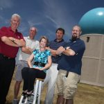
Vaisala Outstanding Research Paper winners (L-R): Richard Adams, Dave Priegnitz, Pam Heinselman, Travis Smith, Kevin Manross. See full story below!
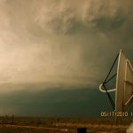
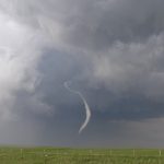
A Shared Mobile Atmospheric Research and Teaching Radar scans a supercell thunderstorm near Artesia, NM during VORTEX2 2010 operations.
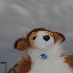
Chase StormDawg, VORTEX2 special correspondent to kids, is showing mammatus clouds he saw in front of his house. He joined VORTEX2 in the field on May 1 to report on what he sees.
NSSL Media Vehicle driver John Oakland snapped this picture of the tornado captured by VORTEX2 in LaGrange, Wyoming.
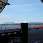
The NO-XP team enjoys the view of the Canadian Rockies from Birch Bay, Washington. They are using the radar to support weather nowcasting for the Cypress Mountain venue at the 2010 Winter Olympic Games.

NSSL’s Pam Heinselman (second row from the bottom, end) and Mike Coniglio (second row from the top, fifth from the left) in the official White House photo with President Obama from the Presidential Early Career…
Mike Coniglio won second place in the “Research Tools of the Trade” category in the OAR photo contest for this photo.
NSSL’s JJ Gourley received first place in the OAR “Research Tools of the Trade” category for his shot of a lightning strike with a VORTEX2 mobile mesonet in the foreground.