
You likely know the NOAA National Severe Storms Laboratory (NSSL) for its tornado research or radar developments, and its support of the National Weather Service (NWS) mission. However, you may not know the lab has an important role in studying the after effects of wildfires.
Rising temperatures, declining snowpack, frequent droughts and other climatological factors are all leading to a dramatic surge in wildfire frequency and severity across the western United States and Canada. Year after year, fire fills the skies with smoke, impairing water supplies, disrupting economies, threatening lives and property, and converting live timber and understory vegetation to burn areas; altering the landscape for years.
NOAA’s engagement with wildfire is comprehensive. Perhaps an unexpected aspect of that engagement comes in the form of NSSL flash flood research.
After a wildfire is contained or extinguished, community perception is often that the threat for further damage is also eliminated and the recovery phase begins, with life slowly returning to normal. While the menace of further fire may be snuffed out, the aforementioned burn areas pose a new type of threat.
Under normal, prefire conditions, as a thunderstorm drops rain on the environment, plants and trees intercept some of that precipitation. Another portion makes it to the ground and is absorbed by the soil. So, both the soils and vegetation act as a buffer to heavy rainfall.
When a wildfire occurs, these buffers are removed and the resulting burn areas leave the landscape vulnerable to flash flooding, severe erosion and debris flows. Extreme and damaging hydrologic events can occur even with low amounts of precipitation, particularly in mountainous areas.
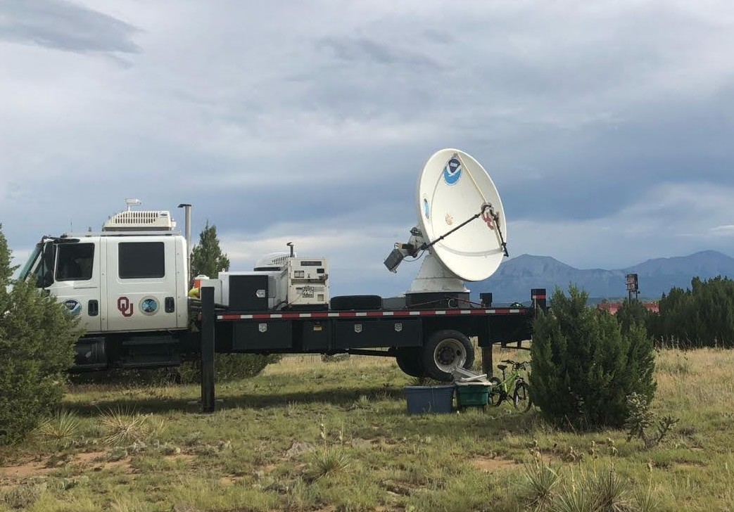
By monitoring the rainfall over a burn area using mobile radars, researchers can get an idea how detailed precipitation patterns in these areas lead to flash flooding and debris flow initiation that can be dangerous and damaging.
“Conventional sensors, like rain gauges, can’t capture the full story of what’s happening in burn areas and flooding,” said NSSL Researcher JJ Gourley. “The rainfall patterns in mountainous areas are complex and it requires a radar nearby for adequate monitoring. Plus, the radar can see storms that are approaching a burn area and can provide some lead time that something bad is about to happen. It doesn’t take much rain to trigger a flash flood or a debris flow on a burn area. It’s just a matter of time before an extreme flow happens. Ultimately we want to be able to predict these events so the NWS can warn and protect the public.”
In collaboration with the U.S. Geological Survey and the State of Colorado, NSSL operated a post-wildfire hydrometeorological observatory on the Spring Creek burn area in southeast Colorado from 2019 to 2021. A suite of instruments, including NSSL’s mobile weather radar, was placed on and near the burn area to provide detailed measurements of rainfall characteristics, soil conditions, and extreme hydrologic responses. All observations were transmitted in real time to local authorities to provide early alerting capabilities.
“We’re upgrading our mobile radar facilities and expanding our observatory to include sensors flying aboard Uncrewed Aircraft System (UAS) platforms,” said Gourley. “Presently, we’re collecting detailed observations that will be used to improve our models. This is a key step toward a future system that will forecast the rain and the hydrologic response in these situations.”
NSSL remains on the cutting edge of severe weather technology and research, seeking to better understand and predict the hazards that come with extreme weather. Ultimately our research is designed to produce the next generation of methods and technologies to equip forecasters to better serve the public and protect lives and property, even after the fire.


