
The Annual Meeting of the American Meteorological Society is the largest recurring conference in our field. In January 2021, the 101st Annual Meeting of AMS took place in a virtual venue, but that didn’t stop the experimental Warn-on-Forecast System (WoFS) from taking center stage in a variety of ways. At least seven posters and a dozen oral presentations covered stories specific to WoFS. Many more covered closely related aspects of mesoscale modeling and forecast and warning operations. WoFS presenters included Norman-community researchers and students, but also National Weather Service forecasters from national centers as well as local offices. One group especially well represented were science operations officers from the group of nine Southern Plains NWS offices that have been evaluating WoFS as part of a two-year project. Many showed real-world examples of the ways in which WoFS is already influencing lead time and specificity of information shared with the public and other users.
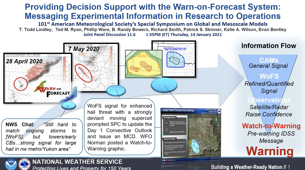
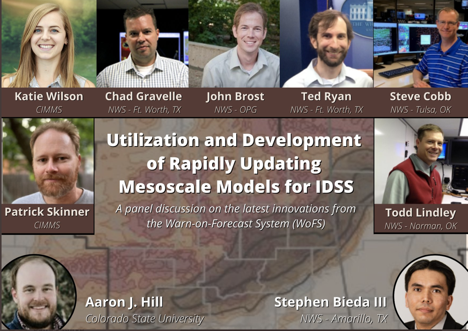
There was so much enthusiasm for developing WoFS-style probabilistic and rapidly updating guidance — with novel data assimilation for the watch to warning time scales — an entire conference session was dedicated to WoFS and included a panel discussion titled, “Utilization and Development of Rapidly Updating Mesoscale Models for IDSS (Incident Decision Support Services).”
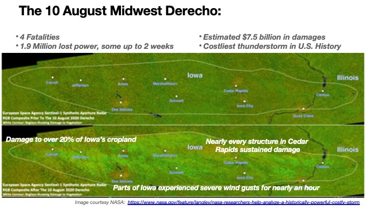
Perhaps no presentation spoke more to the potential utility of WoFS than Patrick Skinner’s talk, “Predictability of the 10 August 2020 Midwest Derecho.” The “Iowa Derecho” was one of the biggest weather stories of 2020. Occurring at the height of the growing season, the swath of destructive winds was not only life-threatening but also obliterated crops in its path, making this the costliest single thunderstorm event in United States history.
Predictability varies for thunderstorm events, and many numerical models did not do a particularly good job of helping forecasters to anticipate such a devastating event, even the day of the storm. To test whether the experimental WoFS could have contributed to an improved forecast of the event, researchers first had to expand the model domain to capture the evolution of such a fast-moving and long-lived storm. Once this had been accomplished, the results of the forecast runs proved very promising. A forecast based on data that was available 12 hours before the derecho correctly predicted a fast-moving, bowing thunderstorm system with significant severe winds (> 75 mph) near the ground. In the loop below, red shading represents the swath of WoFS-predicted significant severe winds, and the small blue squares and red triangles plot the locations where damaging winds and tornadoes, respectively, were observed on August 10, 2020.
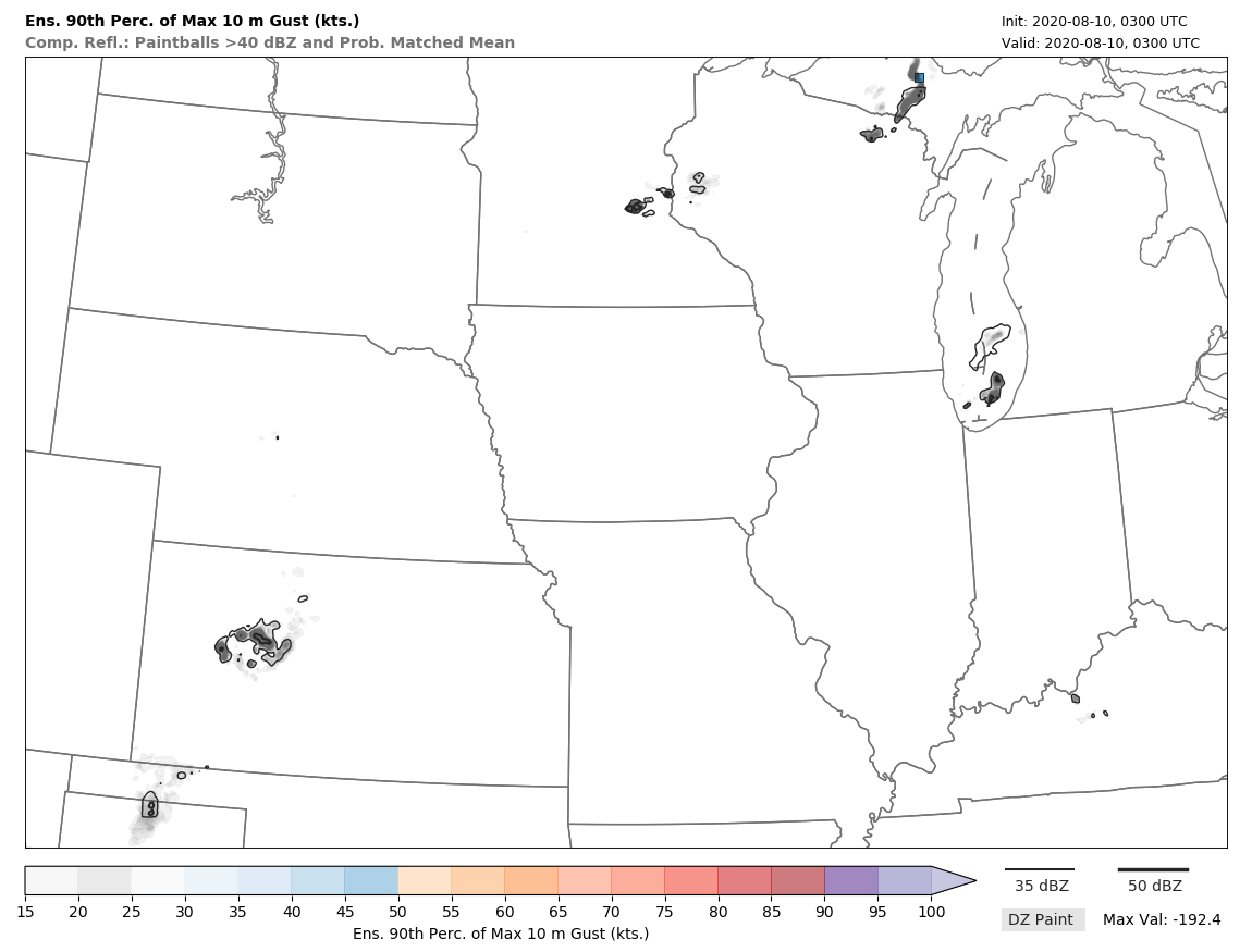
In the future, when a fully developed WoFS becomes available for events such as these, this could lead to earlier anticipation of a high-end event. The initial WoFS forecasts were displaced a little to the north of the worst damage, but as the early stage of the storm development got underway, WoFS forecasts adjusted to the correct latitude/location, still with a few hours of lead time before the worst of the storm would have occurred.

Preliminary results indicate the poor depiction of overnight thunderstorms in Nebraska and South Dakota led to large errors in the operational forecast models. The models generated too many thunderstorms early in the forecast period, thus limiting the energy available for daytime storms in Iowa. Employing rapid and high-resolution assimilation of radar and satellite data, the experimental WoFS forecasts better depicted the overnight storms, and therefore better reflected the large amounts of energy available for the damaging daytime storms in Iowa. The group led by Skinner plans to publish this research in the near future.
For questions on this or other WoFS-related research please contact WoFS Program Lead, Patrick Burke, nssl.noaa@outreach.gov.


