
The National Weather Center will host renowned physicist Dr. Francis Slakey, Associate Director of Public Affairs at the American Physical Society, at 4 p.m. April 23 in Room 1313.
Official websites use .gov
A
.gov website belongs to an official government
organization in the United States.
Secure .gov websites use HTTPS
A
lock (
) or https:// means you’ve safely connected to
the .gov website. Share sensitive information only on official,
secure websites.
The National Weather Center will host renowned physicist Dr. Francis Slakey, Associate Director of Public Affairs at the American Physical Society, at 4 p.m. April 23 in Room 1313.
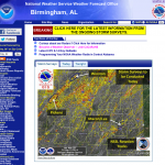
The NWSFO in Birmingham, Ala. used an NSSL product to plan surveys of damage caused by the tornadoes yesterday. NSSL’s On Demand is a web-based tool that can be used to help confirm when and…

NSSL’s Bob Rabin was in D.C. to support Native Alaskan students as they gave presentations on weather and climate.
A team of scientists, including NSSL’s Dave Turner published a new study in Nature that showed how clouds over the central Greenland Ice Sheet last July were “just right” for driving surface temperatures there above the melting point.