
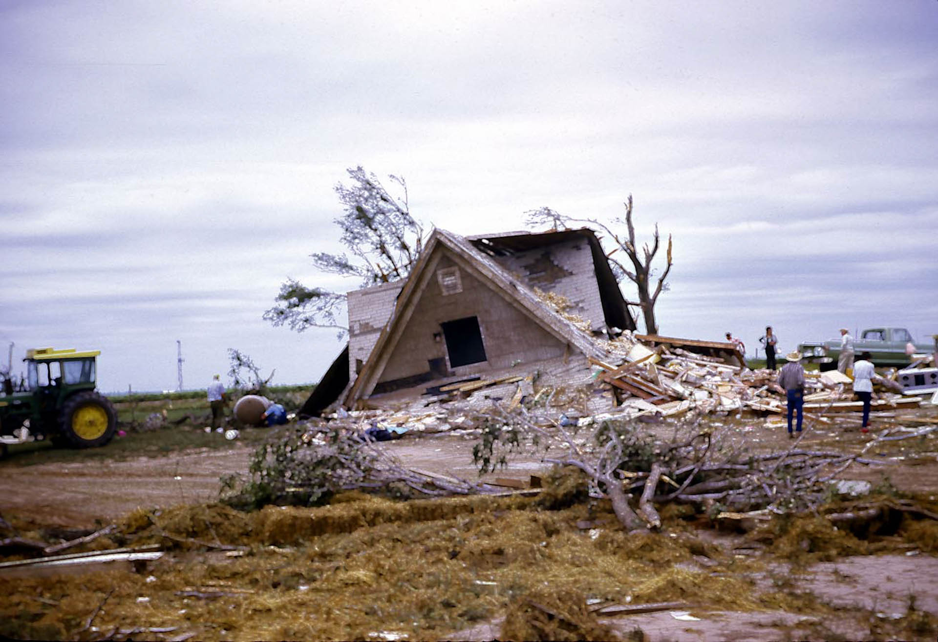
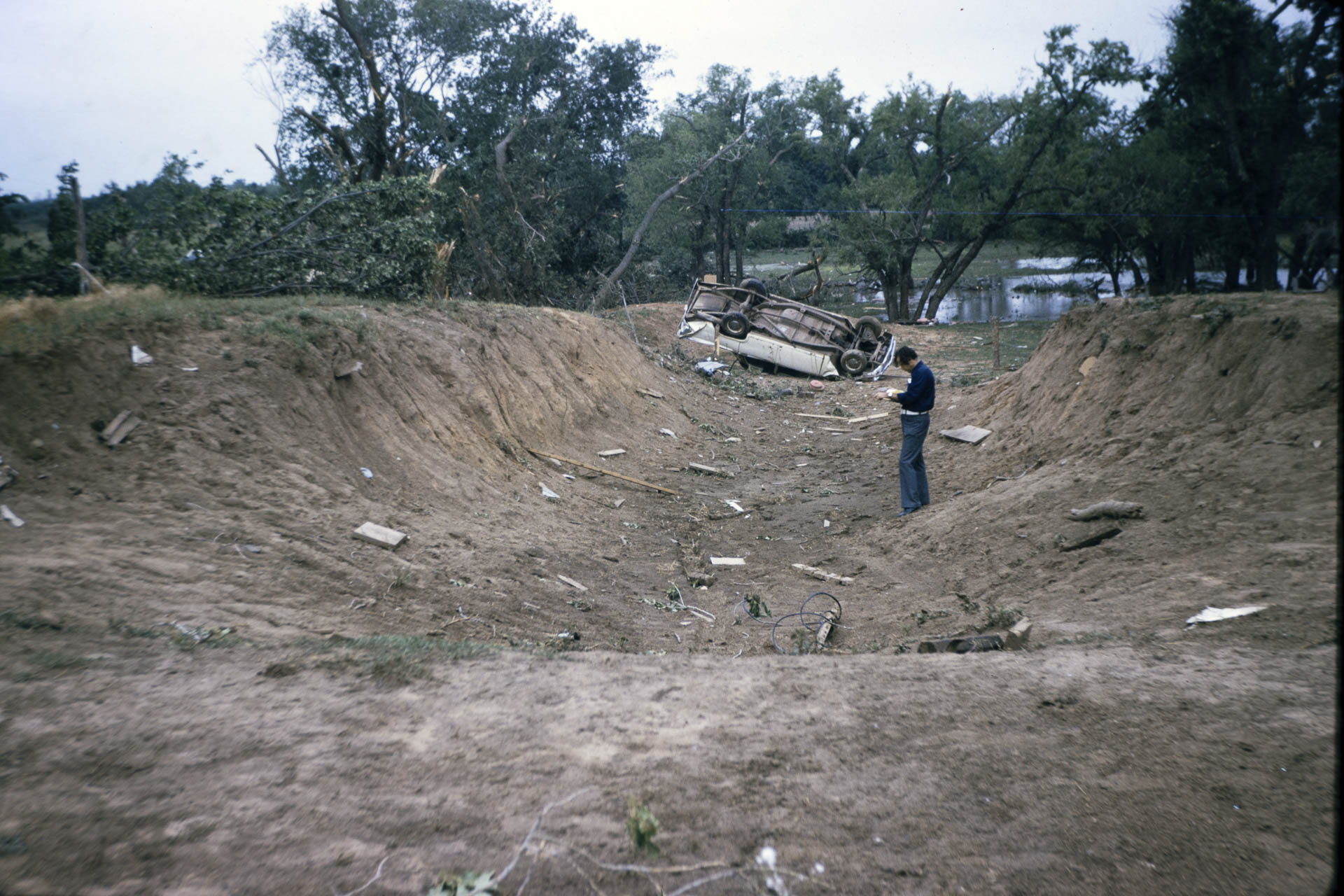
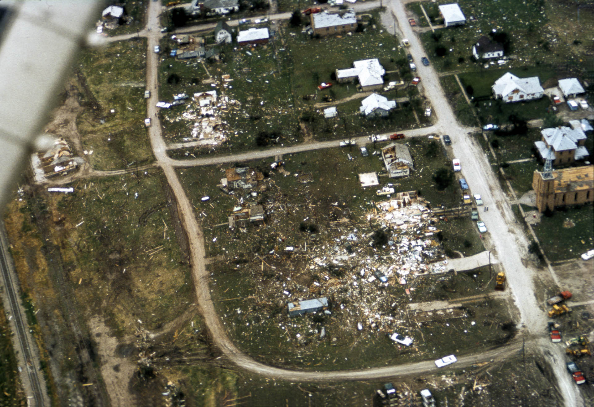
Tornado Intercept
The Union City Twister and the Birth of Doppler Radar
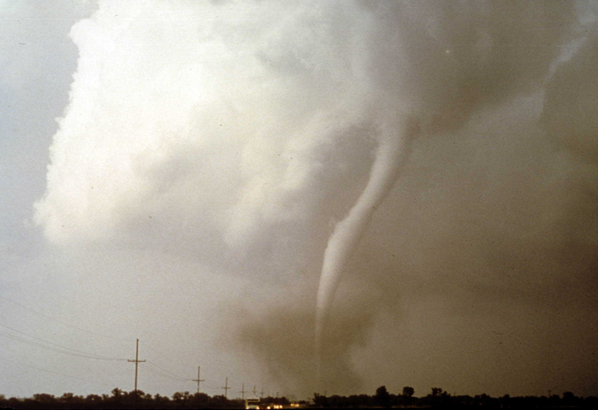
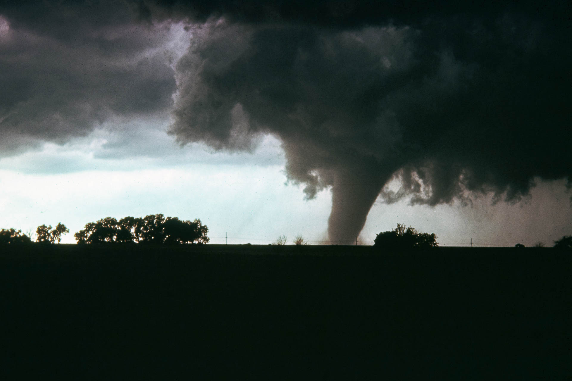
Fifty years ago, on May 24, 1973, a violent F-4 tornado tore through the central Oklahoma town of Union City, killing two people and injuring at least four more. While the human impact of the storm was devastating, the Union City tornado was also historic as it marked the first time researchers were able to use radar to observe the entire lifecycle of a tornado and discover the tornadic vortex signature or TVS.
The data and observations gathered that day by NOAA National Severe Storms Laboratory (NSSL) scientists mark a pivotal day in the history of meteorology and tornado research.
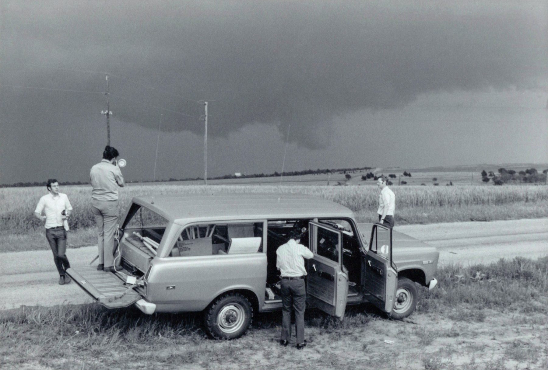
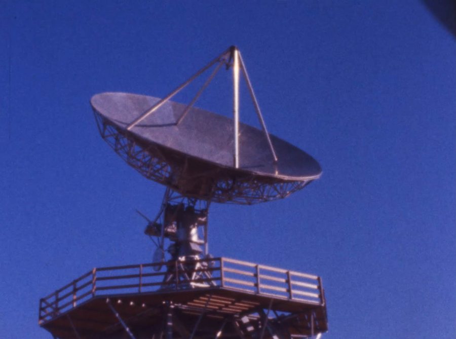
Don Burgess, a retired NSSL researcher, remembers the lab’s efforts to use the then newly built, experimental Norman Doppler Radar to collect the data. With Union City a short drive away, the researchers at NSSL were in prime position to observe the tornado.
“We had the facility here at NSSL ready,” said Burgess. “As storms developed less than 100 miles away, the Storm Intercept Teams were located in the vicinity of the developing tornado, we were able to get the entire life cycle of a tornado documented for the first time ever. Having that lifecycle data and not just snapshots was very revealing about what was going on with the storm.”
The revelations from NSSL’s Union City research were the beginning of a new era of tornado forecasting and warning. The discoveries made that day laid the groundwork for decades of improvements to tornado warning lead time and the ability for forecasters to give the public more time to take life-saving action.
“The Doppler radar data revealed a rotation signature that appeared aloft in the storm 15, 20, 25 minutes before the tornado touched down,” said Burgess. “That’s what we came to call the tornadic vortex signature or TVS. That signature has gone on the be used operationally and helps get that lead time in tornado situations.”
Researchers from the NOAA National Severe Storms Laboratory deployed as Tornado Intercept Teams to document the development of tornadic thunderstorms. These teams documented the lifecycle of tornadoes, including extensive timelapse videos, that when paired with the radar data captured by NSSL’s experimental Doppler radar, proved to be pivotal to our understanding of tornadoes.
Early Days of Doppler Radar
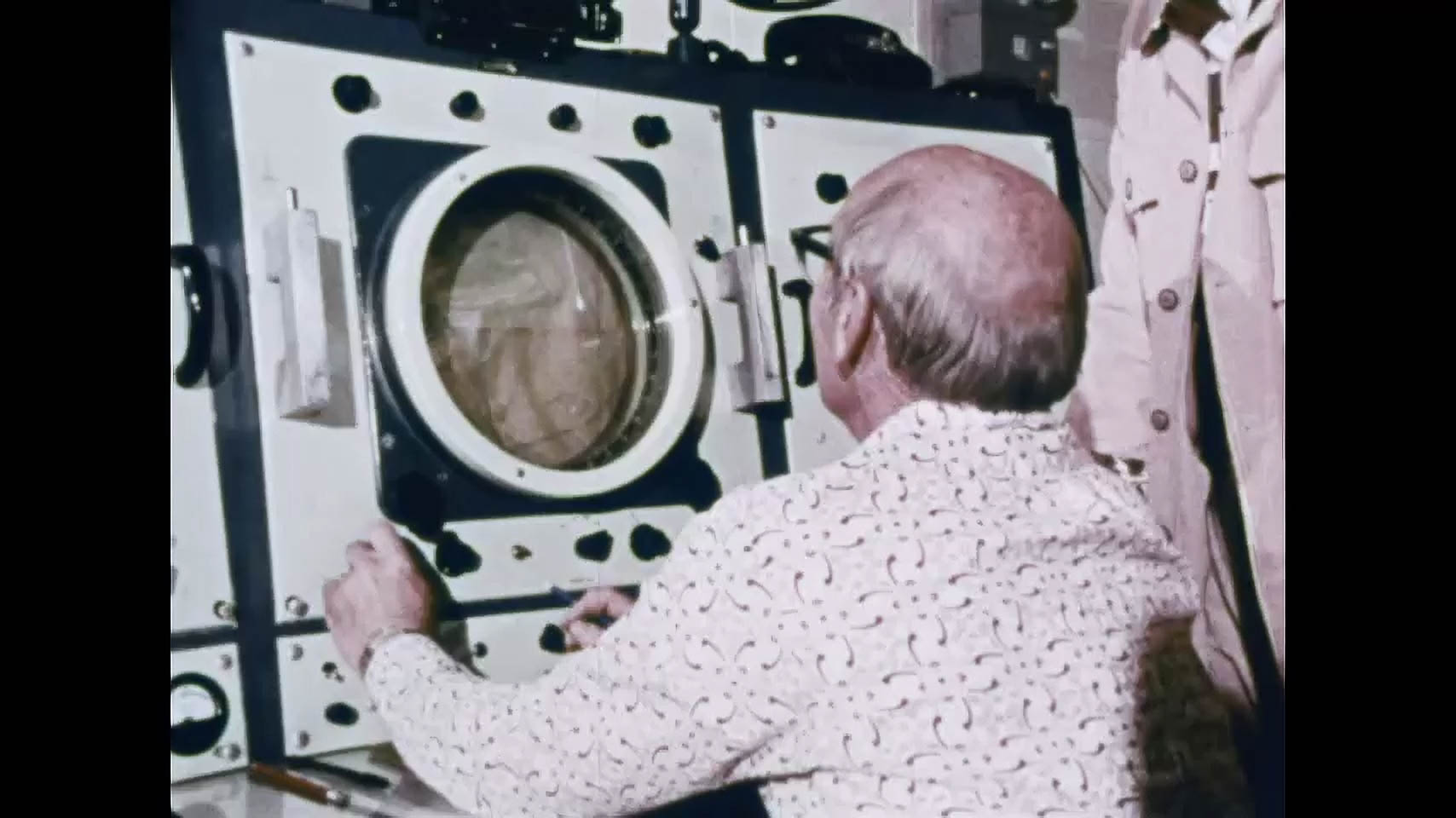
You might be familiar with today’s radar technology. You often see radar data on TV or you might even have a radar app on your phone. Screens fill with colorful images that move and update, close to real time. But the early days of Doppler radar were quite a bit more cumbersome.
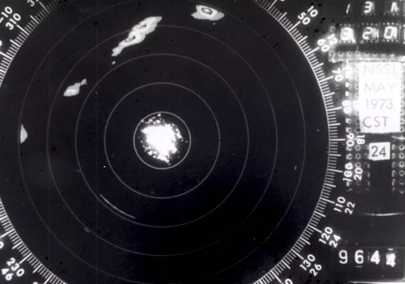
No one saw the The Doppler radar data from Union City for a long time after the storm. It was recorded on magnetic tape that then had to be processed on a computer before researchers could first see the data.
Kurt Hondl, Deputy Director of NOAA NSSL describes what that process might have been like.
“They would figure out where the storm was that they wanted to observe, and they would use that to aim the experimental Norman Doppler. Then they would send those tapes off for processing. It might take months before they would receive back paper printouts of rows and rows of numbers that were the actual data. They then had to hand contour the data to see what the radar saw several months ago. While the data was gathered by the radar in the spring, humans probably didn’t see the numbers until several months later.”
That data was worth the wait.
The Impact

Armed for the first time with a picture of the complete lifecycle of a tornado, researchers knew radar could play an integral role in issuing faster, more accurate warnings. Doppler radar’s ability to “see” the elements of a developing tornado was a game changer.
“With Doppler radar and the NEXRAD program, you can now see the velocities and calculate quantitatively the rotational velocities of the storm,” said Hondl. “The forecaster can see from scan to scan whether that velocity is increasing or decreasing and they can use that to make a decision to issue a warning. That is probably the greatest thing that Doppler radar has provided is improved tornado warning lead times.”
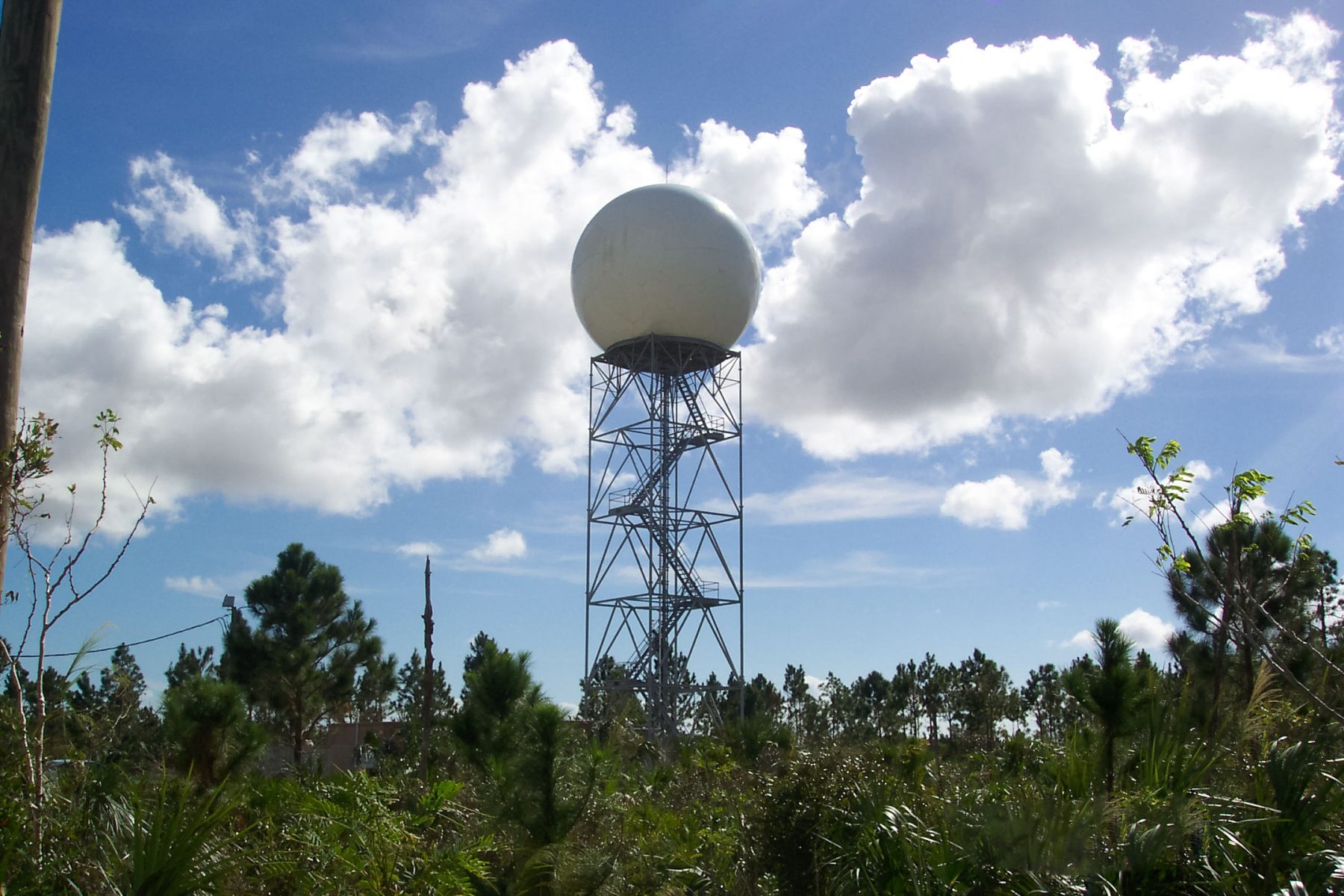
NSSL continued to improve Doppler technology and by 1988, NOAA and the National Weather Service rolled out the NEXRAD (Next Generation Radar) network with the Federal Aviation Administration and the Department of Defense. This network of 160 high-resolution Doppler radars spans the United States, providing critical information to forecasters and researchers, and anyone who needs it.
“That has led to increased tornado warning lead times,” said Hondl. “Certainly that has been of great benefit to the country to have those warnings reduce loss of life and keep people safe.”
Radar History Timeline
WSR-57
In 1956, the NWS introduced the WSR-57, one of the earliest versions of weather radar. These radars displayed information on a black screen called a scope. With each sweep of the radar beam the previous image disappeared. If forecasters or researchers wanted an archive of radar images they would have to periodically take black and white photographs of the screen.
WSR-74
Beginning in the late 1970s the NWS began replacing WSR-57 radars with a new version, the WSR-74. Developed at NSSL, these new radars included Doppler technology that gathered similar data but also measured the relative velocity of air within a storm.
WSR-88D NEXRAD
Operationalized in the early 1990s, the WSR-88D or NEXRAD (Next Generation Radar) System provided marked improvements for the NWS. It increased the resolution of the data, allowing forecasters to see storms in much finer detail. The NWS currently operates 159 of these NEXRAD systems nationwide. Recently the network was upgraded to dual polarization technology, which provides forecasters a new wealth of information.
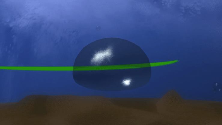
Dual Polarization
NSSL scientists continued their work on radar technology after the deployment of the NEXRAD network. Their next technological leap was dual-polarimetric (dual-pol) technology, which allows the radar to transmit and receive pulses in both a horizontal and vertical orientation. This remarkable technology has many advantages including: improved accuracy of precipitation data, leading to better flash flood detection; the ability to fully discern between rain, snow, sleet, and hail; improved detection of non-weather echoes like birds and lofted tornado debris. Dual polarization gives forecasters and researchers a much more detailed and accurate depiction of the atmospheric conditions inside a storm.
NSSL On the Cutting Edge
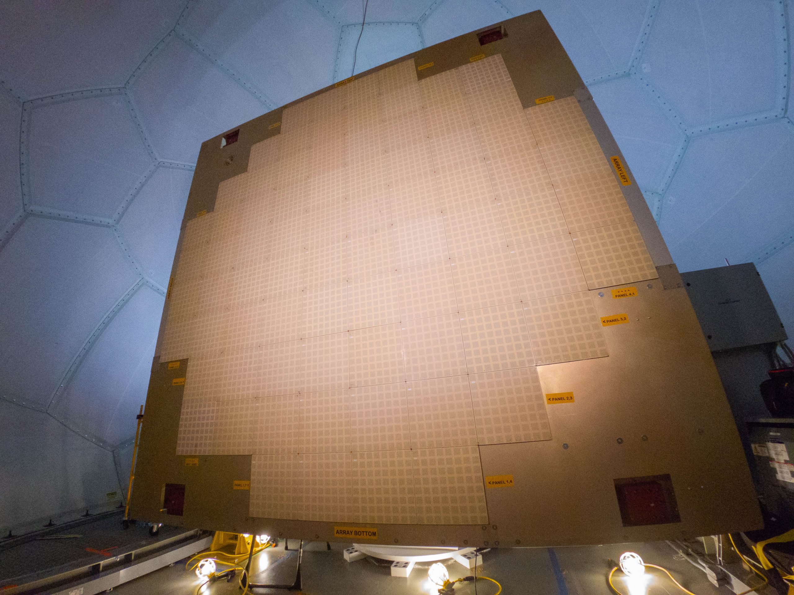
What’s next for NSSL and weather radar? NOAA researchers are currently hard at work developing the next leap in radar technology: phased array radar or PAR. Current weather radars like NEXRAD Dopplers mechanically rotate and tilt the radar dish to sample different parts of the atmosphere. A phased array radar (PAR) has a unique flat panel antenna made up of a grid of thousands of fixed antenna elements, and each can transmit and receive a signal. As a result, the radar beam can be steered electronically, giving users the ability to control how, when and where the radar scans.
“PAR is different from the typical radars that you see have a parabolic dish,” said Hondl. “It’s kind of like a flashlight. You have to physically move your flashlight, or radar beam, to illuminate different parts of the room or in this case, the sky.”
With a phased array however, the radar can remain stationary and by changing the timing or “phase” of the different individual cells that make up the radar, an operator can scan different sectors of the sky more frequently than with a rotating radar.
“So the ultimate goal is to improve the radar update time; how frequently we can get the information to the forecaster,” said Hondl. “As a forecaster is making a decision whether to issue a tornado warning or not, they look at trends in rotational velocities and storm development. If you have to wait four or five minutes between scans, you’re wasting that time. If we have an update more frequently, they’ll be able to make those decisions faster and with more confidence.”
The ATD
The experimental Doppler radar NSSL scientists used on May 24, 1973, was housed at lab headquarters in Norman, Okla. Today, that same site is being used to house the next generation of experimental radar, phased array radar.
The Advanced Technology Demonstrator, or ATD, houses a large dual polarized phased array radar that NSSL is currently using to further develop and refine the technology. With several tornadic storms passing near the ATD recently, researchers have been able to put the radar to the test on real life tornadoes. This data is invaluable as NSSL works to prepare PAR for potential operational use by the NOAA National Weather Service.
“The phased array radar teams at NSSL are world-class scientists and engineers,” said Anthony Reinhart, NSSL Phased Array Radar R&D Program Lead. “For more than a decade, they’ve worked diligently to advance this radar technology from a conceptual idea to a proven and potentially operationally capable product. We’re exceptionally proud to be part of the lab’s legacy of radar innovation.”
Conclusion
From the early days of looking at the Union City data on a black and white screen, to looking at velocities with the Doppler, to dual polarization and now to the development of phased array radar, NSSL continues to be a global leader in radar technology.
For more than 50 years, the NOAA National Severe Storms Laboratory has been pushing the field of weather radar into the future. With Union City as an inflection point for this critical technology, NSSL researchers continue to drive innovation.
“NSSL is absolutely a leader in Doppler weather radar technology,” said Hondl. “From the early days of looking at the Union City data on a black and white screen, to looking at velocities with the Doppler, to dual polarization and now to the development of phased array radar, NSSL continues to be a global leader in radar technology.
“Ultimately our mission is to arm forecasters with the best tools possible so together we can save lives and protect property.” 


