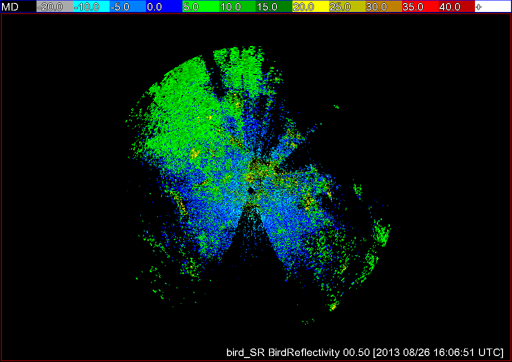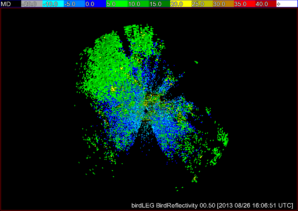
A secondary use of weather radars is to detect biological scatterers such as birds, bats, and insects. When birds are detected, the echoes returned to the radar can be used to estimate the density of birds on the ground. This information is valuable in a number of situations, such as when attempting to determine where birds stop while in their migratory journey.
The algorithm w2birddensity, which is based on an algorithm described in detail here, estimates the bird density from radar reflectivity data. This is done by computing a vertical profile of reflectivity (VPR) and making adjustments to the raw reflectivity field based off of the VPR.
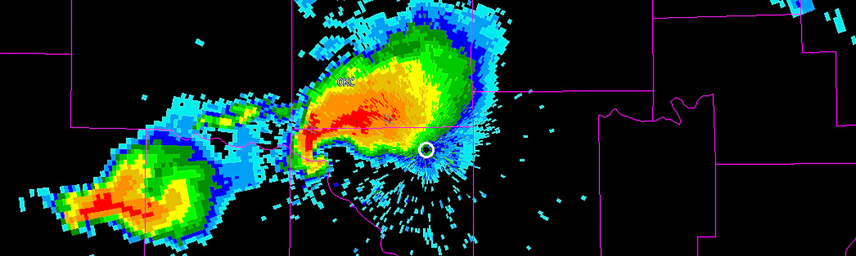
Previously, w2birddensity was carried out at a fixed resolution, but we have now given users the option of defining the resolution of their radar data with the -R flag. As with many of our other algorithms, just specify the gate size in km, the radial size in degrees, and the range in km, as shown below. Additionally, we have given the user the option of specifying that they would like more then the default of 5 tilts processed. This is done by setting the -n flag to the number of tilts desired.
w2birddensity -i /localdata/birddensity/code_index.xml -o /tmp/birds -s KAKQ -E ~/WDSS2/gtopo30/radars -R 0.25x0.5x100 -n 5 --verbose