
This map shows where our teams are deployed today. Elevation ranges about 200 m (darkest green) to above 600 m on Sand Mountain (pale green). Small color-filled circles are our research deployment sites. Huntsville AL is on the west edge, so this map covers all of northeast AL.
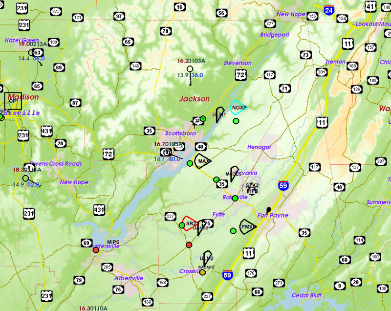
Sand Mountain is that broad swath of gently rising terrain that extends out of the northeast corner of the state. The river on the west edge of Sand Mountain is the Tennessee River, flowing southwest until it turns back northwest toward Huntsville. This area is a good natural laboratory for looking at the influence of terrain features on the small-scale environments of storms, with very rough terrain just northeast of Huntsville, the broadly sloping Sand Mountain plateau, and a similar feature called Lookout Mountain further southeast. There is a big variety of land use here, including cultivated agriculture, dense forests, large lakes/rivers, and large urban areas.
The first round of storms is moving off into Georgia, and now we await more significant supercells from midday through late afternoon.