STATUS: 6 April 2016

STATUS: IOP Watch

We are watching for the possibility of an IOP ~ Tue Apr 12.  Right now, the ingredients are not coming together particularly well, mainly as a result of forecasted nighttime system passage, and the configuration of the cold front.  The odds of an IOP with this system don’t look particularly high right now, but remote investigators need to be considering how they would make travel arrangements with the event occurring early in the week.

(Edit: changed “Mar” to “Apr” above… hat tip to a VORTEX-SE fan in Kansas.)

Tags: None

STATUS: 5 April 2016

STATUS: Down

1 PM Briefings resumed today.

We are monitoring the guidance for Tue 12 April.  Right now it appears that CAPE and shear may be sufficient for severe storms in N AL.  If this guidance persists, we will likely go into “IOP Watch” status tomorrow, Wed 6 April.

Tags: None

STATUS: 4 April 2016

STATUS: Down

There will be no briefing today.  Briefings will resume about 7 days in advance of the next possible severe weather.  Although a front will pass through the VSE domain in the middle of this week, all indications are that the low levels will be too dry to support severe storms.

Some tools suggest that there will be a period of active severe weather in the southern U.S. around mid-April.  It remains to be seen whether this activity will be confined to the middle part of the country, or extend eastward into the Southeast.  Expect that briefings will resume later this week to monitor the evolution of the expected activity.

Tags: None

STATUS: 3 April 2016

STATUS: Down

Daily briefings will resume when it appears that severe weather chances are about seven days away.  Right now, there are no systems in the forecast models for the next ~2 weeks that appear capable of supporting severe storms in Alabama.  The current pattern of an eastern N. American trof favors cool, dry weather, and the persistent subtropical jet favors convection in the Gulf of Mexico and immediate coastal areas, if/when it occurs.

But this could change any day, so watch this blog for updated status and the resumption of briefings.

Tags: None

STATUS: 1 April 2016

STATUS: Down

There are no briefings scheduled for today through Sunday 3 April.

Watch these daily status reports to find out when briefings will resume… about seven days in advance of the next expected weather system.


Tags: None

IOP3 Update #6: 10:00 PM Thur Mar 31

Busy day.  I wish I could write a cogent description of how things evolved in the VORTEX-SE domain today, but I really am unable!  As with our other deployments, I would have been unable to forecast any of the evolution I observed beyond perhaps 30 minutes.  And that may be giving me too much credit!

There were a series of supercells that moved along the TN/AL state line in the northern part of our Doppler area.  We were able to deploy sticknets and disdrometers ahead of one of these early in its life cycle, and one of our teams reported a wall cloud, and another a clear slot.  These storms intensified as they continued to move east, but we haven’t received any reports of serious tornadoes with these despite fairly strong and persistent mesocyclones.

After sunset, a blast of cells formed in MS and moved across our domain.  This evolved into the form of a big bowed line of cells, and along the “bent-back” portion of this line we saw a number of areas of low-level shear.  One of these developed into what was probably a significant tornado northeast of Hartselle AL, southwest of Huntsville.  This was in one of our dual-Doppler lobes.  We don’t yet know how significant this tornado was, but it had a prominent debris signature on dual-polarization Dopplers.

It was a tense ~hour for the UAH people at SWIRLL as this vortex moved toward Huntsville.

A couple of other of these low-level shears were well-sampled in our southwest dual-Doppler lobe; they were non-tornadic as far as we know.

Two or three tornadic supercells also occurred south of the bowing line of cells, but these were south of our observing domain.

So this was a good IOP… well observed from the perspective of dual-Doppler, soundings, and stesonet, and not surprisingly very difficult to observe with the fully mobile assets.

The scientists and teams have been working for 13 hours, and there are a lot of signs that the low-level shear is now not favorable for additional tornadoes.  So operations are being wound down.


Erik Rasmussen

Tags: None

IOP3 Update #5: 5:00 PM Thur Mar 31

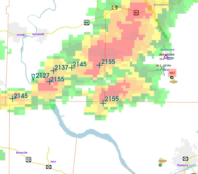
Right now we are focusing on some storms just across the state line in southern Tennessee.  These have had some pretty persistent, but modest, low-level rotation.  Surface conditions near them are fairly cool and stable.  But we are looking at these storms until something more potent moves in later this evening.

500SASSI

The annotated “+” are locations of low-level shear on WSR-88D over the last half hour.  You can see the STK2 team deploying sticknet weather stations ahead of these cells.

Tags: None

IOP3 Update #3: 2:30 PM Thur Mar 31

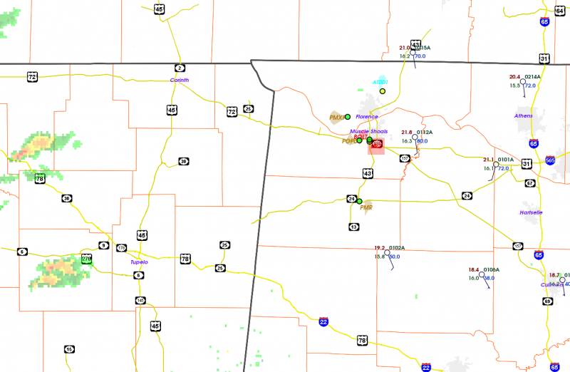
Things might be getting pretty busy pretty soon.  Thunderstorms are forming over north-central MS and moving rapidly toward the east-northeast.  Several of these already exhibit weak shear.  It looks like we are ready to collect data.

230SASSI

These storms are moving into a band of fairly strong temperature contrast.  This would normally favor low-level rotation and possible tornadoes, but at some point they move into air too cool to support them.  Studying these sorts of environmental effects are a big reason for VORTEX-SE.

Tags: None