STATUS: IOP
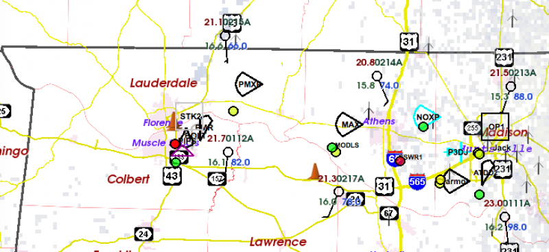
Teams are all deployed and operating across northwestern AL:

Those sideways ice cream cones are mobile radars. The balloon symbols are mobile sounding teams. In the eastern part of the domain you can see an aircraft symbol which is the NOAA P-3 hurricane hunter aircraft on the ground in HSV preparing for an afternoon mission.
We still have no clear idea where/when storms will form. The numerical predictions paint a lot of scenarios, ranging from one to two rounds of storms, and just about anywhere across our domain. In general, conditions would support some rotating updrafts. This is a fairly classic Southeast tornado forecast problem, with a relatively “uncapped” airmass and a lack of clear low-level features (fronts, etc.) to focus the location of the storms. So we are collecting data that should help address this major problem.

