

STATUS: IOP WATCH
The outlook for the activity around the 21st of March continues to be unfavorable, and at this time, it appears an IOP is extremely unlikely. While it appears that low-level heat and humidity will be sufficient for some thunderstorms, the winds aloft will have weakened so much that there should be very little tornado potential. Around midday tomorrow, the researchers are likely to officially, finally, “pull the plug” on this IOP.
However, we expect that by tomorrow, details will start to come into a bit more focus regarding the large pattern change that is expected to occur over the US next week. This pattern change is fairly likely to bring opportunities for IOPs to the Southeast US over the next couple of weeks. The first period we are watching closely will be around Friday or Saturday (24-25 Mar). There are a lot of things that could “go wrong” from the perspective of the VORTEX-SE researchers, so it’s way too early to declare an IOP. But, we will begin watching this possibility tomorrow, and so we will probably again be in an “IOP Watch” for that later period. Compare this forecast to the one posted up-thread:
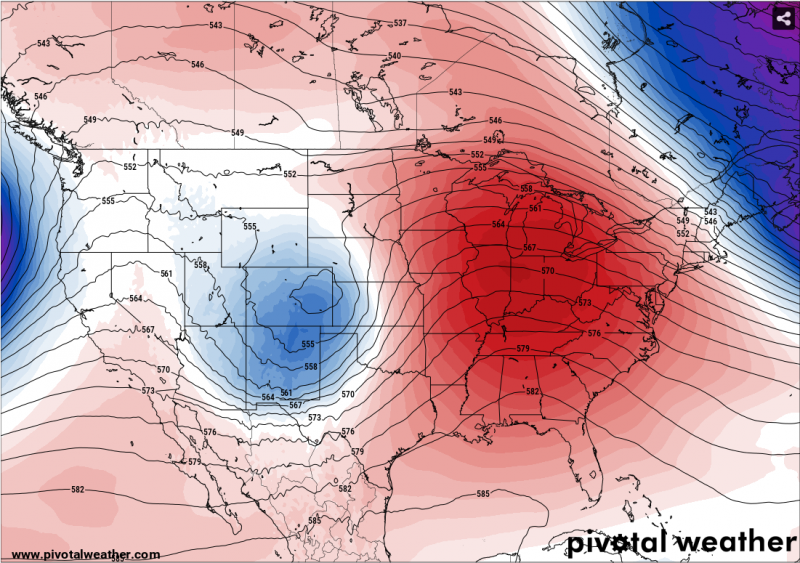
Notice how this forecast for the mid-troposphere for late next week has flipped from an eastern trough-western ridge pattern, to the opposite. This allows stronger southwest flow aloft to develop, and below that should be some fairly strong southerly flow bringing humidity off of the Gulf of Mexico. As this first trough advances toward Alabama, one would expect a fairly strong surface system to eventually pass through the state.
Some of us will be traveling to Alabama next week to get together with the media at the HSV airport on Tuesday and try to convey all the unique, difficult, and exciting challenges this program faces. So these blog postings may be hit-and-miss for the next few days.