In the field, we use 4 different UAS platforms to analyze storm damage.
Trinity F90+
A fixed wing platform used for large-scale mapping and 3D modeling of the Earth’s surface. At NSSL and CIWRO, the Trinity F90+ is used to map storm damage and obtain land surface information for modeling and in-situ observation studies. The Trinity F90+ has vertical take-off and landing capabilities and can map up to 700 hectares at 120 m AGL on a single battery.
It’s equipped with two payloads: Sony UMC R10C 20.1 MP camera and Micasense Red-Edge MX camera, to collect visible and multispectral imagery, respectively. In storm damage assessments, multispectral imagery can detect vegetation damage that otherwise would be indiscernible to the human eye based on the spectral response of vegetation in the red, red-edge, and near-infrared bands.
Atmos Marlyn
A fixed wing platform that is able to operate in high wind speeds and more confined area, which is important for capturing data in areas that are not widely accessible.
It is equipped with a Micasense Altum sensor, to map storm damage in visible, multispectral, and thermal imagery.
Autel EVO II
A quadcopter platform used to collect still photos and videos. At NSSL and CIWRO, the Autel EVO II is used to video and map storm damage in remote or impassable areas otherwise unreachable. It helps our team determine the path extent of a tornado.
It is equipped with a Sony 1″ CMOS, yielding 6K Video and 20 MP JPGs.
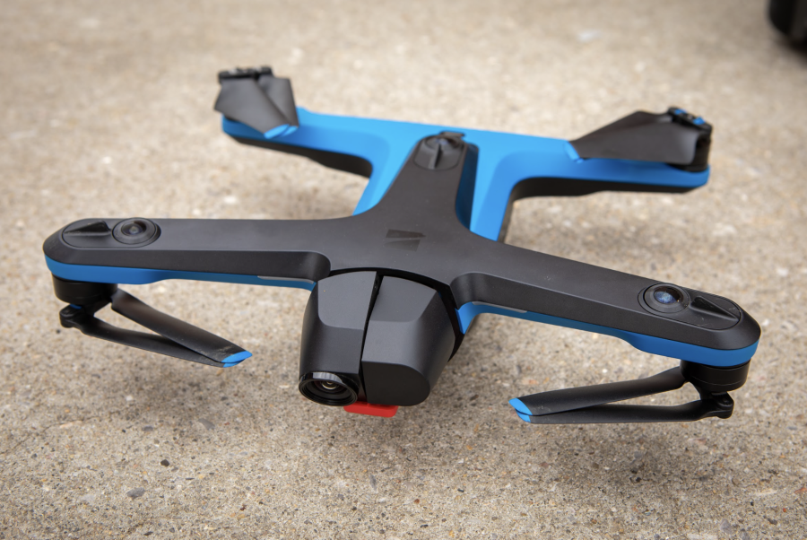
Skydio 2
A quadcopter platform used to collect still photos and videos. At NSSL and CIWRO, the Skydio 2 is used to identify storm damage affected areas, collect imagery that can be shared with local emergency managers and other agencies, and determine targeted areas of interest for large-scale mapping.
It’s equipped with a Sony IMX577 20.1 MP visible camera, yielding imagery with a spatial resolution of 3 cm or less at a flying height of 400 ft above ground level.