On December 10-11, 2021, numerous tornadoes occurred across the central and southern U.S. with portions of Kentucky, Tennessee, Arkansas, and Missouri suffering the most significant damage resulting from three long-track, violent tornadoes (see Figure 1). As part of an ongoing effort to explore the use of UAS technologies for post-storm damage assessments, CIWRO and NSSL collaborated with multiple agencies, including the NOAA Uncrewed Aerial Systems Division (UASD), FEMA IV region, the National Weather Service and NASA, to coordinate ground, UAS and satellite-based surveys of the tornado impacts following this historic event. The CIWRO and NSSL research objectives for these assessments are to: 1) better characterize high-wind impacts to vegetation in rural areas where damage indicators from the Enhanced Fujita Scale are scarce, and 2) better understand the role of land cover and terrain in tornado behavior.
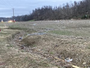
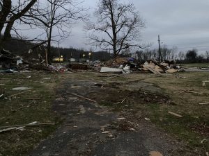
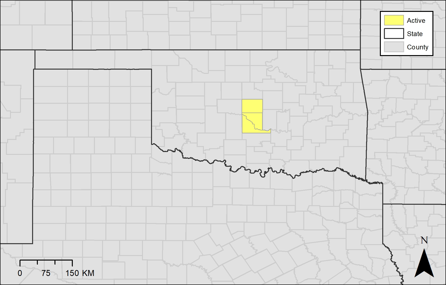
On December 13, 2021, teams from CIWRO, NSSL, and UASD deployed to portions of northwestern TN and western KY to collect UAS imagery in three key areas determined from analysis of radar observations and early damage reports: 1) where the tornado crossed the Mississippi River, 2) Reelfoot Lake State Park, including Samburg, TN and Tiptonville, TN, and 3) near Bremen, KY.
For the river crossing, initial radar analysis and ground-truth information suggested that the tornado may have weakened (or the storm ‘cycled’ tornadoes) in this area, but our surveys indicated the tornado continued strong across the river, with a path that widened and deviated to the left after the river, raising the question of how land cover (surface roughness) can modify tornado behavior.
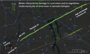
The Reelfoot Lake State Park area and points east were chosen based on uncertainty in damage in this remote area. Indeed, our aerial surveys and high-resolution satellite imagery noted a clear cessation to widespread and intense damage as the tornado climbed a ridge to the east side of Reelfoot Lake, bolstering the ground surveys that found little damage in this area. The aerial surveys confirmed a gap in the damage on the ‘leeward’ side of the ridge in our ground surveys and satellite imagery analysis, suggesting that the gain in elevation could have disrupted the circulation. This may have been key to preventing the longest single tornado track on record. In mid-January 2022, we returned to this area to collect additional UAS imagery to further examine the role of topography and land cover. We mapped three key areas – before the tornado crossed the lake (Tiptonville, TN), after the tornado crossed the lake near Samburg TN (where the tornado intensified), and along the transition area or sharp gain in elevation. Currently, we are analyzing the damage patterns using multiple datasets (satellite and UAS imagery, elevation information, land cover information) and geospatial techniques. In addition to observational analysis, we are using a large eddy simulation (LES) model to explore the role of topography and land cover to investigate hypotheses of tornado behavior related to elevation and surface roughness, similar to Satrio et al., 2020, Lewellen 2012, Lewellen and Lewellen, 2007.
We decided to survey the Bremen, KY area due to initial reports of high end damage in that area (that eventually received an EF-4 rating) and very high rotational velocities observed in the storm from the WSR-88D radars over this rural area. Here, the few damaged structures in predominantly open fields serve as ground truth for our goal to contribute to the development of damage indicators to vegetation that are more reflective of true tornado intensity. We are continuing our observational analyses of damage information as well as running additional simulations to better investigate these factors in tornadogenesis. We are excited to expand upon our work published in Monthly Weather Review and efforts (see timeline) as well as contribute to the greater scientific community on the investigation of topography and land cover on tornado behavior.
Timeline and Relevant Work:
Wagner, M.A., Doe, R.K., Wang, C., Rasmussen, E., Coniglio, M.C., Elmore, K.L., Balling Jr, R.C. & Cerveny, R.S., 2021. High-resolution observations of microscale influences on a tornado track using Unpiloted Aerial Systems (UAS). Monthly Weather Review, 149(8), 2819-2834.
Satrio, M.A., Bodine, D.J., Reinhart, A.E., Maruyama, T. and Lombardo, F.T., 2020. Understanding how complex terrain impacts tornado dynamics using a suite of high-resolution numerical simulations. Journal of the Atmospheric Sciences, 77(10), 3277-3300.
Wagner, M., Doe, R. K., Johnson, A., Chen, Z., Das, J., & Cerveny, R. S., 2019. Unpiloted Aerial Systems (UASs) Application for Tornado Damage Surveys: Benefits and Procedures. Bulletin of the American Meteorological Society, 100(12), 2405-2409.
Wagner, M., Doe, R. Using Drones to Image Tornado Damage with Melissa Wagner and Robert Doe. AMS on the Air. April 13, 2019.
Wagner, M., Doe, R. Making Sure No Tornado Damage is Too Small. The Front Page of the American Meteorological Society Blog. http://blog.ametsoc.org/
Doe, R., Wagner, M. Tornado Pathway Dynamics Using UAS: The Influence of Topography on Tornadoes. Paper presented at American Meteorological Society Annual Meeting; January 7, 2019: Phoenix, AZ.
Doe, R., Wagner, M. Tornadoes and Topography: an Enhanced Understanding of Site Dynamics using Unmanned Aerial Systems (UASs). Paper presented at American Geophysical Union Annual Meeting: December 10, 2018: Washington, D.C.