This project proposes to advance the state of observations of the water cycle across the U.S. in order to improve hydrologic forecasting with the new National Water Model (NWM). The United States Geological Survey (USGS) operates and maintains over 7000 streamgages across the U.S. These observations serve as a critical network to inform hydrologic simulations and to improve the forecasts by assimilating the data into the NWM.
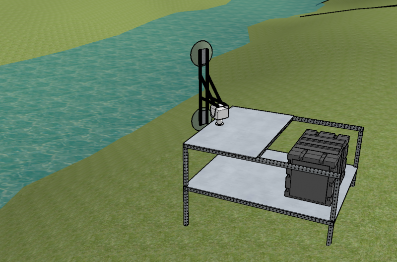
Three non-contact technologies are proposed for improving the observational and monitoring capabilities in rivers: Streamflow Radar, Scanning Lidar and Interferometric Stream Radar (ISRad).
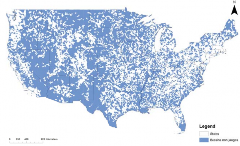
Improved monitoring capabilities will serve a twofold purpose. First, data collected at new stream radar sites can be readily assimilated into the NWM, leading to immediate improvements in forecasts at downstream rivers. Second, forecasters and researchers can use the new datasets to better inform the model structure and parameters at similar locations that do not have prior data records. This will lead to improved hydrologic forecasting at ungaged locations.
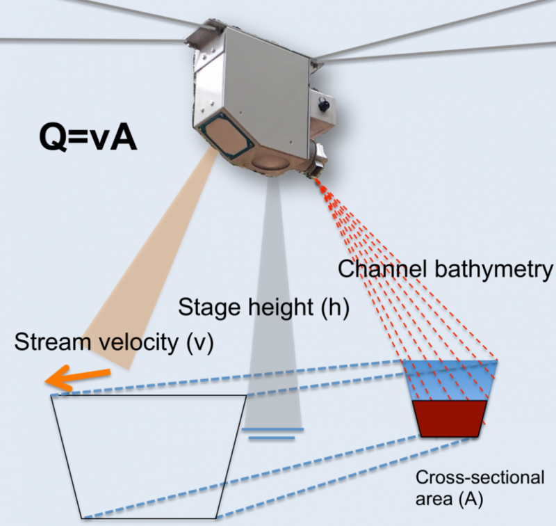
The Scanning LiDAR (Light Detection And Ranging) allows to map a river’s cross-section in an automated way. Revealing the underlying elevation in rivers could greatly advance the ability of high-fidelity flood inundation models to provide more accurate forecasts of water levels and their impacts on infrastructure adjacent to rivers. More importantly, these bathymetry data combined with the measurements provided by the streamflow radars will provide integral and prompt information regarding the state and behavior of streams.
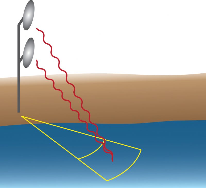
ISRad is an experimental radar intended to retrieve surface dynamics in a 2D field, covering a swath of a medium-to-large river. A 2D velocity vector field will reveal the bank-to-bank velocity profile and features like eddies and backwaters. By analyzing the phase difference of the echoes received by its two stacked antennas, ISRad will also be able to determine the downstream slope, an indicator of discharge. ISRad is currently being built by NSSL, OU CIMMS, and University of Washington researchers.