Hurricane Dorian will go into the record books as one of the most powerful tropical cyclones in the history of the north Atlantic basin. The very slow forward motion over the Bahamas has produced catastrophic damage from the sustained Category 5 winds and 20+ foot storm surge, yet the slow storm motion has produced another significant hazard over the region… prolonged rainfall. This is similar to what has been observed with Harvey (2017) and Florence (2018). The forward motion of Dorian has been 10 knots or less for the past five days, including a period of being stationary over Grand Bahama.
So how much rain could have fallen with this system in that region?
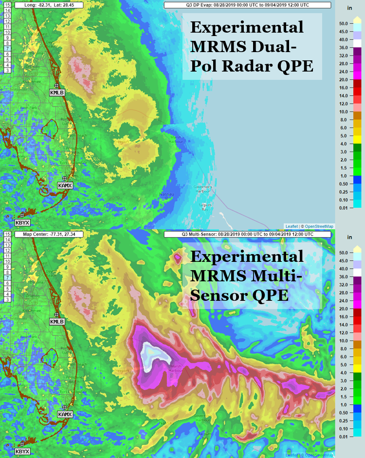
Given the lack of gauge observations and radar data over the Bahamas, it is hard to determine from the current NEXRAD radar fleet. The top image shown here depicts the rainfall from our WSR-88D radars using the experimental MRMS dual-pol synthetic QPE with evaporation correction. Dorian passing near the east coast of Florida allowed for better sampling, resulting in the product estimating over 12 inches of rain offshore and 4-6 inches of rain inland with the outer bands. But you get very poor representations of radar near the center of the storm track and areas eastwards; moreover, you cannot properly depict the potential rainfall over the Bahamas at this far range.
The experimental Multi-Sensor QPE in MRMS utilizes other near real-time sources to compensate for this. In this case with Dorian, the 1-h forecast QPF from the HRRR is the input that supplements the radar QPE. The estimated totals are astonishing, with 20-40 inches of rain over the islands with approximately 50 inches of rain over open water. Researchers will continue to evaluate these products and investigate how to keep improving the experimental product suite. Other efforts are ongoing to investigate additional observational sources in the real-time MRMS system to feed into such products as the Multi-Sensor QPE.


