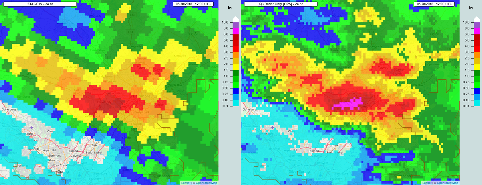
Less than two years removed from the devastating flash floods that impacted Ellicott City, MD in 2016, the same area experienced another catastrophic flash flood on Sunday, May 27th. The work conducted by NSSL scientists with the recently updated Multi-Radar Multi-Sensor (MRMS) system along with the hydrologic modeling from the Flooded Locations and Simulated Hydrographs (FLASH) project was put to the test during this event.
One of the key benefits of quantitative precipitation estimations (QPEs) from the MRMS system is the high spatio-temporal resolution of the products. The comparison of the operational MRMS radar-only QPE product at the 1-km Cartesian grid space versus QPE generated at a coarser 4-km polar stereographic grid space displays the ability for MRMS to capture the greater precipitation totals because of its finer resolution.

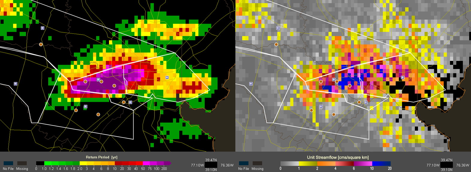
Using the 1-km resolution MRMS QPE, the FLASH system performs QPE comparisons and runs hydrologic models to determine areas that could experience flash flooding and their potential severity. The rainfall shown exceeded the 200 year return period color scale and was likely a 1000 year return period. The unit streamflow map highlights the areas of the flash flood threat. The blue colors representing unit streamflow values exceeding 10 cms/square km are generally correlated with major flash flooding and “Flash Flood Emergency” events.

NSSL scientists will analyze this particular case and other flash flood events to continue improving upon the research and algorithms that drive the MRMS and FLASH systems. While events like these are tragic for those impacted by the power of flood water, the findings and continued research will allow for even better products to assist forecasters with flash flood prediction and their operational warning decisions.
Operational MRMS Product Viewer: https://mrms.nssl.noaa.gov/
FLASH Product Page: http://flash.ou.edu/

