

On the evening of May 23rd into the early morning of May 24th, 2015 the Blanco River in Texas experienced a significant flooding event resulting in the closure of I-35 north & southbound near the city of San Marcos, TX. There were also multiple high-water rescues in the area including helicopter rescues of victims trapped in houses. The Hays County jail in Texas was also evacuated due to threatening flood waters. The FLASH development system was running for this event producing products forecasting & monitoring the flooding in near real time.
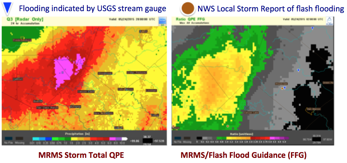
Traditional rainfall based products including the rainfall accumulation and the ratio of rainfall to flash flood guidance highlight a large area northwest of San Marcos for flooding impacts. The storm system produced 6-8″ of rain over the region to the northwest resulting in exceedance of flash flood guidance by 160-180%.
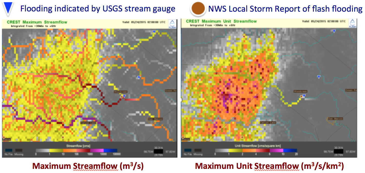
The FLASH hydrologic model based products correctly show the heavy rainfall being concentrated into the rivers and the downstream flooding impacts in San Marcos resulting from the heavy rainfall to the northwest of the region.

Conclusions
- This was a very heavy rainfall event that was captured well by MRMS radar-only estimates
- The flash flood guidance product indicated significant exceedance over threshold values, but the areas of concern were limited to the headwaters of the Blancos river
- The distributed hydrologic model forecasts better refined the threat area to the Blancos river and provided several hours of lead time
- This event clearly highlights the need to account for overland flow and routing, displacing the impacts well downstream of the causative rainfall