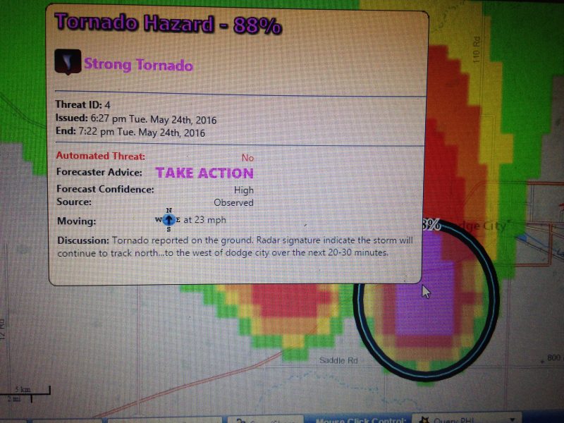
The second week of the PHI prototype experiment kicked off on Monday, and swung into full gear on Tuesday with an active period of realtime weather. Evening operations focused on the tornadic supercells affecting the NWS Dodge City service area, and in particular the storm that produced multiple tornadoes in the immediate Dodge City vicinity.
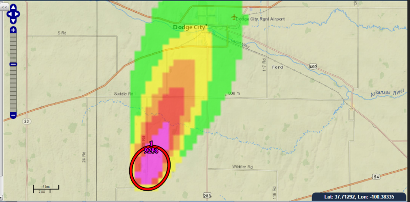
Emergency managers and our broadcaster were “positioned” in the Dodge City area to perform job related tasks, and evaluate how PHI and associated text products based on the NWS Hazard Simplification project assisted in their decision making. The mock operations were quite realistic, with emergency managers making decisions about deploying search and rescue teams while additional storms were threatening, and our broadcast team conducting interviews with HWT forecasters about the storms. HWT forecasters monitored the live feed from our broadcaster, and also live chase footage via the Internet.