 V2 teams were subdued as they gathered this morning. No one likes to see tornadoes affect people, but we know they do. These tornadoes hit close to home for many of us. Even folks at the National Weather Center in Norman could see the tornado develop from the observation deck and saw it touch down to the east.
The morning briefing was held at the one hotel that did have electricity. Today’s goal was to move out of the hotels in Shawnee to make room for those affected by the storms who needed the rooms. The second goal was to meet in Clinton, Oklahoma. A warm front was hanging over the state with a dryline to the west. The area was boasting Convective Available Potential Energy (CAPE) of 5000 Joules/Kilogram! That is A LOT of energy! Last year we were excited about a CAPE of 500. Or really ANY CAPE.
We arrived in Clinton, and waited. Today we followed the sounding teams. The launched weather balloons to sample the environment ahead of and around the storm. They have their routine perfected, and it was fun to watch.
As the day went on, we drifted south to near Cordell, Oklahoma. A cell was popping to the southwest. It was small, but grew quickly. A balloon was launched ahead of the storm. We watched as the storm moved past, and then fizzled.
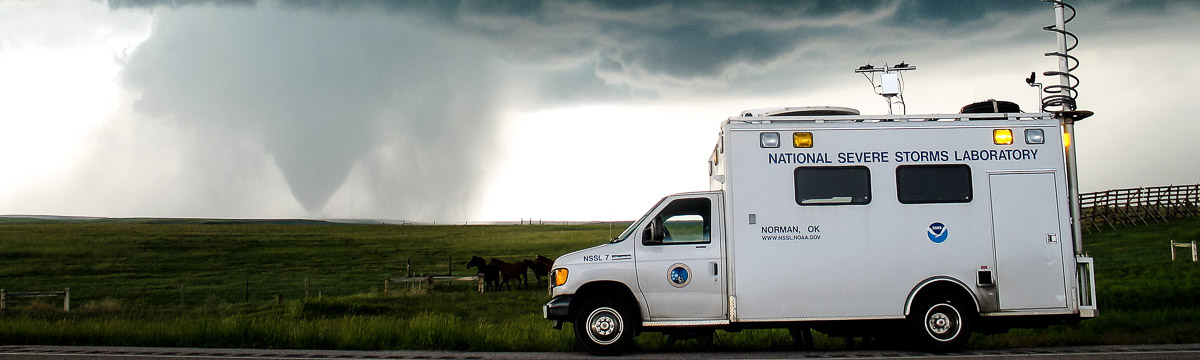
The atmosphere still seemed like it could give us a supercell. We moved back north of Clinton. In the distance along the warm front we could see more cells firing. The radars set up and scanned.
The storm had 2.5″ hail, and had radar indicated rotation. Tornado warning issued, and mobile mesonets reported a low circulation, but no tornado. The radars scanned until after dark, but at sunset, the balloon launches were done.