The tragic flash floods in Tennessee on August 21-22, 2021 unfortunately took the lives of 20 people, as record rainfall and swift waters carried away homes and vehicles. Analysis of the event from operational NWS forecasters noted the extreme precipitation totals within the MRMS system and how its forcing into the FLASH system translated to products signaling the potential catastrophic nature of this event.
An internal evaluation of the MRMS quantitative precipitation estimation (QPE) products first yielded two notable results: 1) the MRMS dual-polarization synthetic QPE was remarkably accurate compared to gauge observations, and 2) it allowed for precise QPE inputs into the FLASH product suite.
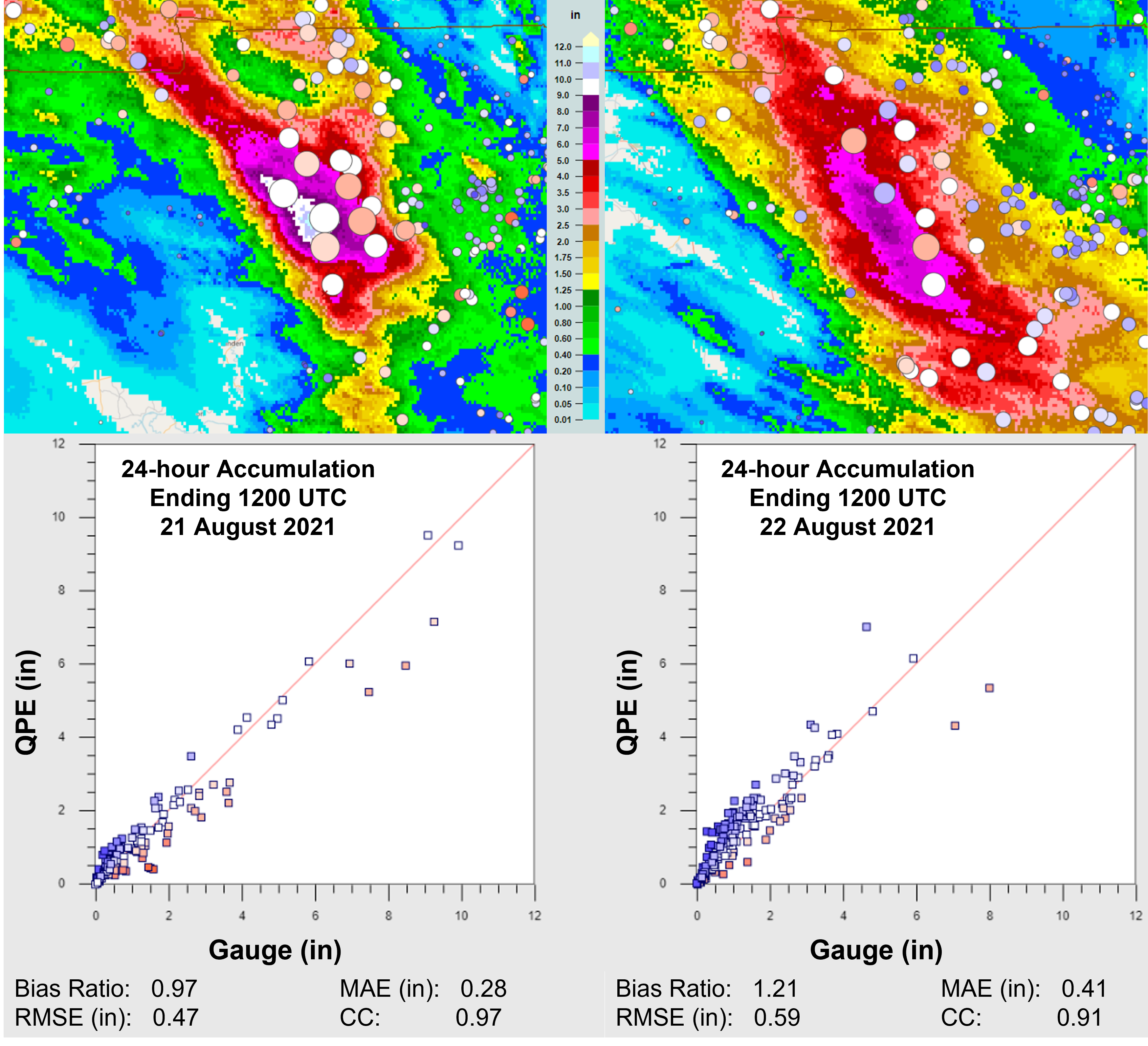
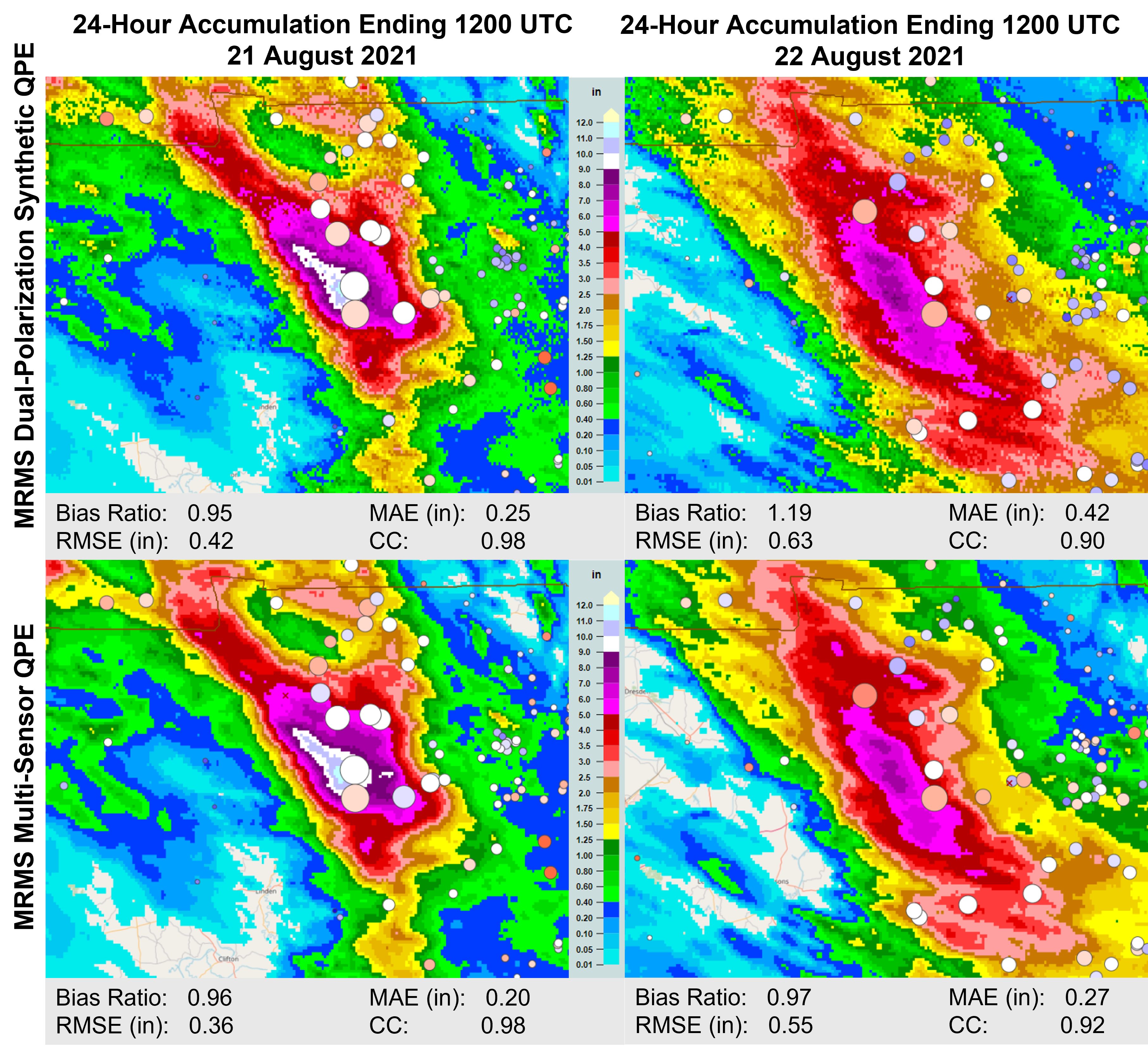
Starting with the operational MRMS dual-polarization QPE accumulated for 24-hours, the analysis of 21 August showed a well correlated comparison to both hourly HADS/MADIS gauges as well as daily CoCoRaHS gauges. There was some slight underestimation with accumulations > 6.0 inches, yet the two gauge observations near the highest accumulation totals were well matched to the MRMS QPE (Fig. 1). MRMS QPE for the 24-hour period ending on 1200 UTC 22 August showed an overestimation bias with accumulations < 2.0 inches, but the overall data was also well correlated (Fig. 1).
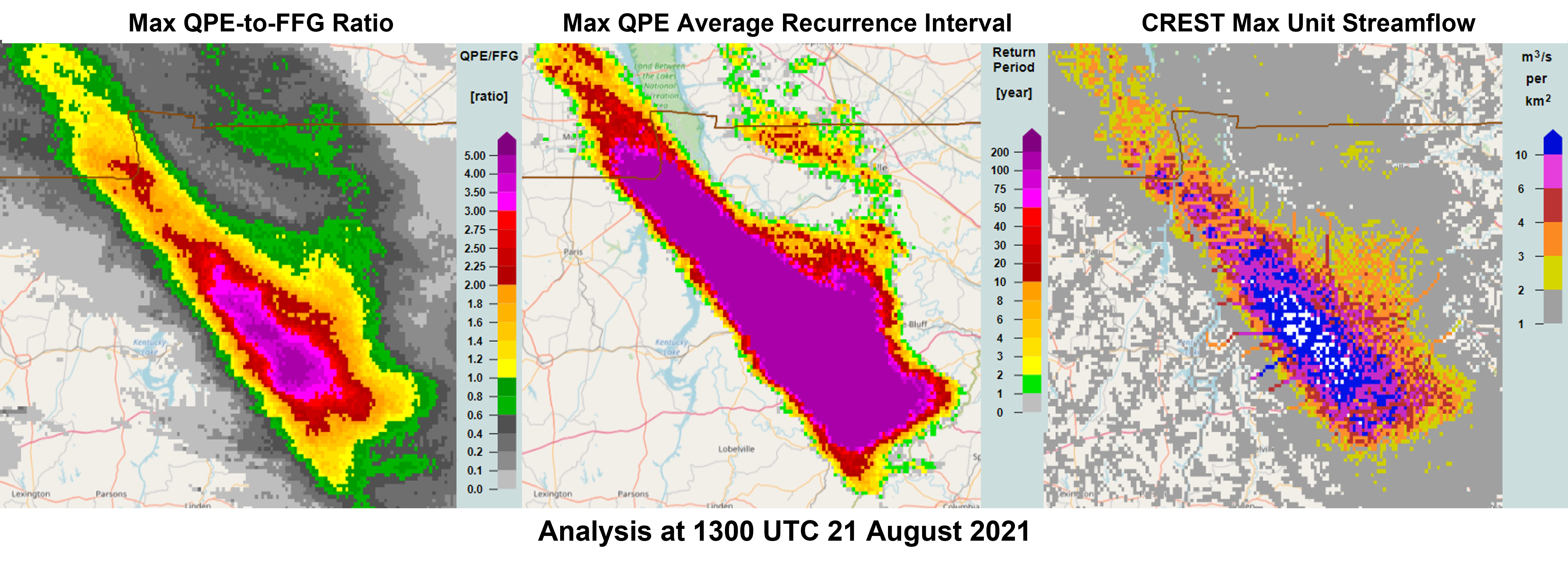
Knowing that the radar-based QPE performed well, one can get a representative analysis with the FLASH product suite without having to worry about QPE biases. The different FLASH products showed a classic signal for a catastrophic event (Fig. 2). The QPE-to-FFG ratio exceeded the guidance needed for bankfull conditions on small channels by a factor of four or more. The average recurrence internal easily maxed out with a 200-year return period, notably for accumulation periods from 3 to 24 hours. The CREST maximum unit streamflow values were also off the chart, signifying the potential for extreme flash flooding.
One additional evaluation of the MRMS product suite with the Multisensor QPE (MSQPE) product yielded a third notable result: 3) the performance of the MRMS dual-polarization synthetic QPE was similar to that of the MSQPE, especially for the 24-hour accumulation ending 1200 UTC 21 August (Fig. 3). The bias ratio and correlation between the dual-polarization QPE and MSQPE products were nearly identical on August 21, while there was a reduction in the MAE and RMSE statistics. The MSQPE scheme for August 22 improved all statistics and helped mitigate the overestimation bias seen east of the main precipitation event.
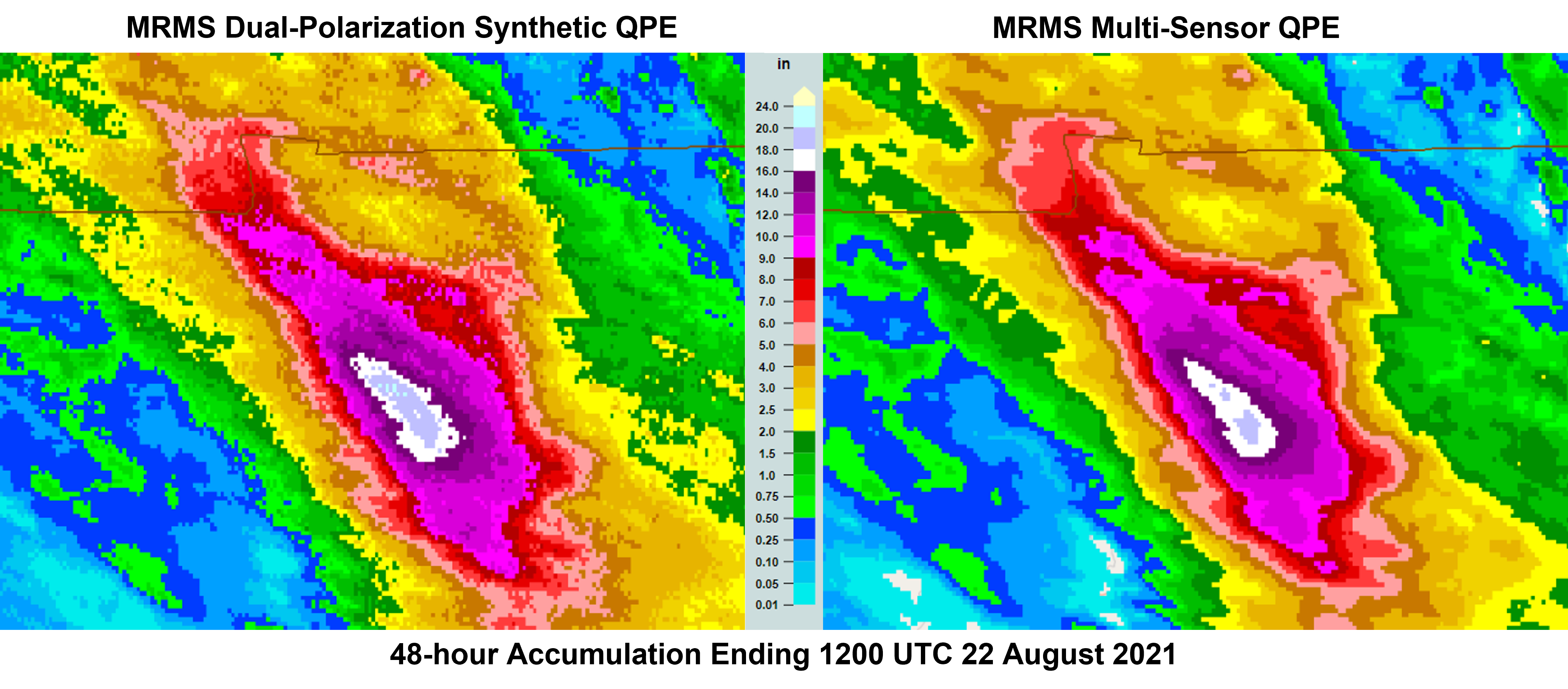
The final storm-total precipitation yielded a widespread area of rainfall exceeding six inches, with a localized area of 16-20 inches (Fig. 4). The MSQPE values near McEwen, TN matched well with the preliminary rain gauge storm total of 17.02 inches. Overall, it was a successful performance of the MRMS precipitation product suite for this historic event.
Operational MRMS products can viewed on the following public web page: https://mrms.nssl.noaa.gov/qvs/product_viewer/