NUCAPS in Amarillo CWA

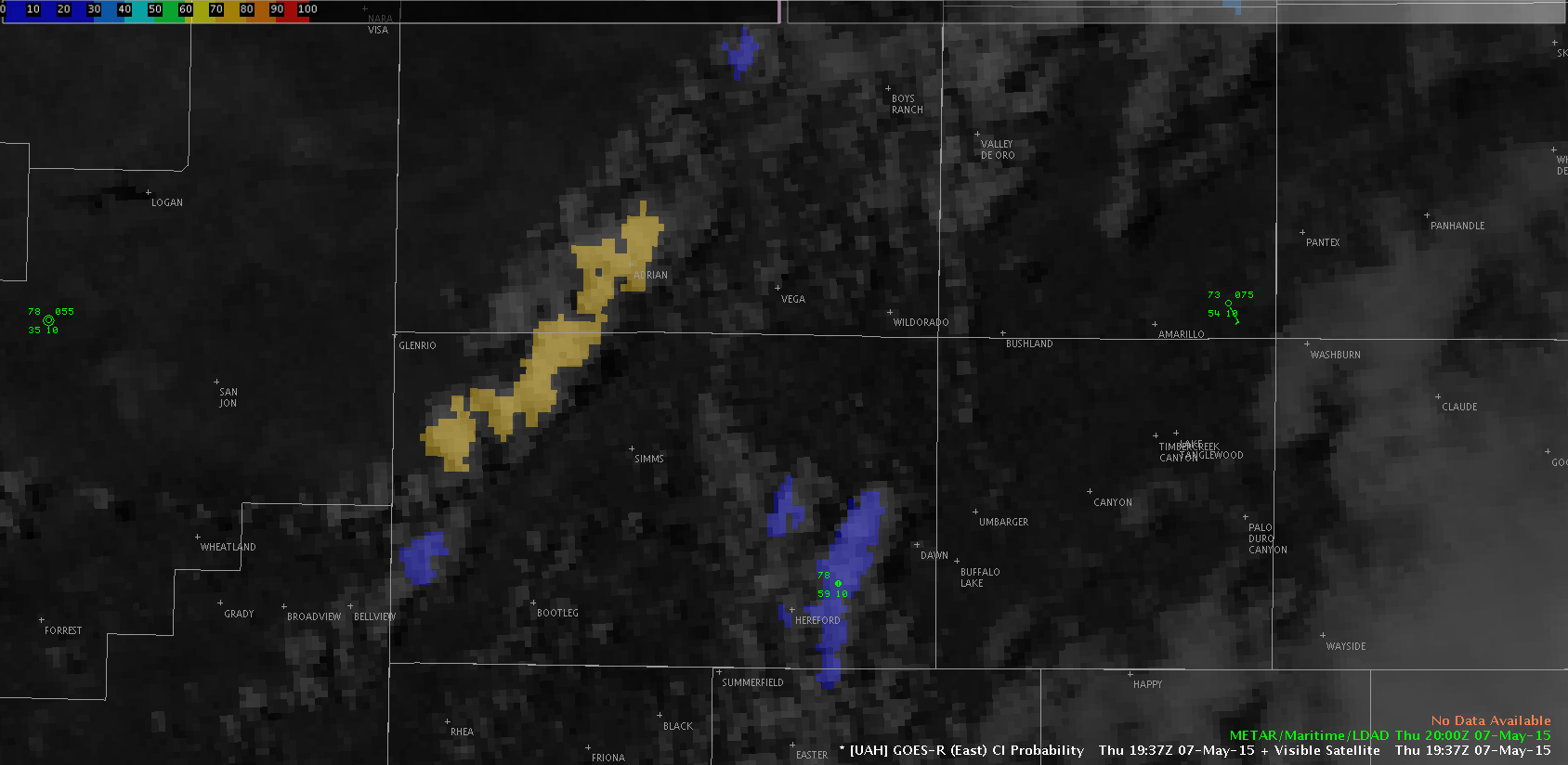
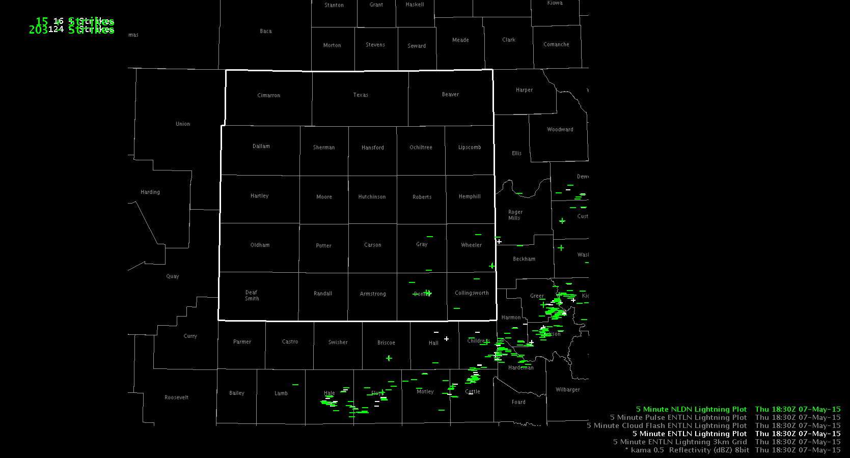
Three NUCAPS soundings were sampled this afternoon around the Amarillo CWA.  Several boundaries are observed in the CWA today…of most interest, a westward propagating outflow boundary from morning MCS and the dryline.  The northern and central soundings were west of the ouflow boundary, but east of the dryline.  Both of these soundings were about 8 degrees too cool (temperature) and 15 degrees too dry (dewpoint) at the surface.  Once the profiles were modified, they yielded 1500 J/kg and 2770 J/kg CAPE, respectively.  The sounding behind the dryline was a close match to observations…and little modification to the sounding was needed.AMANUCAPS

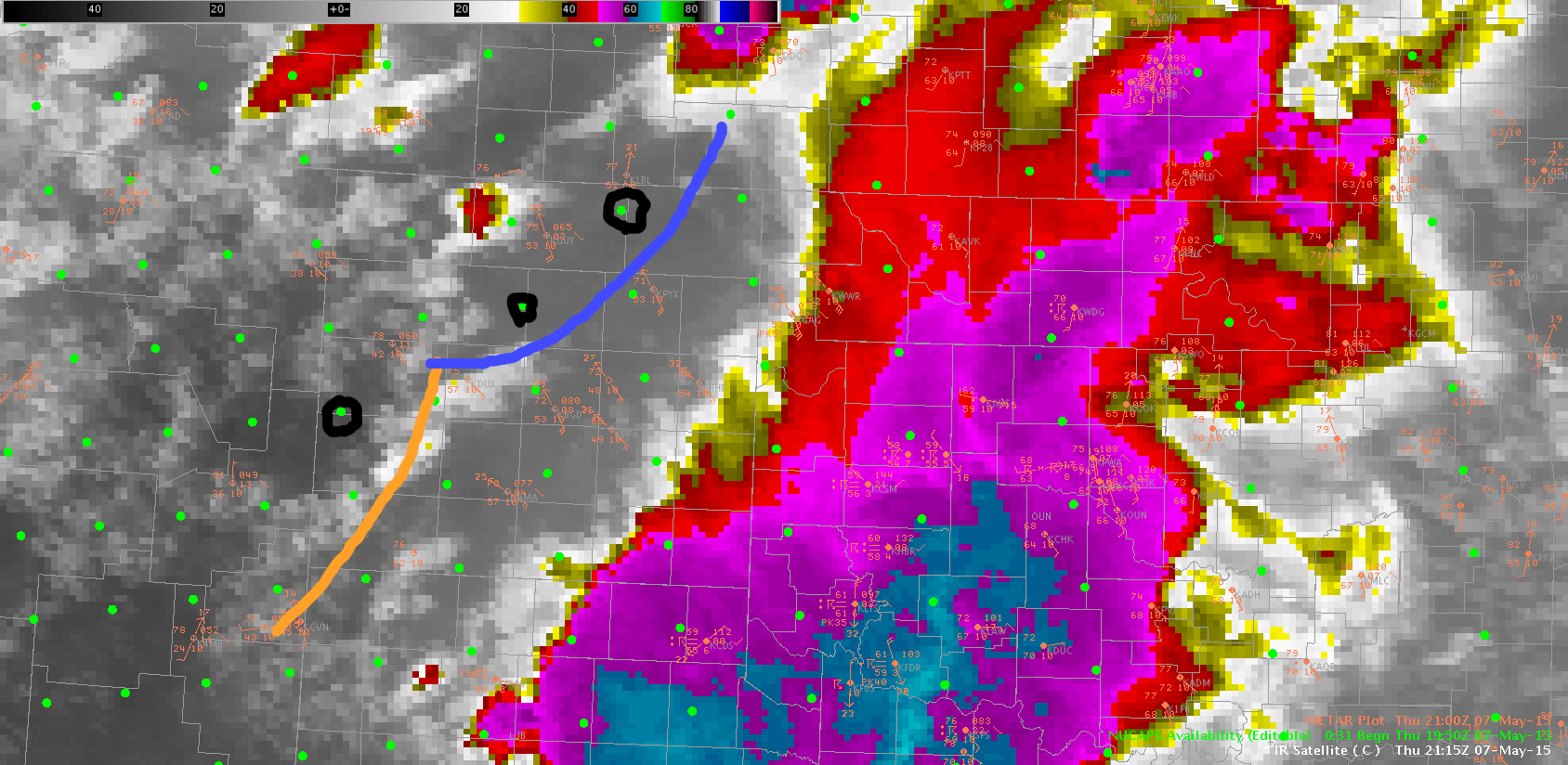
Blue line is westward moving outflow…dryline is marked in yellow.  NUCAPS soundings modified are circled in black.

ALEXANDER’S DARK BAND/LYNFORD

Tags: None

GOES CI in Amarillo CWA

Morning MCS over the southeastern Texas panhandle has resulted in a north-westward propagating outflow boundary.  This boundary has merged with a loosely defined dryline in northern parts of the CWA, with the dryline then extending further to the south.  More elevated values of GOES CI (30-60%) has focused very well along these boundaries.  An area of 75% probability was indicated at 1937 UTC.  By 1956, a weak echo was apparent in the AMA radar reflectivity.  By 2008 UTC, the intensity had increased to 50-60 dBz.

AMACI75 AMAreflecGOESCI

ALEXANDERS DARK BAND/LYNFORD

Tags: None

Amarillo Synoptic/Mesoscale Discussion

Around 1800 UTC, a MCS is going across the southeastern portion of our CWA.  We expect this region to remain stable in the wake of this system as it progresses eastward along the Red River Valley.  Central and western parts of the CWA have seen ample sunshine.  A dry punch is visible moving in from the southwest, and dewpoints have dropped into the 40s through eastern New Mexico, with low to mid 50s through much of the Texas panhandle.  We expect some additional moisture return, especially through southern parts of the CWA…along with a tightening of the dryline feature.  There is some question to the amount of instability, although GOES LAP algorithm indicates 800-900 J/kg through central and southern parts of the CWA…although with heavy clouds in the region, it’s difficult to gage the accuracy of the values.  A 500 mb low is centered over central California, with southwest flow over west Texas.  Any subtle wave or ripple in this flow may be enough to trigger high based convection along the dryline feature.  The 12 UTC AMA RAOB indicates mainly unidirectional flow through the column.GOESR_CAPE_1700

Tags: None