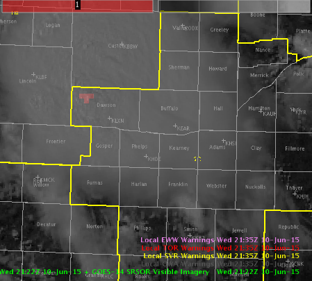
Line coming in from North Platte CWA is weakening some according to DVIL and lack of recent Overshooting Tops. Decided to go with an SPS for gusty winds, to 50 mph.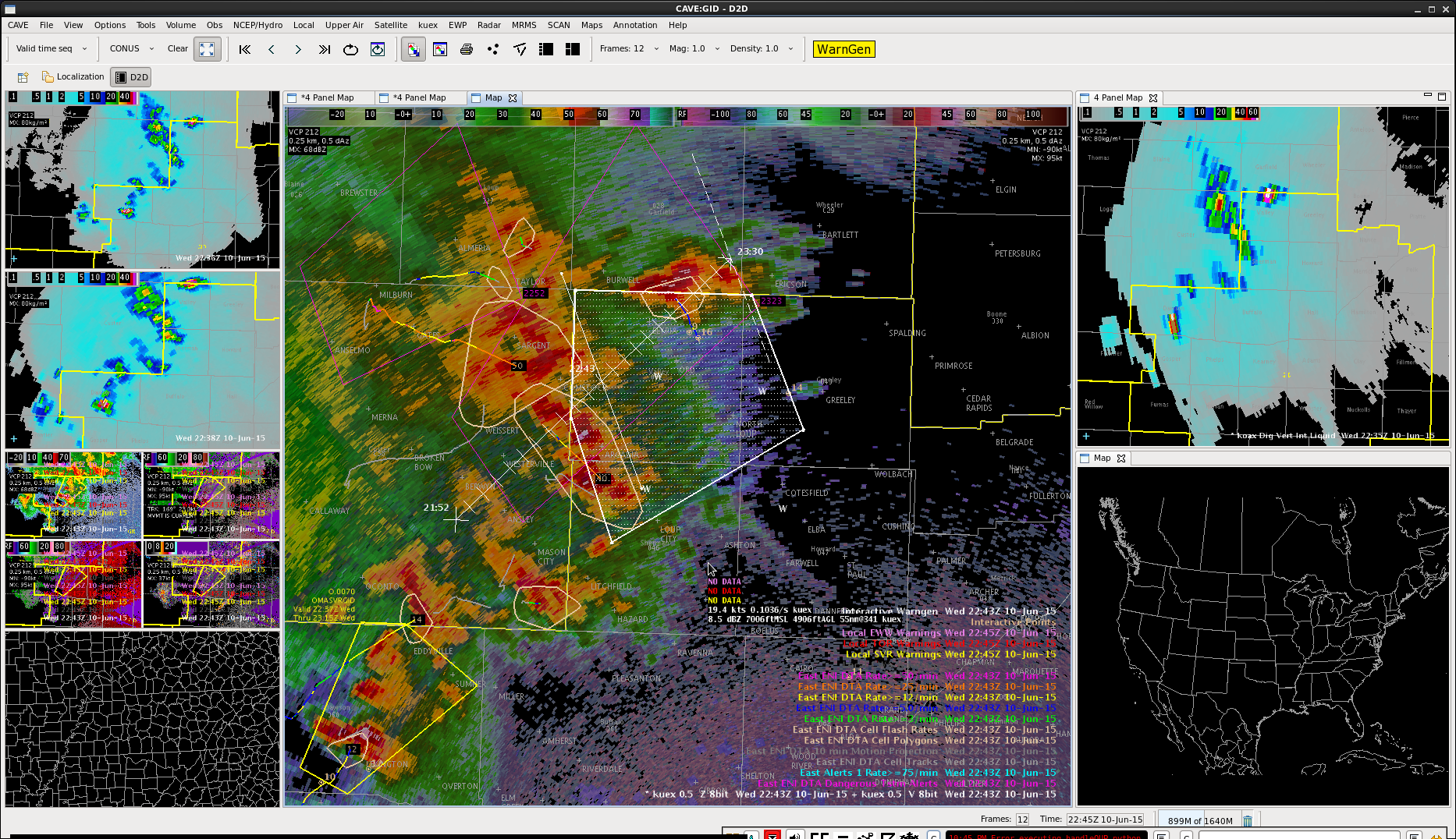
Author: Gabe Garfield
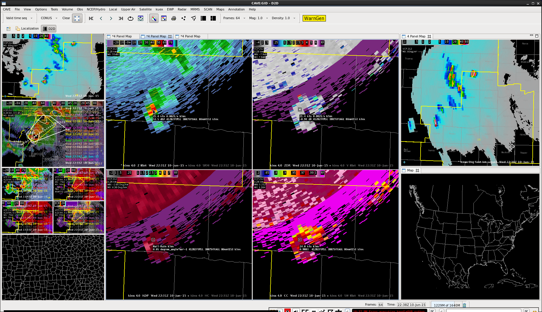
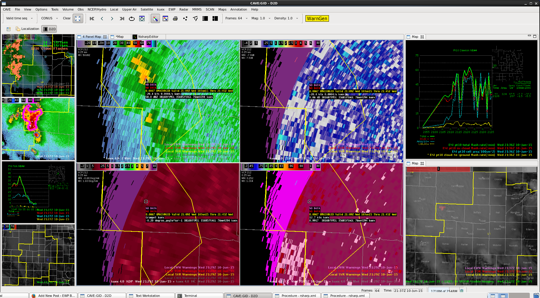
Upgrade to an SVR at Dawson County Charley
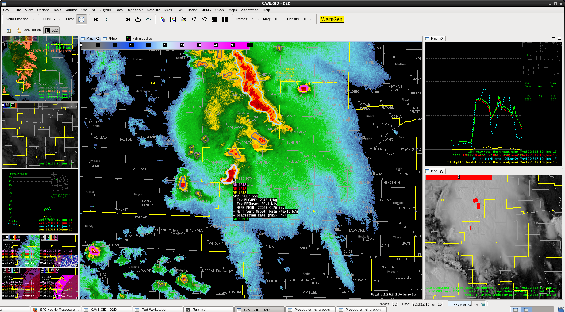
All tilts indicated high dbZ’s to ~40 kft from LNX and UEX radar. DVILs spiked up and ProbSevere jumped to likely levels.

SPS 3 for UEX Charley
Seeing this cell perk up again in Dawson county. Had a brief overshooting top signal there as well as higher DVILs. Decided to go with an SPS there, given what should be a fairly stable low level airmass given earlier cells.
Severe Storm Ending
DVIL coming down from all radars. Higher dbZ’s now in the low 22 kft range. Lightning coming down
ProbSevere down as well, time series on the southernmost cell dropping off as well.
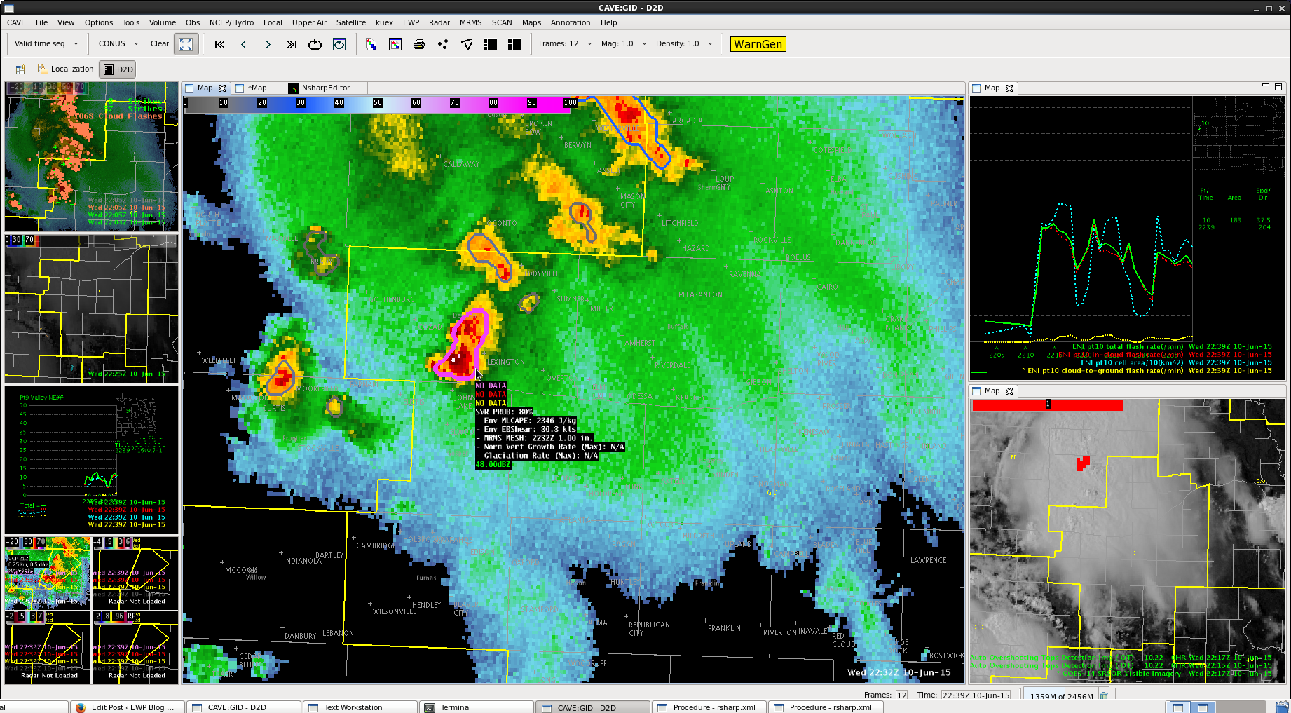
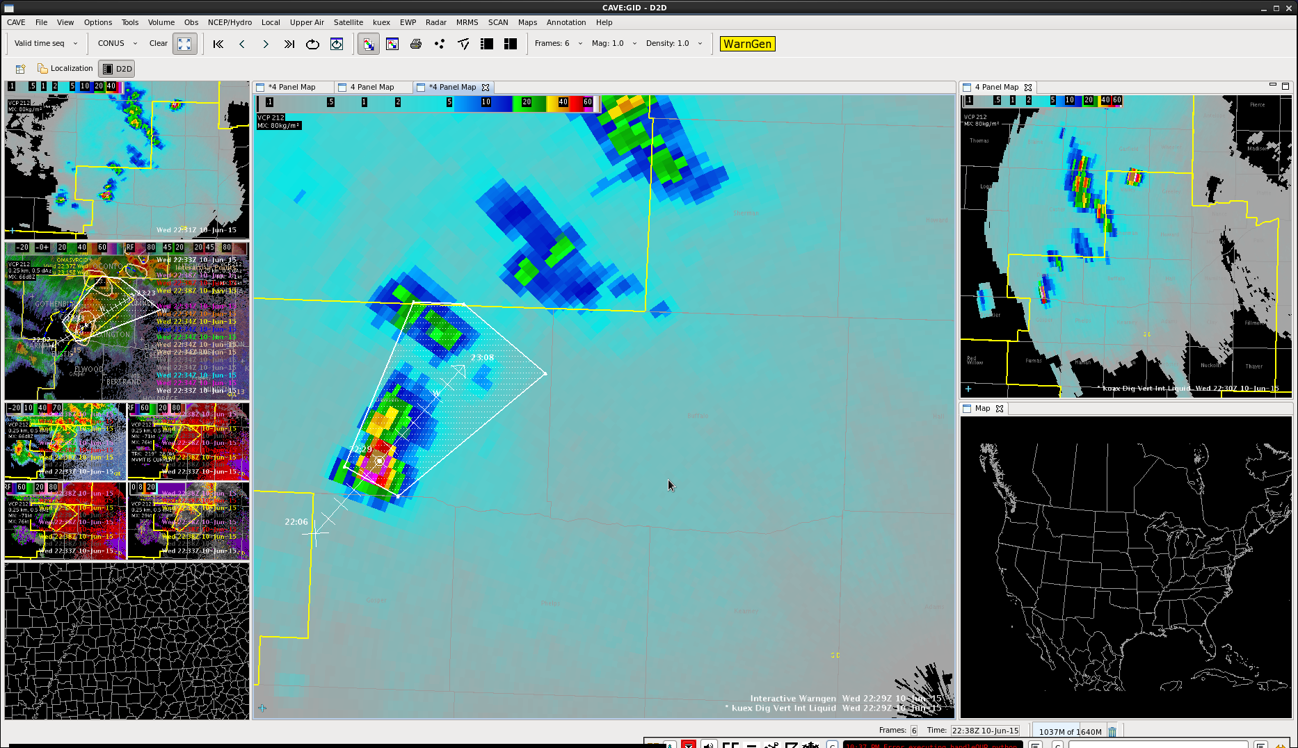
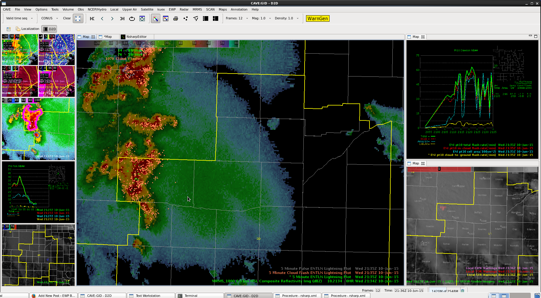
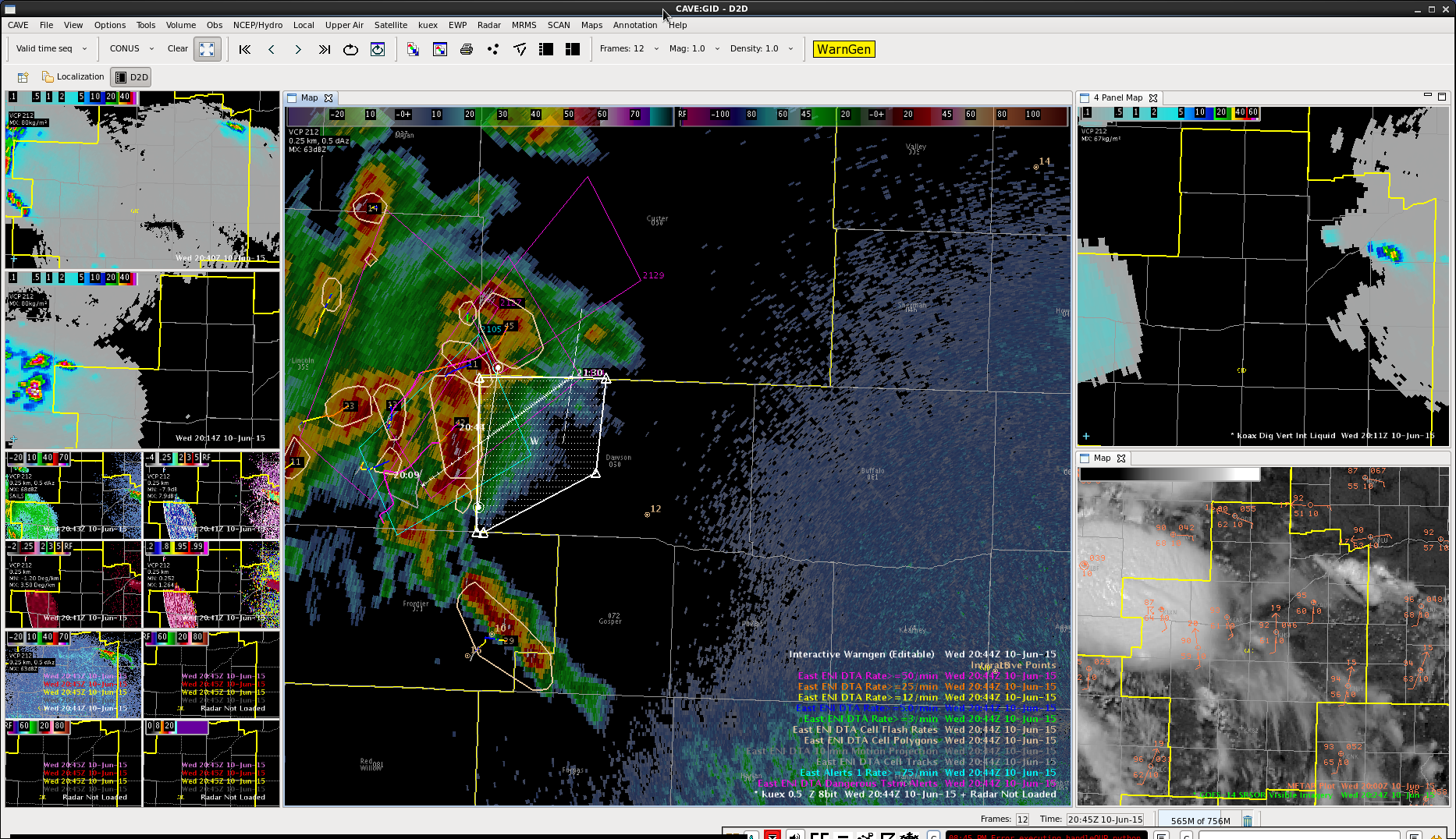
Another Severe for Dawson and Gosper Counties Charley
 Continue to have an overshooting top. Also heard a report from a neighboring CWA of 57 mph winds in Custer county, a little out ahead of my previous warning box. Decided to go ahead and issue a downstream warning to cover that area as well.
 Still have tall cells in the middle, matching up with that good OT.
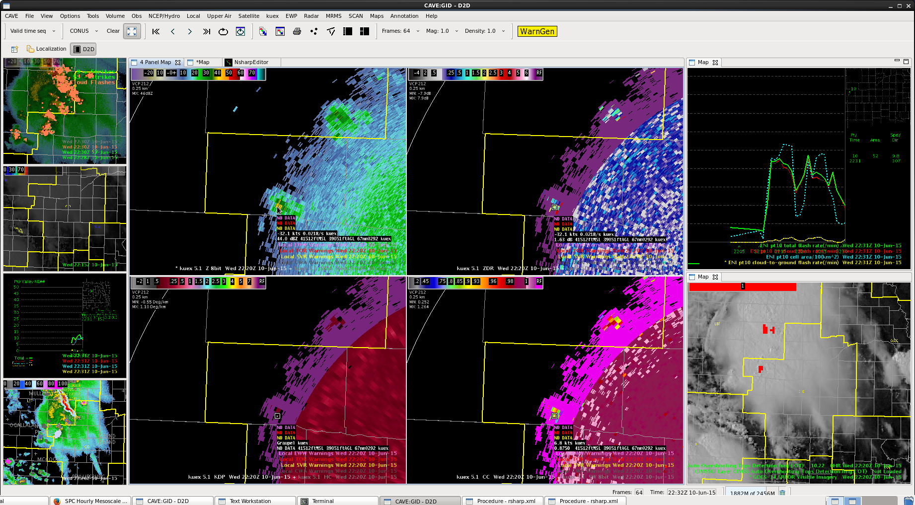
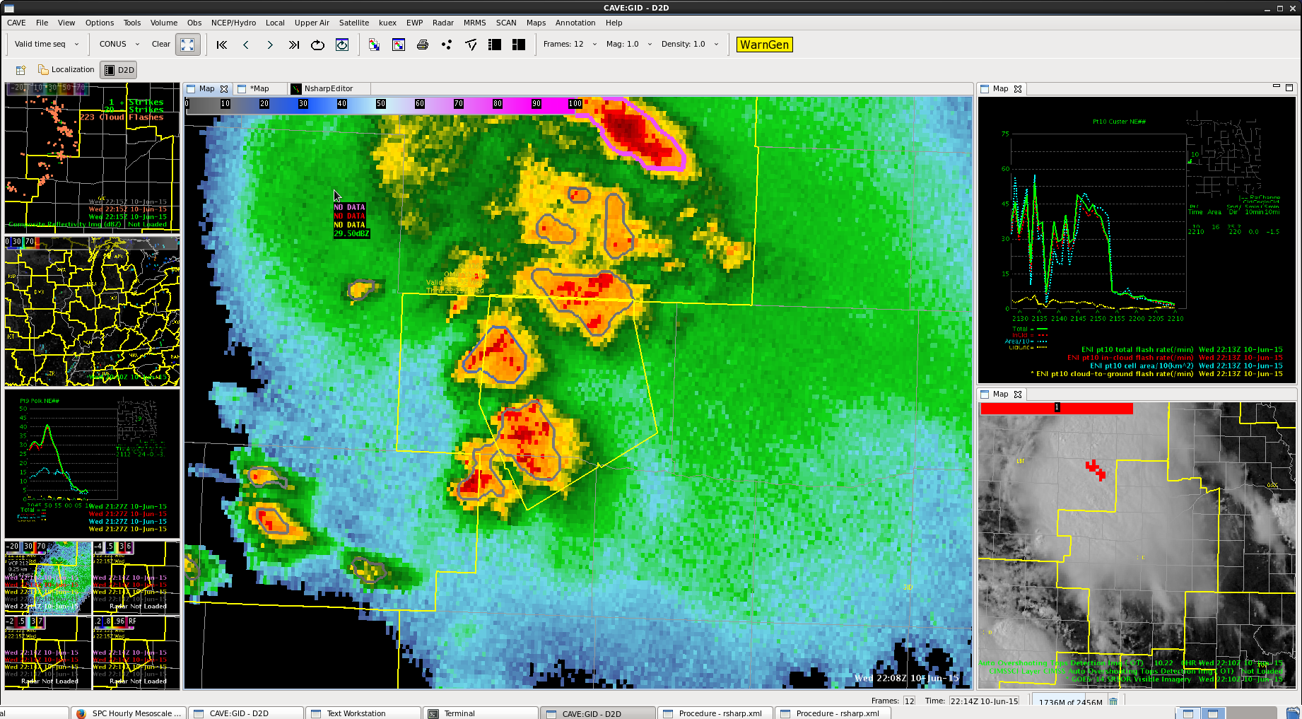
 Plenty of cloud to cloud lightning, but notice on the upper right the time series following the storm. The storm tracking “blobs” merged and broke up several times.
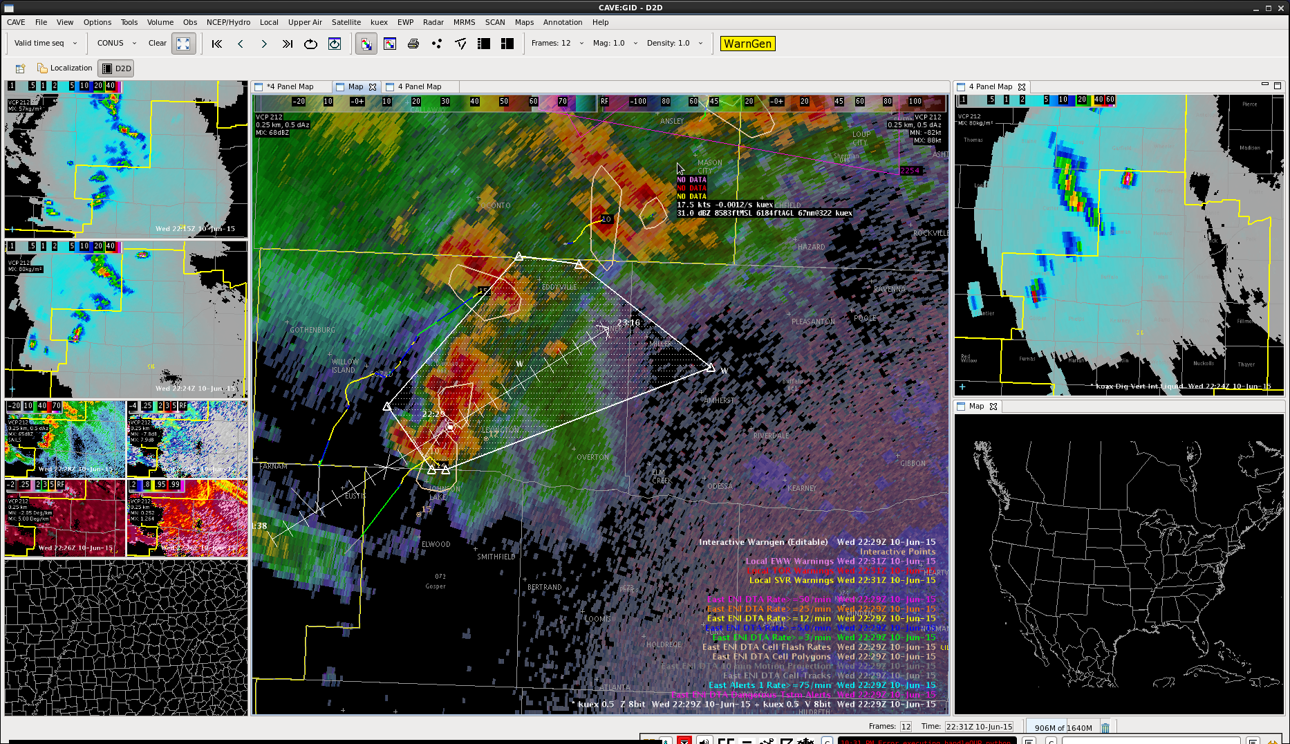
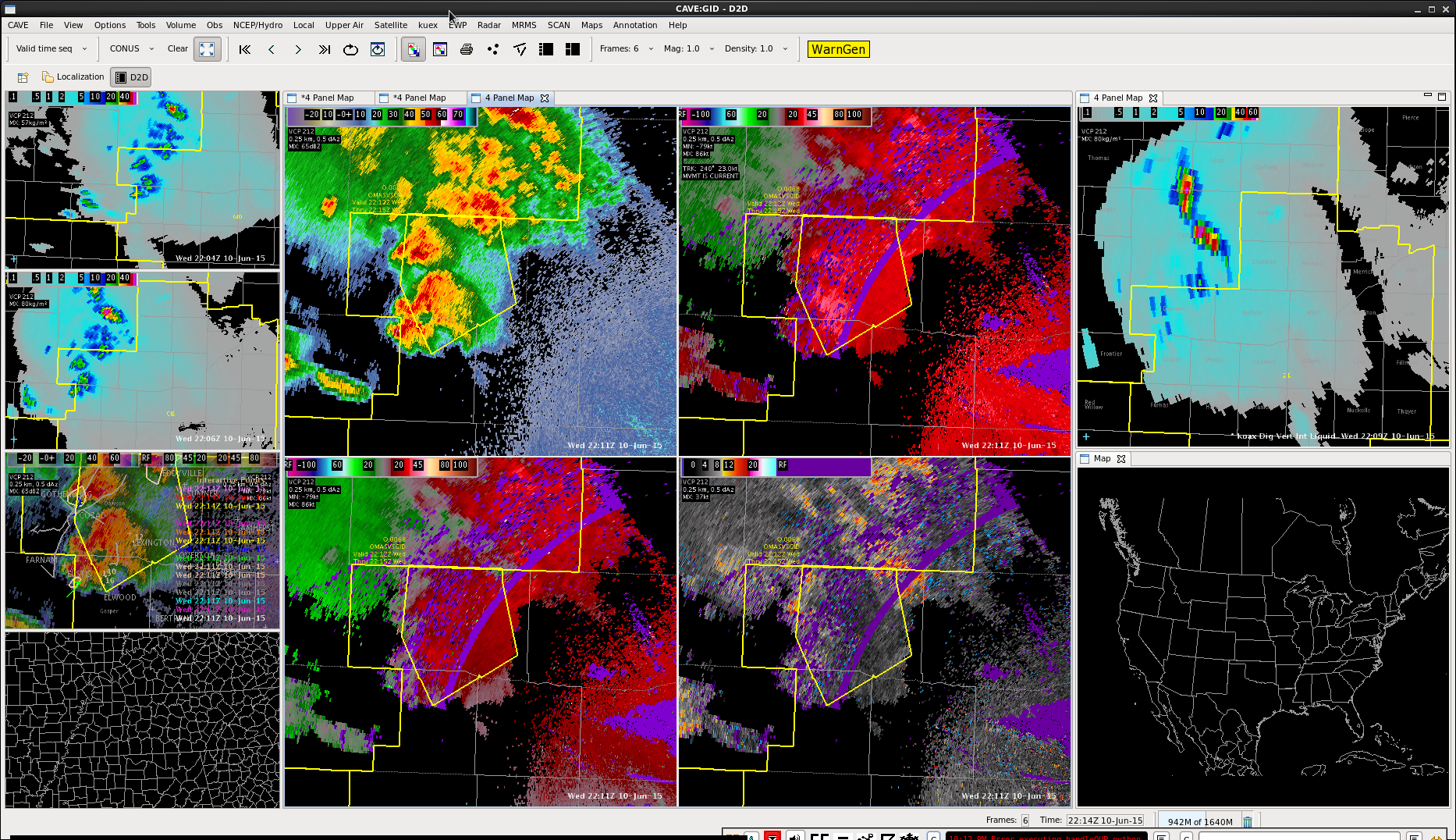
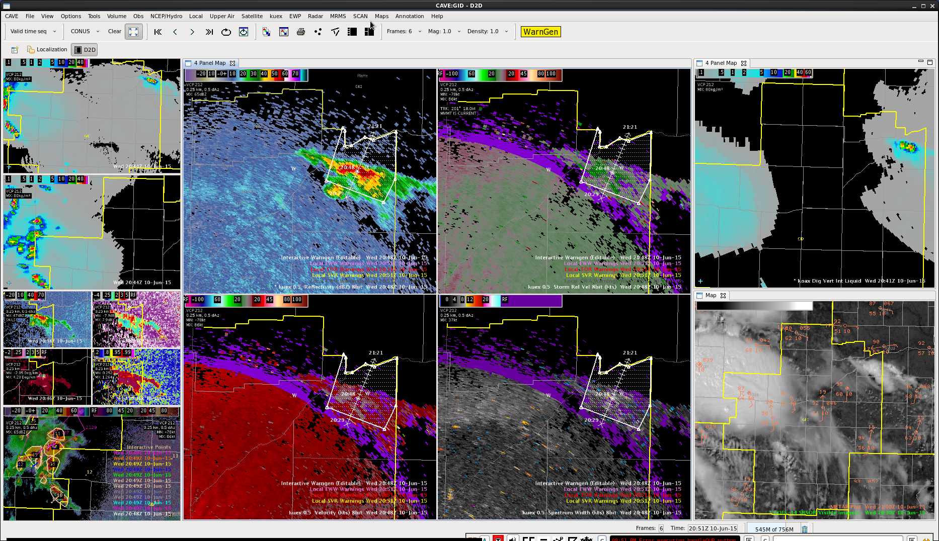
SVR in the northwest, Charley
OT product showed a good updraft. Also saw signal for a strong updraft in the Dawson county part of the line with 60+ knots inbound winds at the storm top.
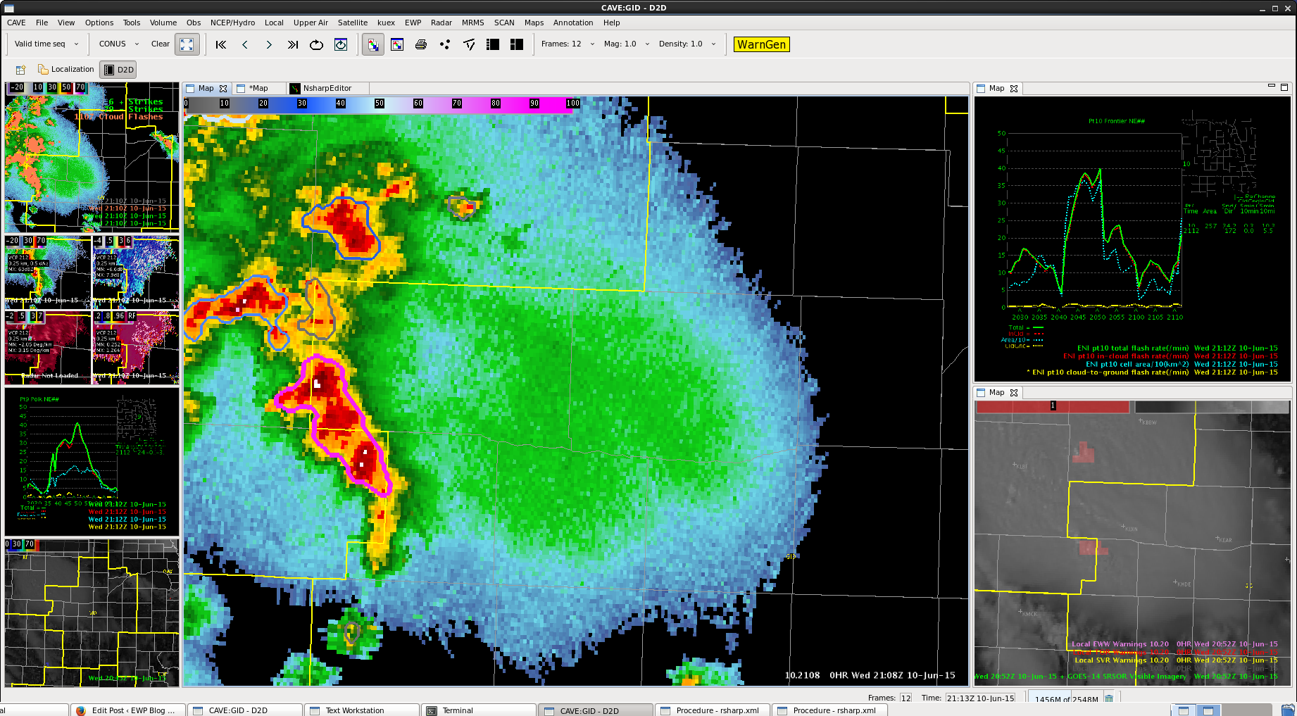
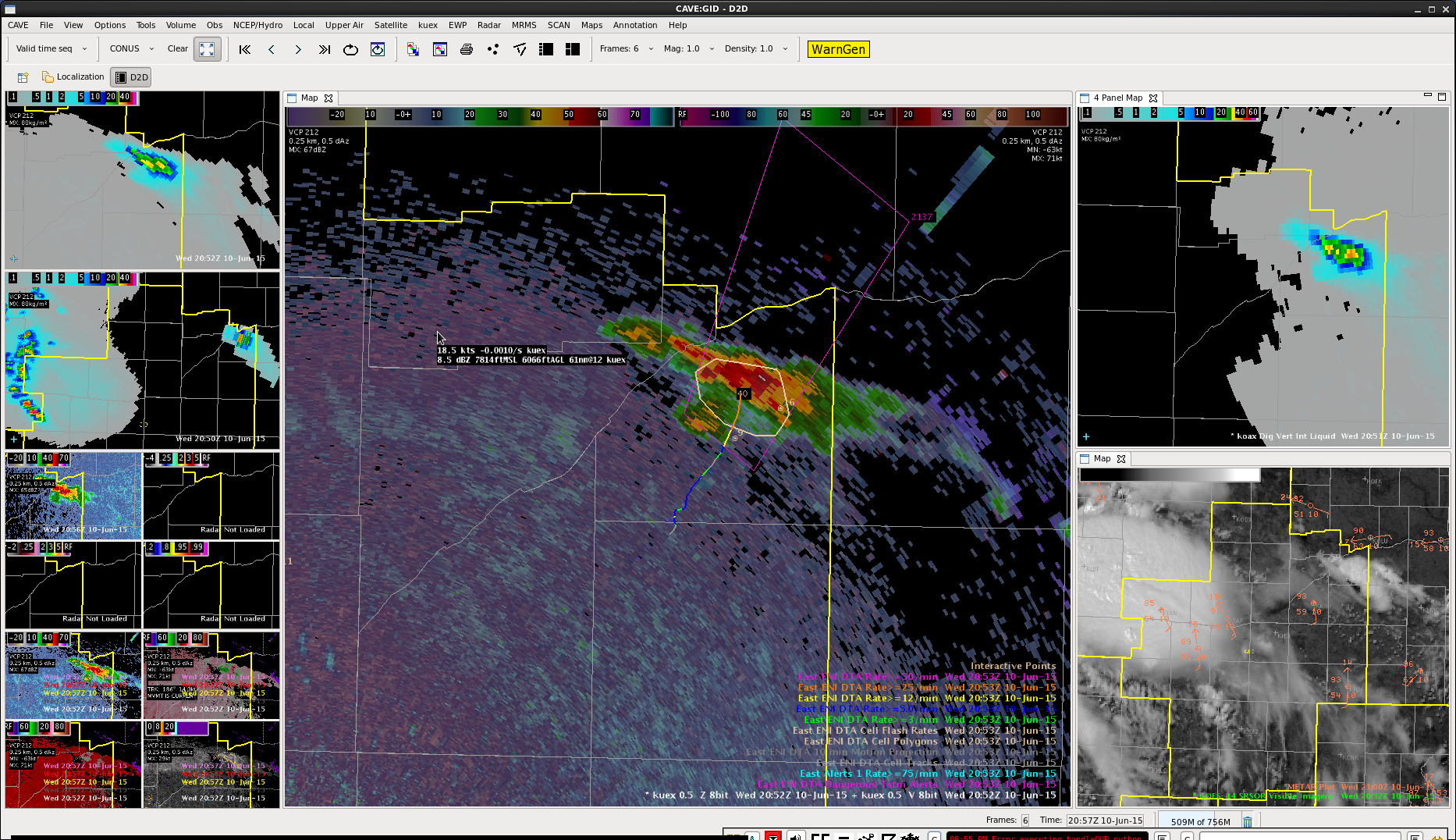
ProbSevere should not be useful, given this cell had been around for awhile and was more of a line, but still high. Time series showed lightning dropping though further inspection showed lots of cell mergers and breaks occurring.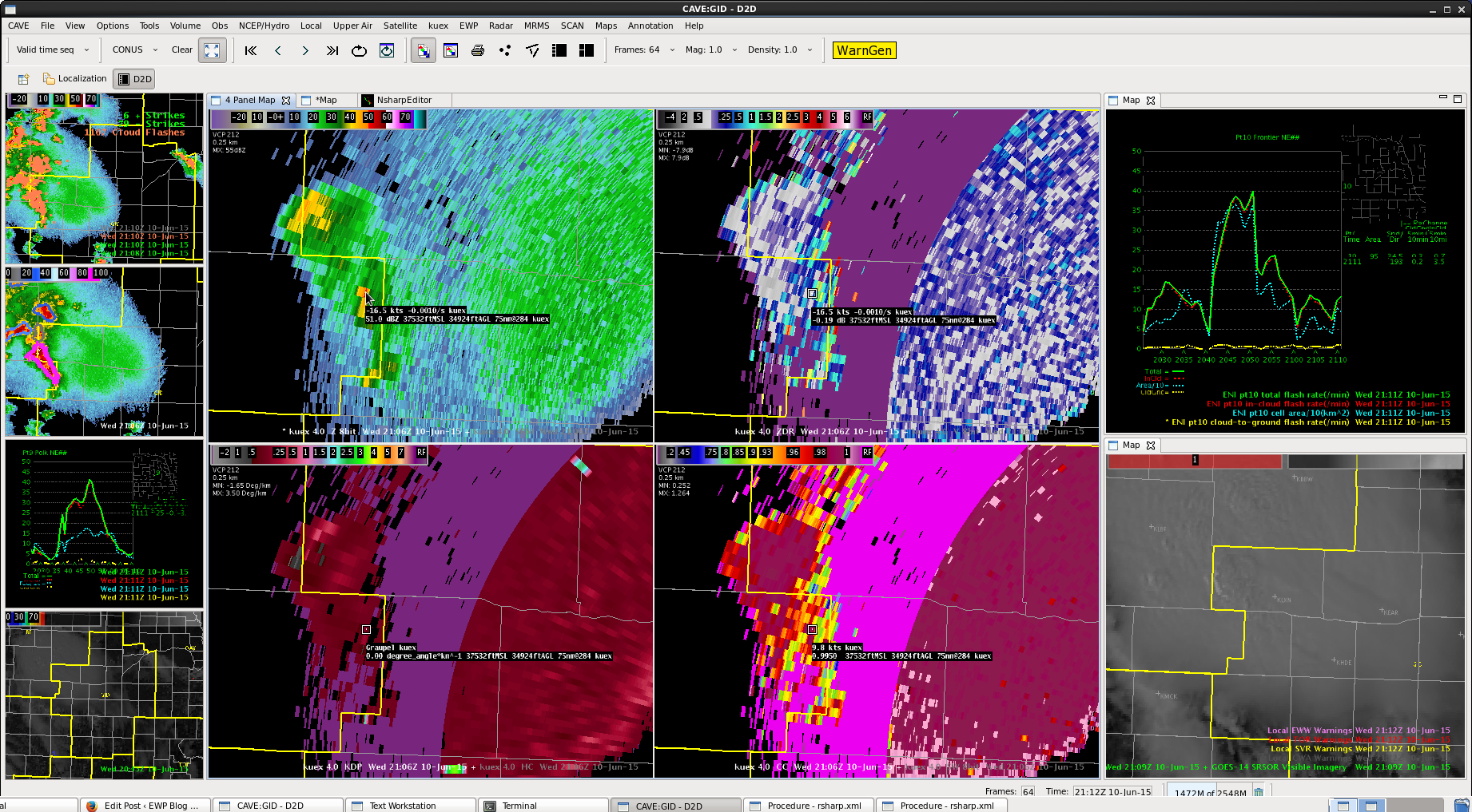 Cell was tall still in the upper tilts, higher dbZ.
Bumped up to a SVR for the northeast, Charley
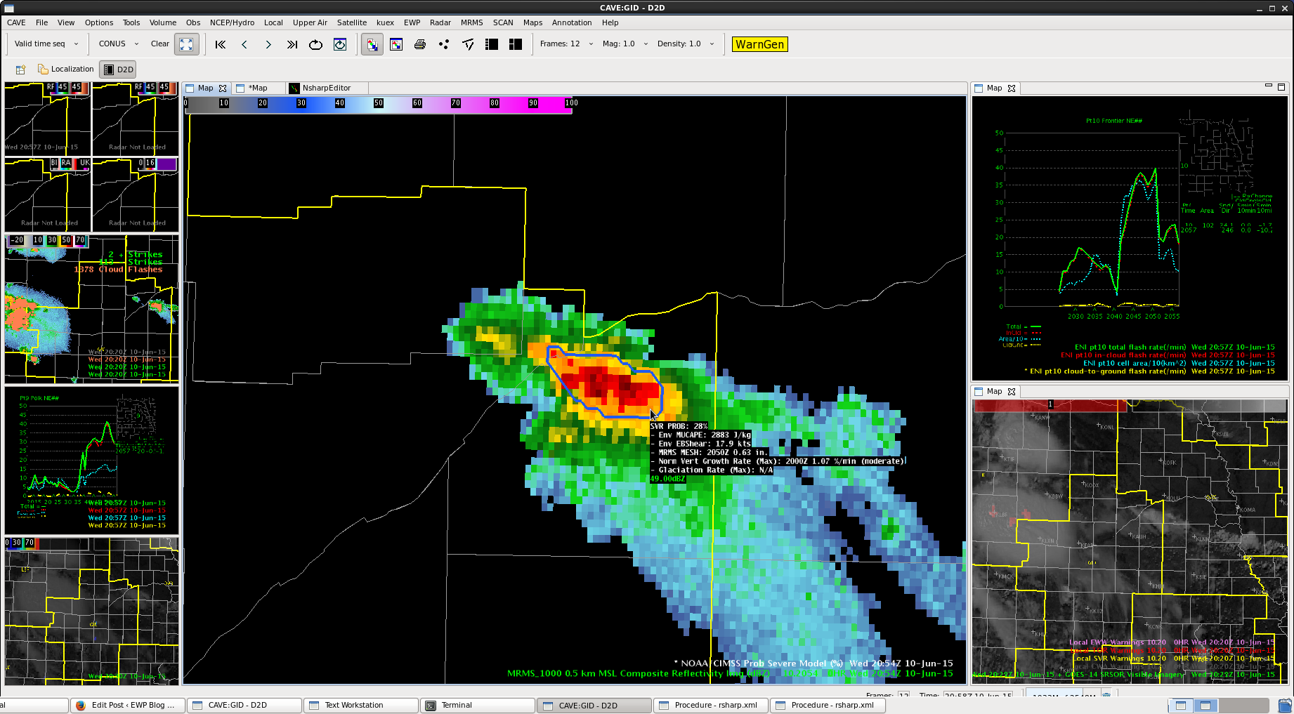
 ProbSevere not as high (still around 30%), reflectivity aloft is increasing. Had ~45 dbZ up to 40 kft.
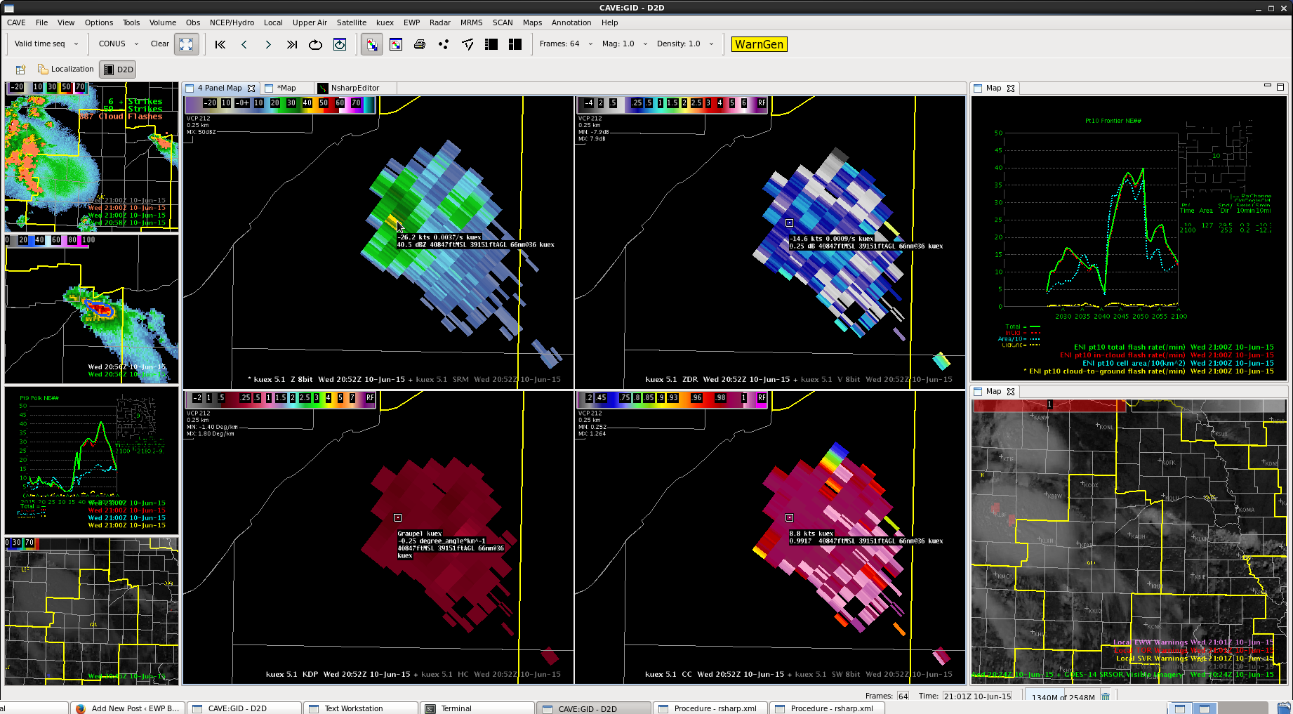
Second SPS Polk and Merrick Charley
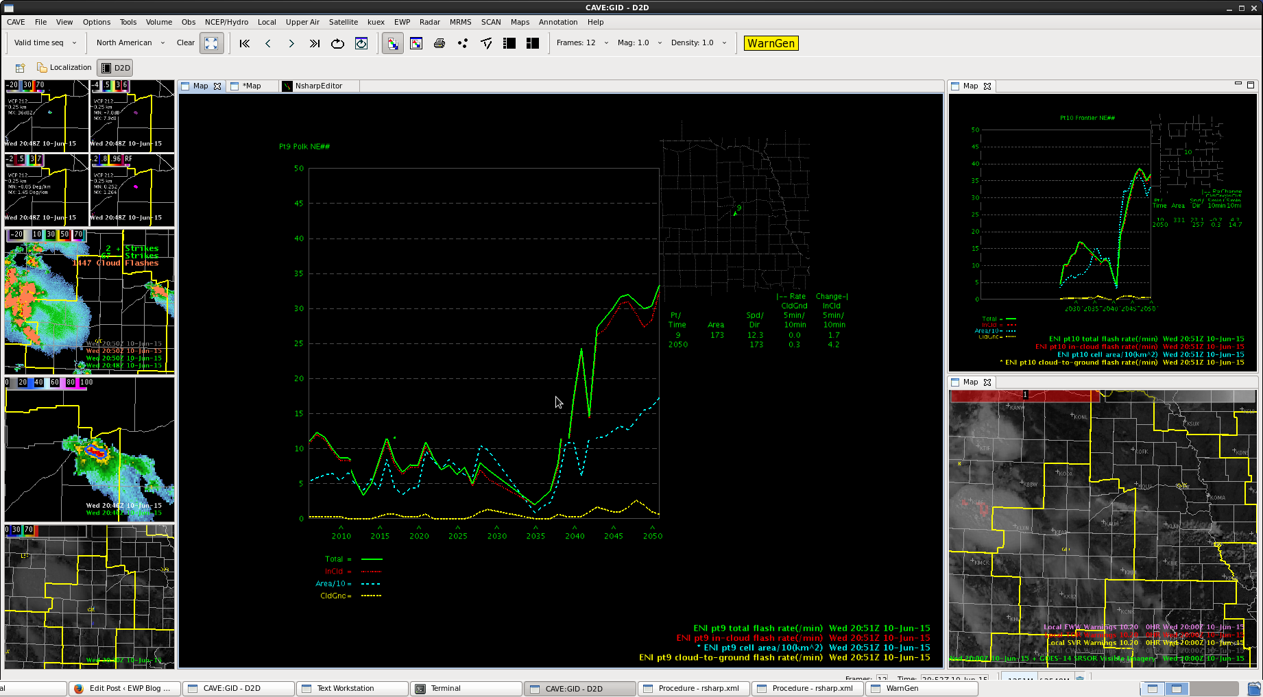
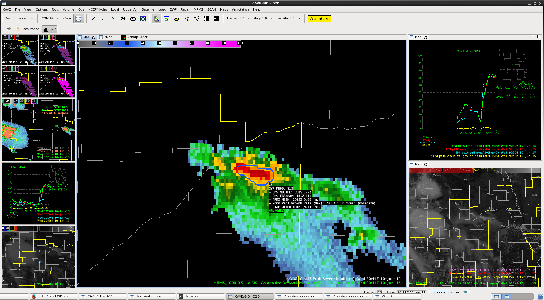
Cell perking up in the northeast CWA. ProbSevere up to 31%. Lighting is increasing as well as DVIL. 50 dbZ height up over 30 kft now as well.
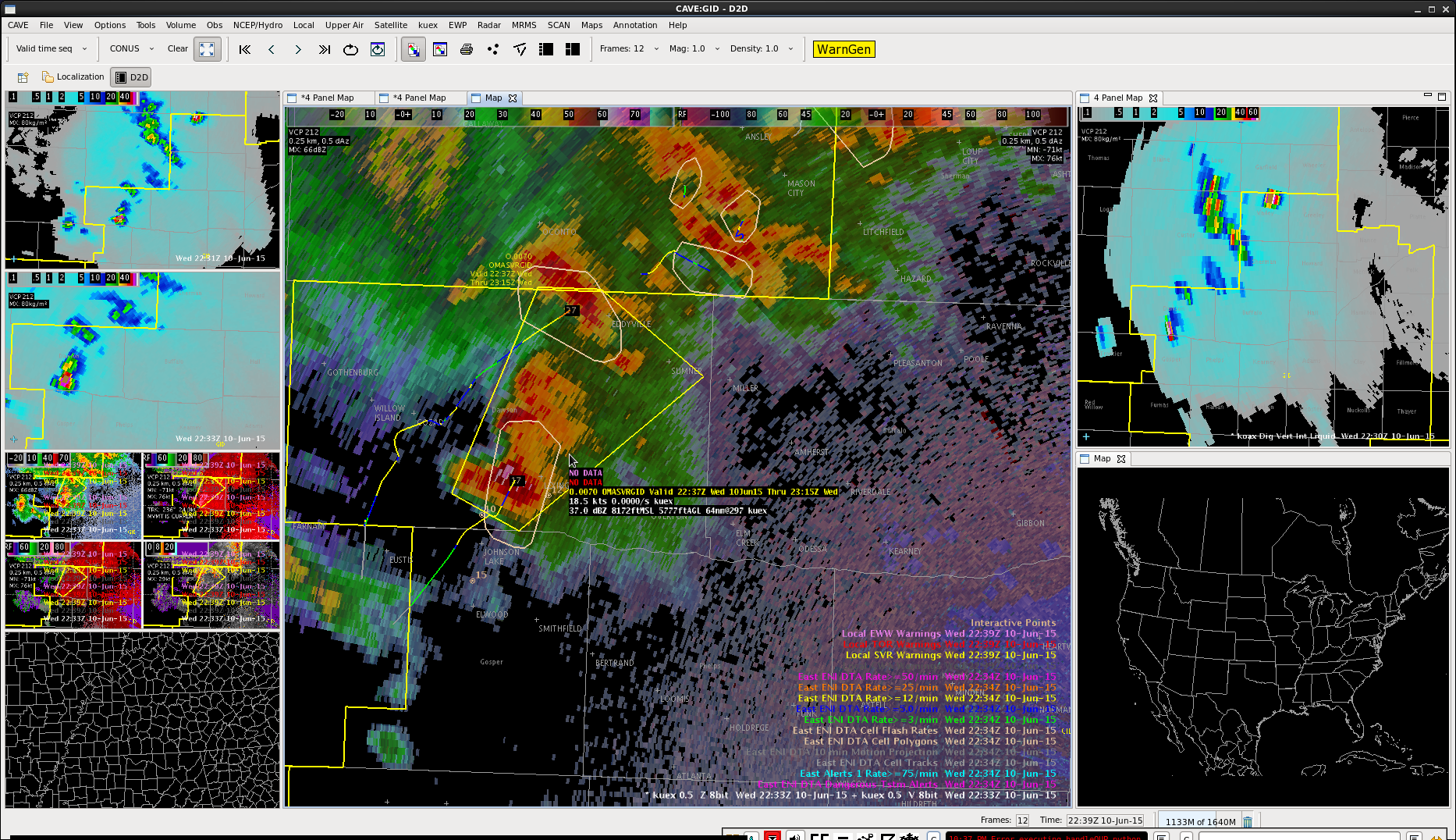
SPS for Dawson county Charley
Finally have the cell to our west edging into our region. Given quite a bit of anvil clouds likely cooling that region down, would expect less winds. Also line is showing evidence of weakening some. Put out SPS for 40 mph and possible nickel-sized hail, despite upstream reports of some larger hail.
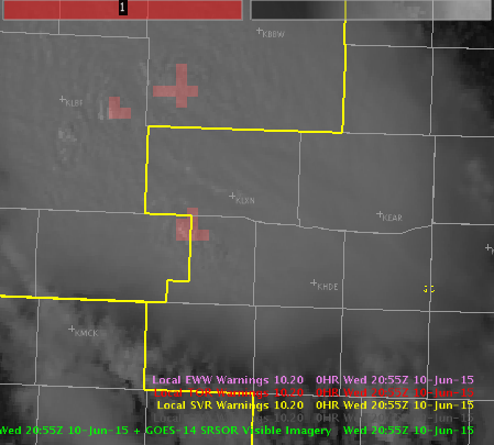
New NUCAPS sounding for Hastings CWA Charley
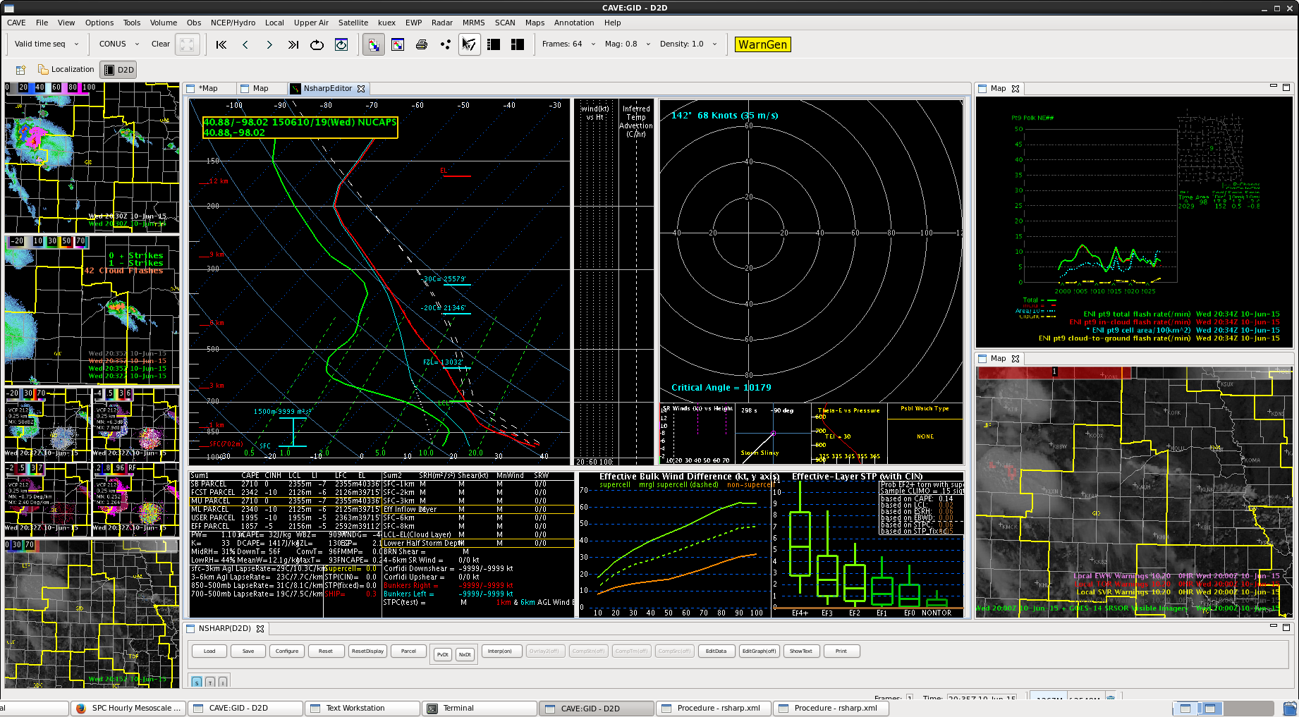
NUCAPS sounding just south of the front modified to similar values of CAPE/DCAPE to RUC soundings.
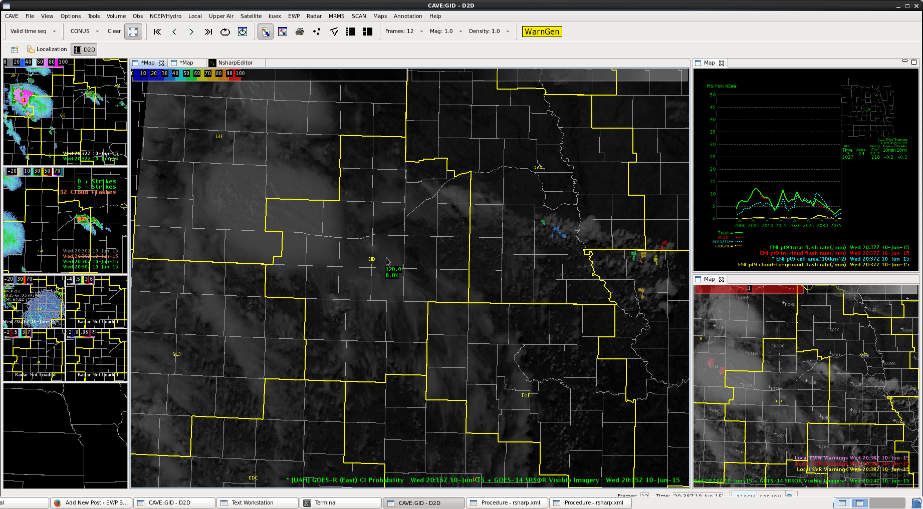
Still no CI over the area, though we have had some cells develop.