
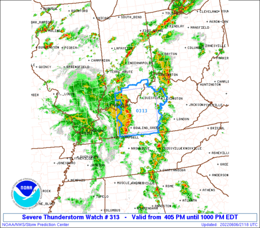
The first day of familiarization with the tools for the hazardous weather testbed and we were assigned the Louisville CWA to test a number of products on. The synopsis of the area’s weather features a line of convection moving in from the west with a Severe Thunderstorm Watch in place and several storms had already been warned on.
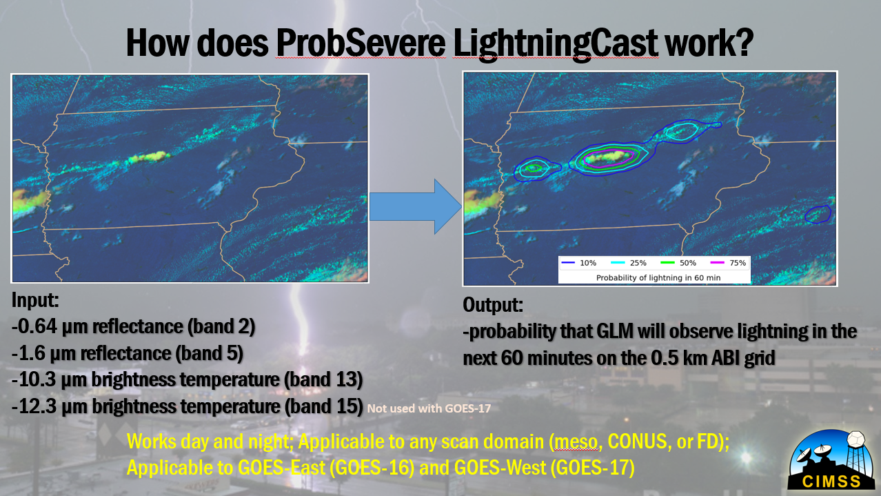
On the other side of the CWA, a few weaker cells had developed under a mix of sun and high clouds. It’s this convection across the eastern CWA that became the focus for today’s blog. We chose to target the LightningCast product because we noticed that although the -10C MRMS data would suggest lightning, the LightningCast data was actually much lower than anticipated (below 10 percent). Why was this the case?
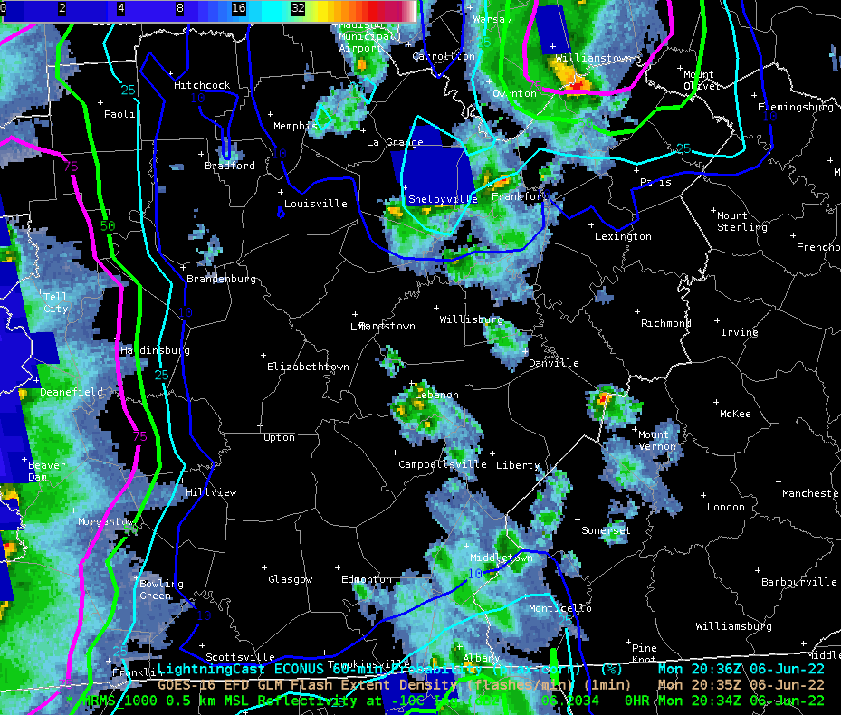
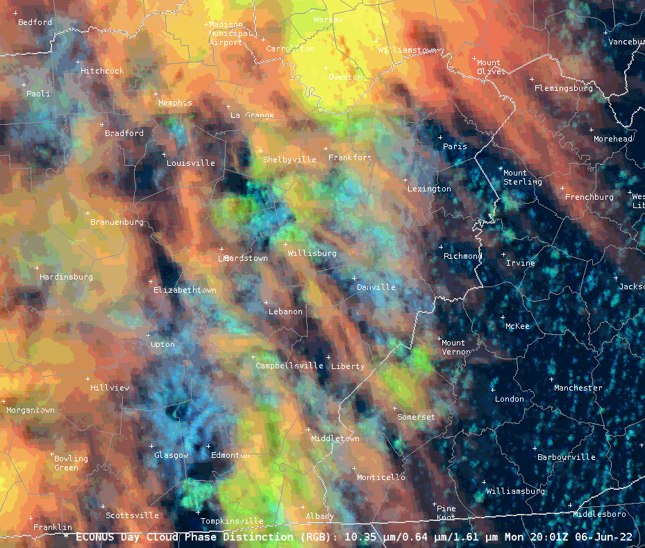
After speaking with John Cintineo about this, and looking at the training that was provided for this testbed, it was surmised that this may be a case where convective debris or high clouds could mask the signal of weaker convection.
Eventually LightningCast did highlight this area with a lightning risk, but this case is relevant because if we are using this tool to aid in DSS to our partners, we must also identify some potential limitations.
Noctilucent/Mr. Bean