
Synopsis: A deep upper low tracked slowly northeastward across Missouri today. The main cold front associated with this low moved across the Greenville, SC region. Along and ahead of the front, widespread showers and thunderstorms continued over western South Carolina for most of the afternoon and evening hours.

Our DSS messaging was for Softball Tournament Games located at Clemson University.

SPC Convective Outlook: Slight risk of thunderstorms over extreme northwestern SC, with marginal risk elsewhere.

Primary threat was wind flash flooding and wind with a chance of hail and a possible tornado.

Scattered showers and thunderstorms tracking northward across the forecast area.

IR imagery overlaid with lightning data.

Greenville ACARS sounding taken in 1910Z.

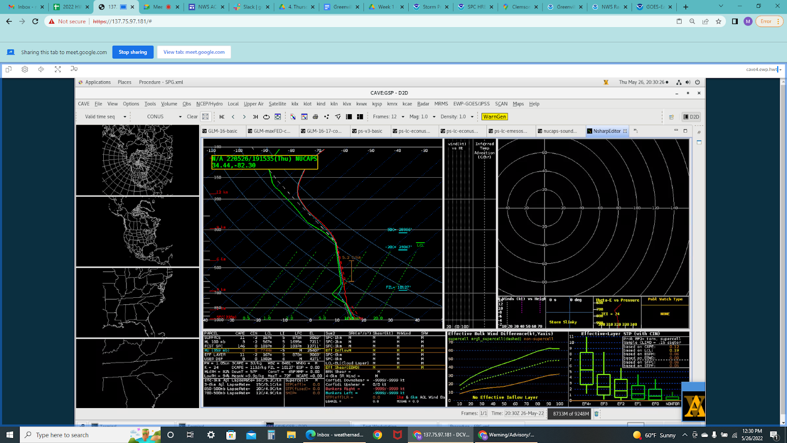
NUCAPS Sounding nearby Greenville.
Another NUCAPS Sounding nearby Greenville.
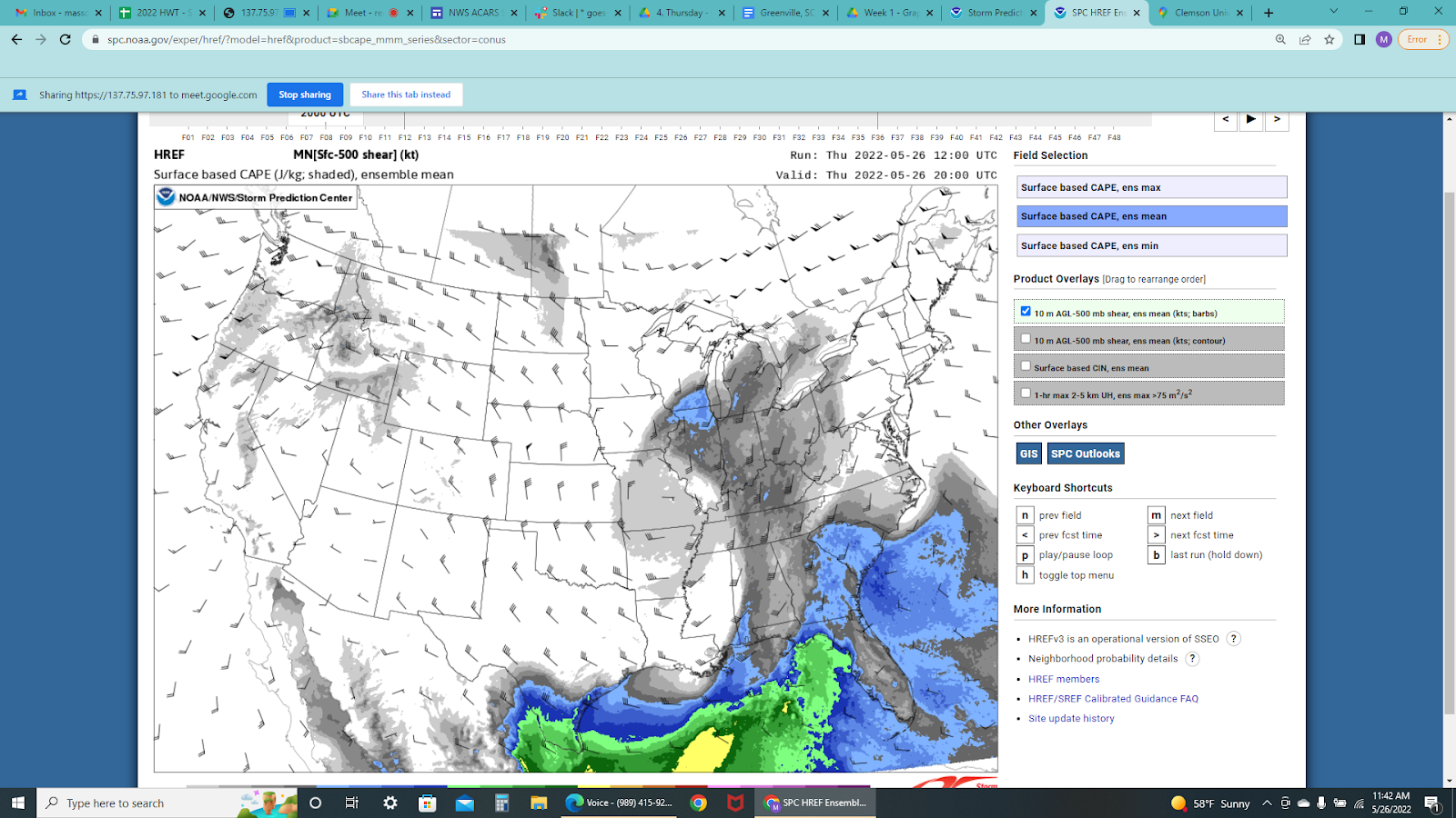
Mesoanalysis – Surface CAPE values ranging from 500 to 1,000 J/kg.

PHS showing similar instability parameters.
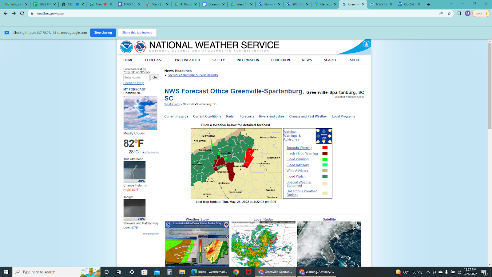
Watches/Warnings products issued throughout the day by WFO Greenville.
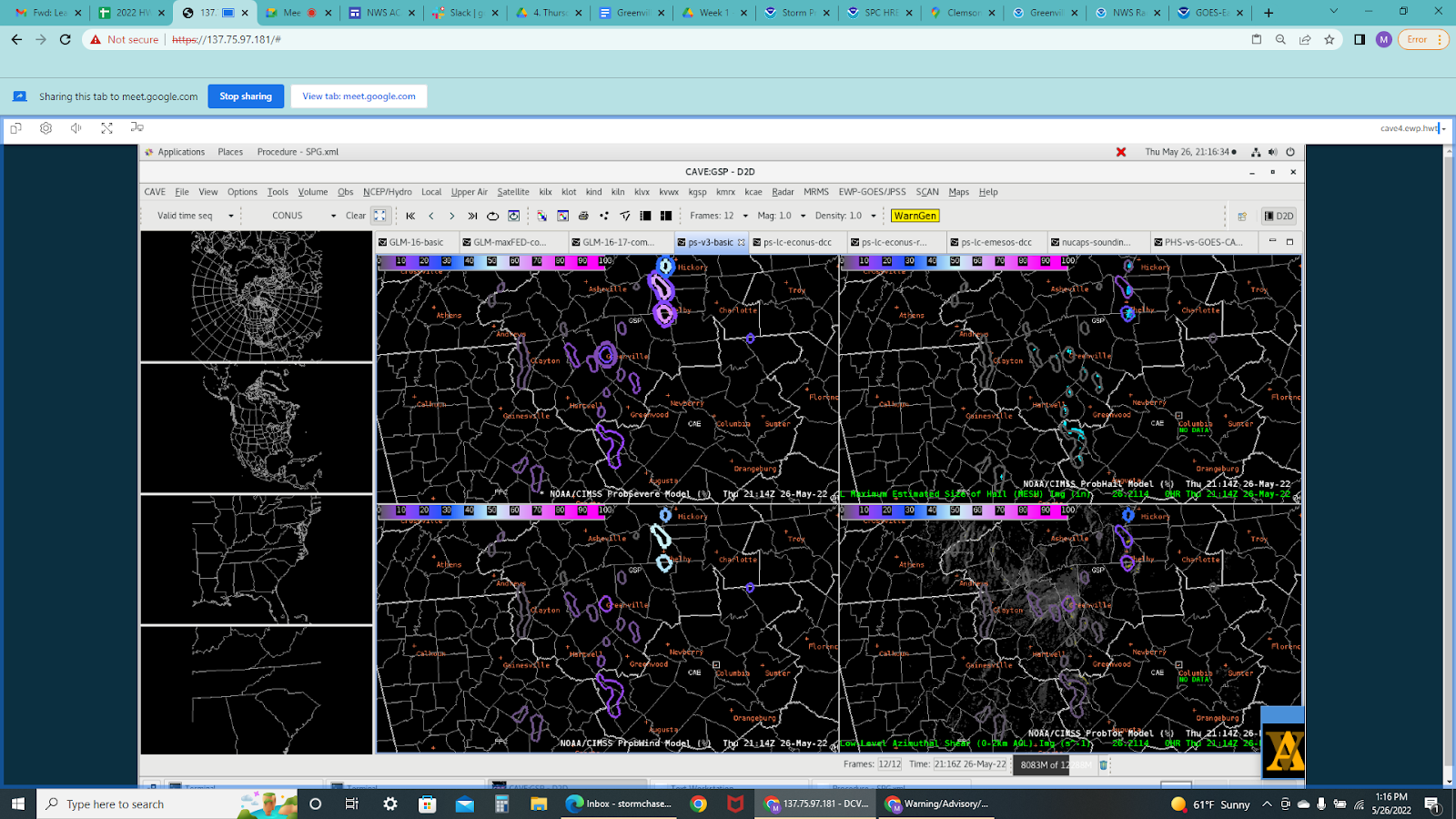
ProbSevere3: Low probability of severe weather, but sufficient enough for storm warning operations and convective maintenance situational awareness.
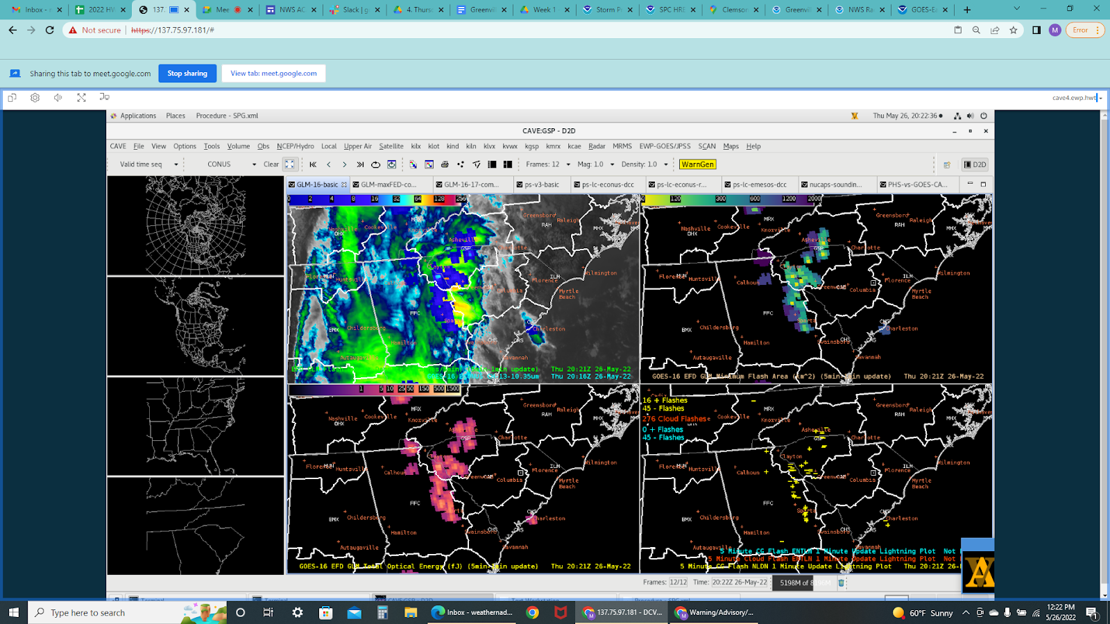
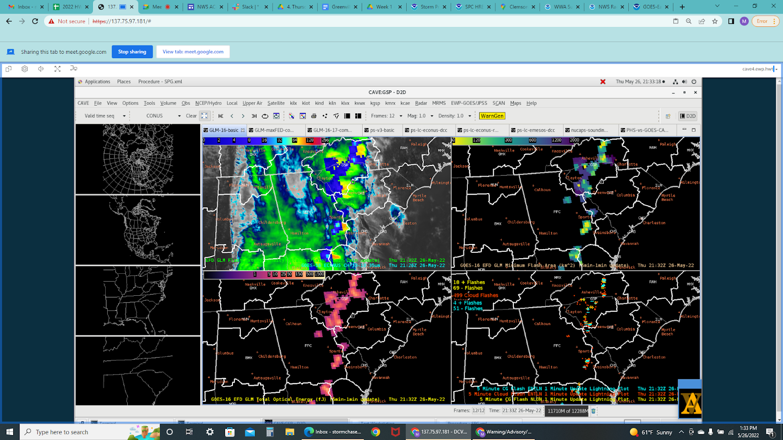
GLM Basic – Helped with operations as well as DSS.
GLM

GLM

Lightning Cast overlaid with satellite was helpful for enough lead time and confidence.

Lightning Cast overlaid with radar.

Lightning Cast overlaid with satellite.

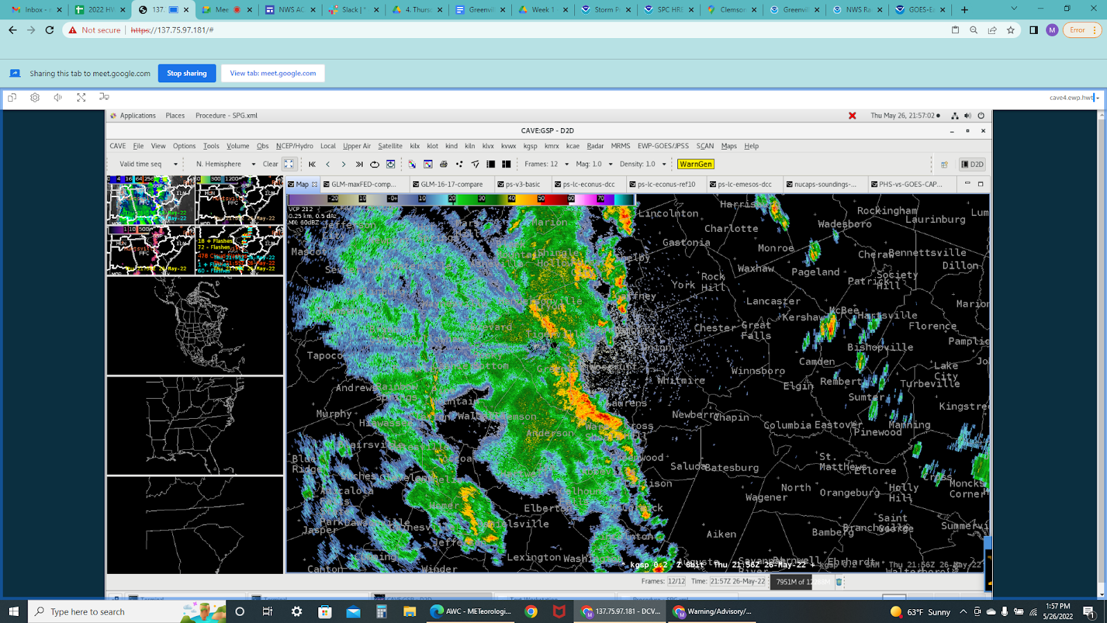
Radar overlaid with Polygon Warnings issued throughout the day.
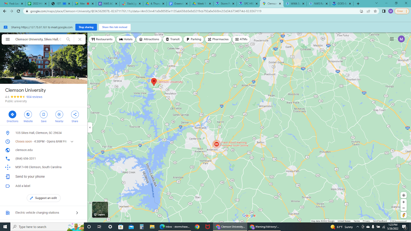
DSS update: A Flash Flood Warning was issued for Northwest South Carolina near Anderson county and remained in effect until 9:00 PM EDT.
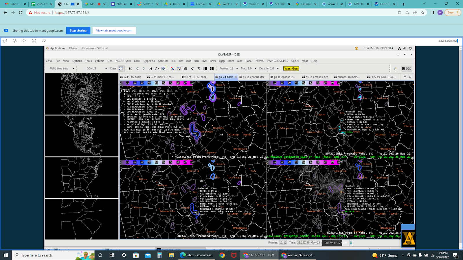
Latest update on ProbSevere3 and tracking any nearby storms.
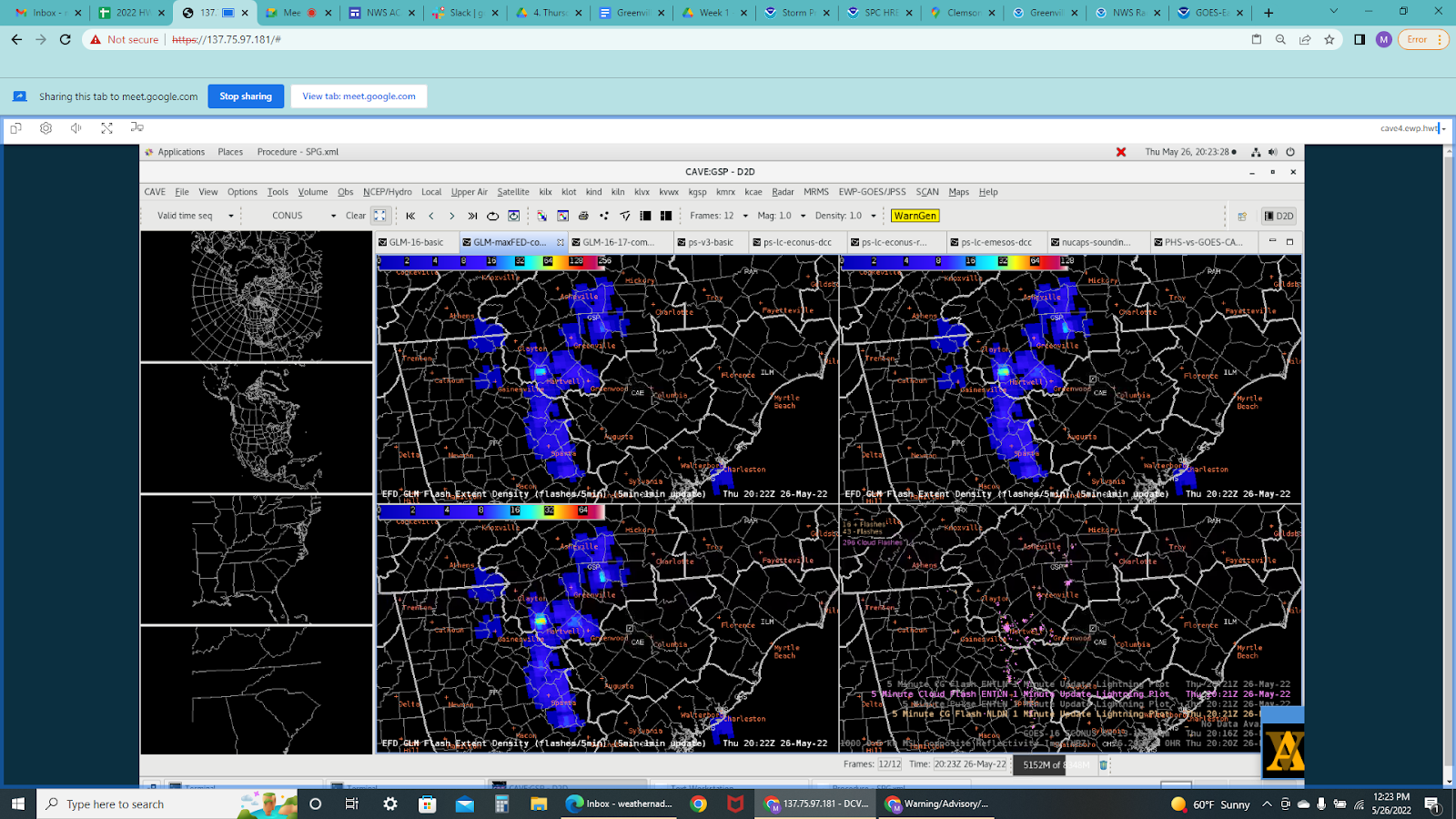
Latest update on GLM.

SPC Mesoscale Discussion. Thunderstorms intensified across northeast GA into upstate SC, near and south of a warm front that slowly lifted northward toward western NC.
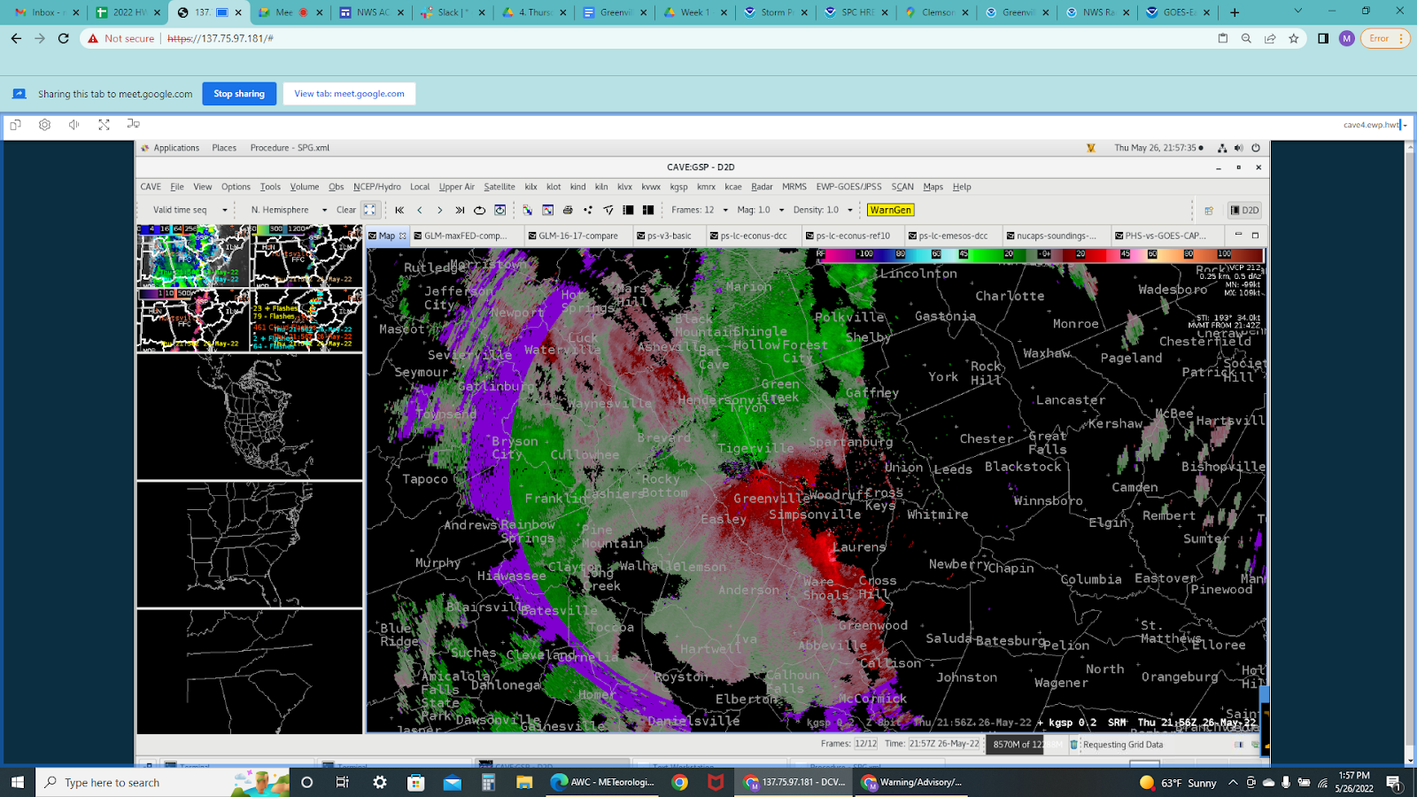
Storm velocity showing gate-to-gate or small rotational couplets near Ware Shoals and Spartanburg.
Vortex Power