
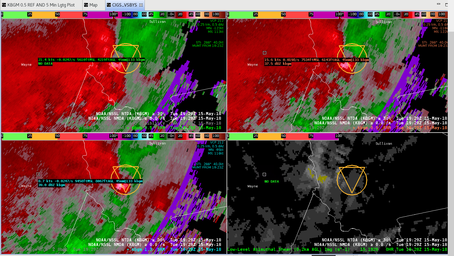
A supercell formed along the squall line/QLCS moving through the Catskills and Sullivan County. The circulation strengthened around 1925 UTC and continued through 1929 UTC with a deep MESO detected through the lowest 5 tilts of the radar beam and around 100 nm from the KBGM RDA. The probabilities for a tornado increased to ~60% with a strong inbound velocity and some outbound in terms of the mesocyclonic couplet. The potential tornado was moving towards KMSV. The two images below show the cursor readout (0.5 DEG, 0.9 DEG, 1.3 DEG of SRM/REF data and 0-2 km Azimuthal shear). The radar beam is up high, but I felt with a medium strength MESO and high Probs for a TOR from the NTDA that an upgrade from a SVR to a TOR was warranted.

– Yoda777