
Covering the CTP (State College) area today. Initial convection has moved through, but models are suggesting redevelopment later in the afternoon along a front. The help see changes in the atmospheric moisture, I’ve captured an animation of a 4 panel AllSkyLAP PW.
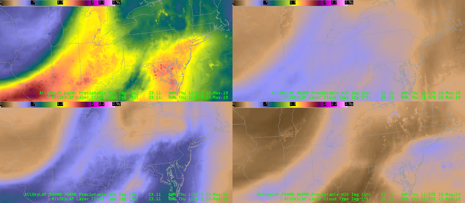
For reference, the upper left is the total column PW, the upper right is 1-0.9 sigma, the lower left is 0.9-0.7 sigma, and the lower right is 0.7-0.3 sigma. What stands out to me surging eastward of lower values of the upper-most layer (0.7-0.3) towards the CWA, while the lowest layer (1-0.9) is remaining mainly unchanged. This suggests that the drying above the 0.7 sigma level (approximately 600-700 mb for CTP) may lead to increased values of DCAPE later this afternoon, so that any storms that do manage to initiate could have a threat of severe winds.
Thorcaster