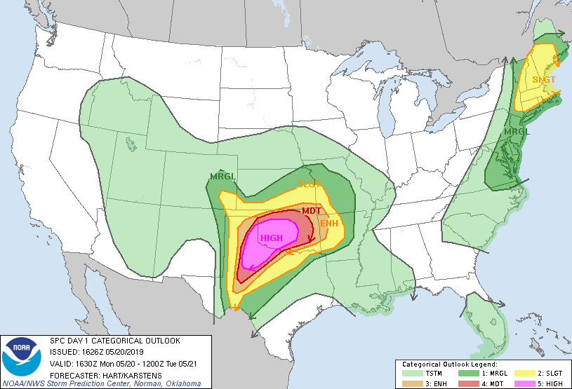
Today is one of those rare days in the parameter space of severe weather. A high risk has been issued for portions of the Texas Panhandle into western and central Oklahoma, including us here in Norman and the OKC metro area. Models continue to paint an ominous picture of numerous waves of tornadic supercells within the warm sector and east of the dryline throughout SW Oklahoma into the OKC metro area. Flooding will also be a major concern and could potentially have as much impact as the tornadoes. We will be operating in the Norman, OK, Amarillo, TX, and Lubbock, TX CWAs throughout the day.
-Michael