As a forecaster in the Pacific Northwest, where severe weather tends to be limited, I have had to adjust my perspective of what is/isn’t a strong storm. Most of our tornadic storms tend to be cold core funnels that dissipate as quickly as they develop. I can see AzShear being used as a powerful situational tool for forecasters, especially when storms that have weak rotational signatures.
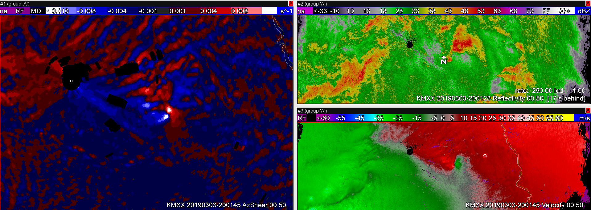
The image below is relatively close in time to when the simulation started and my eyes immediately went to the “hot spots” in the single-radar AzShear product. It took me all of a couple of seconds to realize that I needed to pay attention to this storm and as soon as I looked at the Z/R products I immediately started thinking that we need to issue a TOR if one wasn’t already issued. This storm is probably a “No Duh!” TOR for almost all forecasters, but being able to see the AzShear product and quickly orient yourself is extremely useful and when used with other base products can save time in spinning up at the start of a shift.