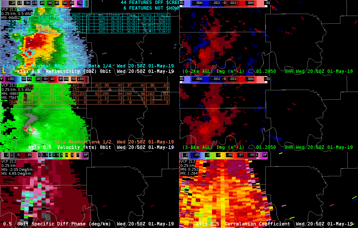
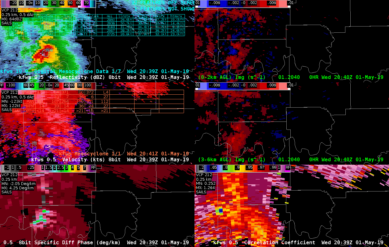
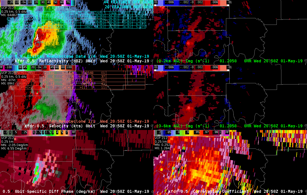
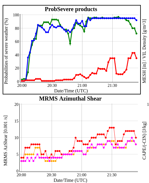
KTLX, KFWS and KFDR perspectives of tornadic supercell near the Red River. Spotters indicated occasional brief touchdowns with this storm. Animation is from 2050 to 2143 UTC around the time of the reported brief touchdowns. Last image is the time trend of ProbTor (red trace) and MRMS AzShshear (red trace). KFDR seemed to sample the mesocyclone the best and subsequent gate-gate-shear (90 nm from RDA). ProbTor indicated a gradual increase then took a sudden drop shortly after 2130 UTC, then continued to increase. This may have been the result of a similar drop in the MRMS AzSHear. Not clear why AzShear dropped off briefly (perhaps a sampling issue with one of the radars). However, radar SRM data did not show any indication of weakening circulation in any of the, in fact the velocity couplet was even stronger around 2130 UTC especially KFDR radar. A caution to forecasters to be careful when examining trends in the ProbTor and be sure to examine the various inputs into ProbTor in conjunction with the radar (velocity trends). – Quik Twip