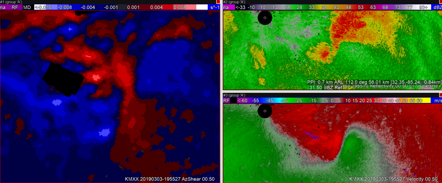
 The case above shows a situation where due to the orientation of the zero isodop compared to the radar location, AzShear values are surprisingly low considering the strength of the convergent signature that preceded tornado development.
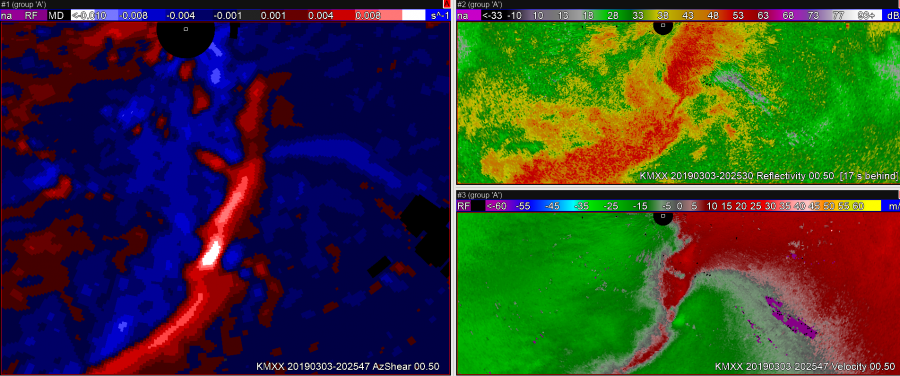
The case above shows different tornadic circulation developing, but this time to the south of the radar – a different orientation of the convergent signature relative to the radar. In both of these first two cases, the eventual tornado had not touched down yet, but the AzShear values were quite different. Training on zero isodop and how its orientation relative to the radar affects AzShear should be created for users before this product is used operationally. 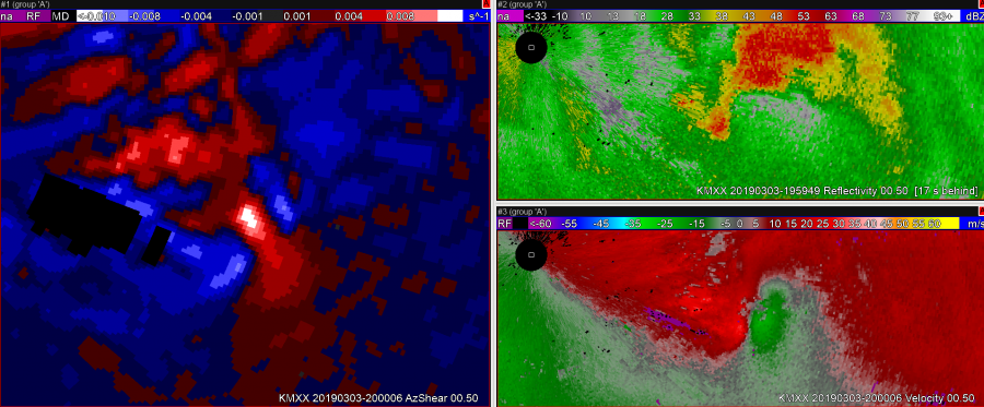
This image shows the first circulation a bit farther in time as the orientation of the convergence changed and AzShear value bins began to max out.
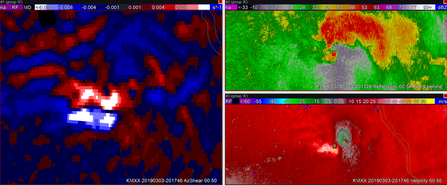
A case where using a color table with bins detracts from the usefulness of AzShear. There are two areas of high AzShear indicated, however very different things are going on in each of these locations. One is a strong tornado on ground the other is flanking line convergence. These two features should not have the same color if this product is to be used in operations. Consider a graduated color ramp with a high range instead of broad bins.
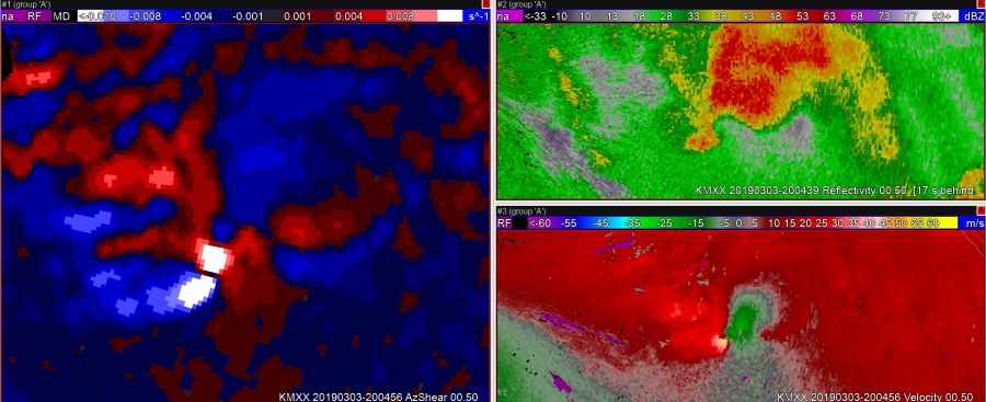 A case where the anticyclonic shear component is extremely prominent in AzShear. Are these regions useful for forecasters focusing on the tornado? Are they more of a distraction? They could be a distraction in some situations.
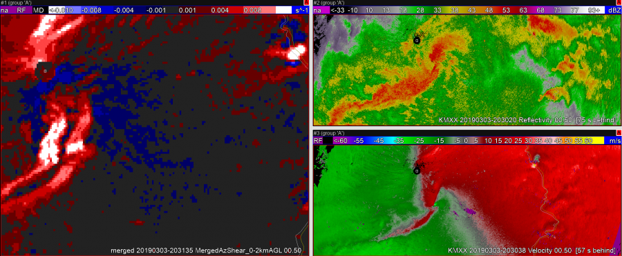
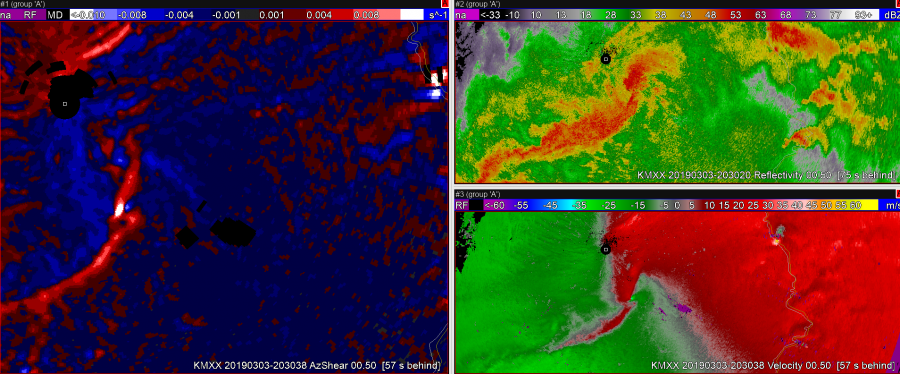
The two above images compare 0-2 AzShear (top) and single scan AzShear (bottom). Due to multiple sampling by multiple radars, it appears as though 4 different iterations of the squall line shear boundary are plotted. This renders the merged 6646data almost useless for interpretation purposes. The single scan data removes this issue. Also from these screen grabs, it appears as though the farthest east scan is coming from the KMX, the single scan site used here.
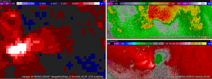
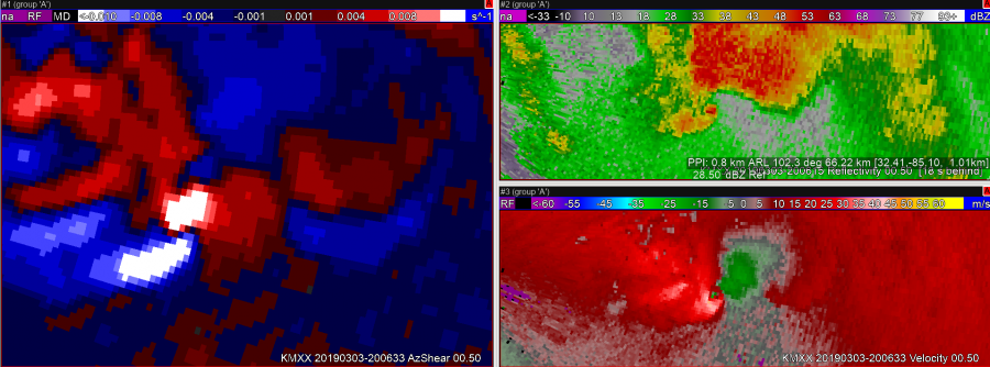
The two examples above show the benefits of single radar versus merged once again. The merged azshear core is several miles behind the circulation center at this time. The single radar data follows the current velocity scan as expected. In a time-sensitive warning operation scenario, knowing this I would likely use the single radar product exclusively.
-Dusty Davis
