Storms are approaching the HGX CWA. GOES-16 imagery shows amply cumulus development across much of the CWA. With temps in the upper 70s and dew points in the upper 60, I expect there to be ample instability in this environment.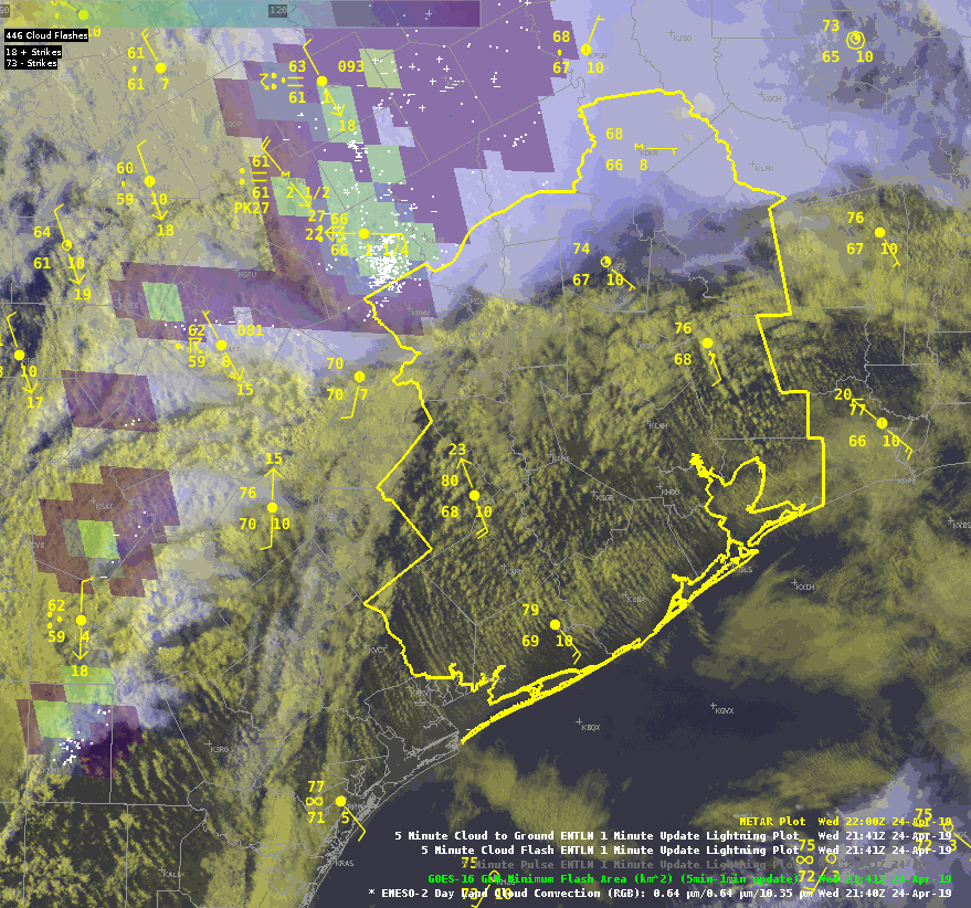 All Sky LAPS retrievals indicate ML CAPE just shy of 1000 J/kg, but with this environment, I would expect instability to be higher.
  The modified NUCAPS shows a profile more in line with what I would expect to see. In this profile, the surface dew points were close to what surface obs show, but the surface temp did need to be adjusted up a bit. This sounding, coupled with analyzed deep layer shear, leads me to think severe weather is a possibility in this area.
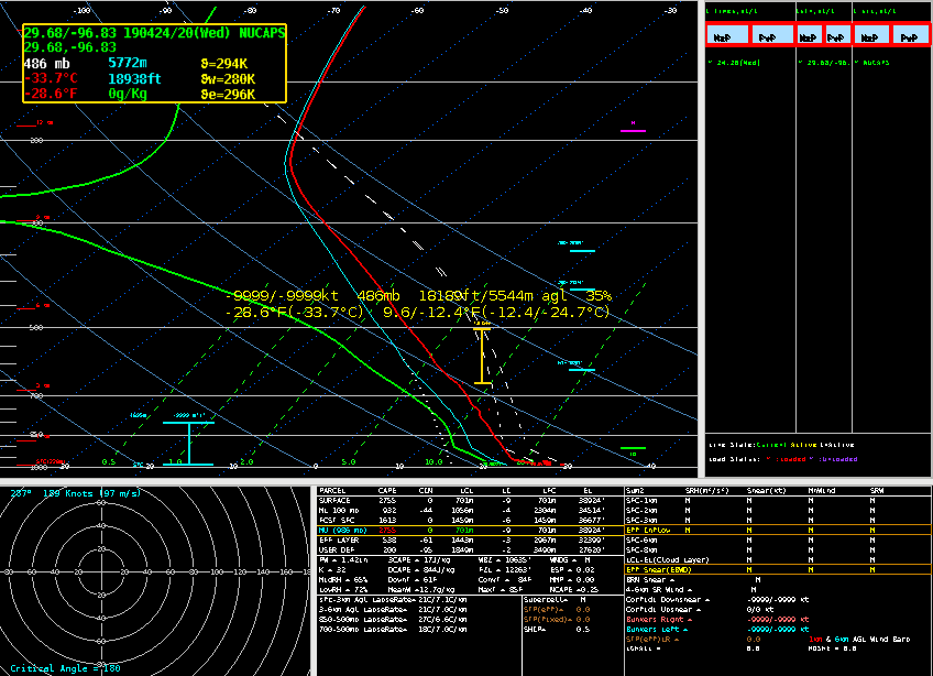 Sandor Clegane
EWP Blog
Spring Experiments & Beyond
